Country:
Region:
City:
Latitude and Longitude:
Time Zone:
Postal Code:
IP information under different IP Channel
ip-api
Country
Region
City
ASN
Time Zone
ISP
Blacklist
Proxy
Latitude
Longitude
Postal
Route
Luminati
Country
Region
bc
City
faraoani
ASN
Time Zone
Europe/Bucharest
ISP
Orange Romania S.A.
Latitude
Longitude
Postal
IPinfo
Country
Region
City
ASN
Time Zone
ISP
Blacklist
Proxy
Latitude
Longitude
Postal
Route
db-ip
Country
Region
City
ASN
Time Zone
ISP
Blacklist
Proxy
Latitude
Longitude
Postal
Route
ipdata
Country
Region
City
ASN
Time Zone
ISP
Blacklist
Proxy
Latitude
Longitude
Postal
Route
Popular places and events near this IP address

Bacău County
County of Romania
Distance: Approx. 9295 meters
Latitude and longitude: 46.42,26.78
Bacău County (Romanian pronunciation: [baˈkəw] ) is a county (județ) of Romania, in Western Moldavia, with its capital city at Bacău. It has one commune, Ghimeș-Făget, in Transylvania.

Bistrița (Siret)
River in Romania, tributary to Siret River
Distance: Approx. 9009 meters
Latitude and longitude: 46.49111111,26.98694444
The Bistrița (Romanian pronunciation: [ˈbistrit͡sa] ; also called Bistrița Aurie or Bistrița Moldoveană; Hungarian: Aranyos-Beszterce) is a river in the Romanian regions of Maramureș, Bukovina and Moldavia (most of its length). It is a right tributary of the river Siret. At Chetriș, near Bacău, it flows into the Siret.

George Enescu International Airport
Airport in Bacău, Romania
Distance: Approx. 9390 meters
Latitude and longitude: 46.52194444,26.91027778
George Enescu International Airport (IATA: BCM, ICAO: LRBC) is an airport located in Bacău, Romania. Named after the Romanian composer George Enescu the airport shares its runway with RoAF 95th Air Base, and Aerostar, a major Romanian aerospace and defence company. The airport is located 5 km (3.1 mi) south of the city centre of Bacău.

RoAF 95th Air Base
Distance: Approx. 9359 meters
Latitude and longitude: 46.52166667,26.91027778
The Romanian Air Force 95th Air Base "Captain Alexandru Șerbănescu" (Romanian: Baza 95 Aeriană "Căpitan Aviator Alexandru Șerbănescu") is an air force base adjacent to George Enescu International Airport, Romania, south of Bacău, Bacău County. The current base was organized on 25 August 1995, having as its purpose the support of the 95th Fighter Group training. From 1 May 2001 until 1 July 2004, during the military reorganization process, the Supersonic Jet Training Center operated in the Bacău air base, preserving the tradition of training the young pilots according to the MIG-21 LanceR program.
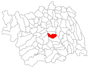
Cleja
Commune in Bacău, Romania
Distance: Approx. 4459 meters
Latitude and longitude: 46.4,26.91666667
Cleja (Hungarian: Klézse) is a commune in Bacău County, Western Moldavia, Romania. It is composed of three villages: Cleja, Somușca (Somoska) and Valea Mică (Pokolpatak). In 2011, the commune had a population of 6621: 94.41% ethnic Romanians, 2.43% Hungarians and Csangos.
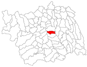
Faraoani
Commune in Bacău, Romania
Distance: Approx. 536 meters
Latitude and longitude: 46.43333333,26.9
Faraoani (Hungarian: Forrófalva) is a commune in Bacău County, Western Moldavia, Romania. It is composed of two villages, Faraoani and Valea Mare (Nagypatak). On the eastern side of the commune is the Faraoani railway station, serving the Căile Ferate Române Line 500 that runs from Bucharest to Focșani, Bacău, and on north to the Ukraininan border.
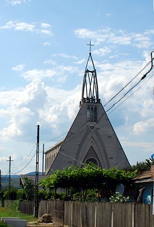
Nicolae Bălcescu, Bacău
Commune in Bacău, Romania
Distance: Approx. 5048 meters
Latitude and longitude: 46.48333333,26.9
Nicolae Bălcescu (until 1948 Ferdinand, and previously Satu Nou, Hungarian: Ferdinándújfalu) is a commune in Bacău County, Western Moldavia, Romania. It is composed of five villages: Buchila, Galbeni, Lărguța, Nicolae Bălcescu, and Valea Seacă. It also included Bălțata and Sărata villages until 2004, when they were split off to form Sărata Commune.
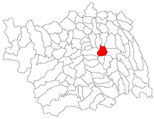
Tamași
Commune in Bacău, Romania
Distance: Approx. 8245 meters
Latitude and longitude: 46.48333333,26.98333333
Tamași (Hungarian: Tamás) is a commune in Bacău County, Western Moldavia, Romania. It is composed of three villages: Chetriș (Ketris), Furnicari (Furnikár) and Tamași. It included the village of Gioseni until 2005, when it was split off to form a separate commune.

Sărata, Bacău
Commune in Bacău, Romania
Distance: Approx. 7316 meters
Latitude and longitude: 46.5,26.86666667
Sărata is a commune in Bacău County, Western Moldavia, Romania. It is composed of two villages, Bălțata and Sărata. These were part of Nicolae Bălcescu Commune until 2004, when they were split off.
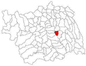
Gioseni
Commune in Bacău, Romania
Distance: Approx. 6544 meters
Latitude and longitude: 46.43333333,26.98333333
Gioseni is a commune in Bacău County, Western Moldavia, Romania. It is composed of a single village, Gioseni. It was part of Tamași Commune until 2005, when it was split off.
Weather in this IP's area
clear sky
9 Celsius
5 Celsius
9 Celsius
9 Celsius
996 hPa
76 %
996 hPa
973 hPa
10000 meters
8.75 m/s
170 degree
07:21:34
16:34:57