Country:
 Romania
Region:
City:
Latitude and Longitude:
Time Zone:
Postal Code:
IP information under different IP Channel
ip-api
Country
Region
City
ASN
Time Zone
ISP
Blacklist
Proxy
Latitude
Longitude
Postal
Route
IPinfo
Country
Region
City
ASN
Time Zone
ISP
Blacklist
Proxy
Latitude
Longitude
Postal
Route
MaxMind
Country
Region
City
ASN
Time Zone
ISP
Blacklist
Proxy
Latitude
Longitude
Postal
Route
Luminati
Country
RORegion
b
City
bucharest
ASN
Time Zone
Europe/Bucharest
ISP
Orange Romania S.A.
Latitude
Longitude
Postal
db-ip
Country
Region
City
ASN
Time Zone
ISP
Blacklist
Proxy
Latitude
Longitude
Postal
Route
ipdata
Country
Region
City
ASN
Time Zone
ISP
Blacklist
Proxy
Latitude
Longitude
Postal
Route
Popular places and events near this IP address
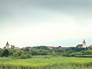
Avrig
Town in Sibiu, Romania
Distance: Approx. 1257 meters
Latitude and longitude: 45.70805556,24.37472222
Avrig (Romanian pronunciation: [aˈvriɡ]; ‹See Tfd›German: Freck/Fryck, Transylvanian Saxon: Freck/Fraek, Hungarian: Felek) is a town in Sibiu County, Transylvania, central Romania. It has a population of 12,815 and the first documents attesting its existence date to 1346. It officially became a town in 1989, as a result of the Romanian rural systematization program.

Porumbacu de Jos
Commune in Sibiu, Romania
Distance: Approx. 7222 meters
Latitude and longitude: 45.75805556,24.45694444
Porumbacu de Jos (‹See Tfd›German: Unter-Bornbach; Hungarian: Alsóporumbák) is a commune in Sibiu County, Transylvania, central Romania, first documented in 1473. It is composed of five villages: Colun, Porumbacu de Jos, Porumbacu de Sus, Sărata, and Scoreiu. The commune is located in the southeastern part of the country, at the extreme west of the historical region of Țara Făgărașului.
Avrig (river)
River in Sibiu County, Romania
Distance: Approx. 3555 meters
Latitude and longitude: 45.7221,24.3433
The Avrig is a left tributary of the river Olt in Romania. It discharges into the Olt in the town Avrig. The upper reach of the river is also known as the Râul Mare.

Sebeș (Sibiu)
River in Sibiu County, Romania
Distance: Approx. 7638 meters
Latitude and longitude: 45.6684,24.3153
The Sebeș is a left tributary of the river Olt in Romania. It originates in the northwestern part of the Făgăraș Mountains. It discharges into the Olt near Sebeșu de Jos.
Sărata (Olt)
River in Sibiu County, Romania
Distance: Approx. 8476 meters
Latitude and longitude: 45.7696,24.4634
The Sărata is a left tributary of the river Olt in Romania. It flows into the Olt in Porumbacu de Jos. Its length is 16 km (9.9 mi) and its basin size is 31 km2 (12 sq mi).
Moașa
River in Sibiu County, Romania
Distance: Approx. 7457 meters
Latitude and longitude: 45.6684,24.3185
The Moașa (also: Moașa Sebeșului) is a right tributary of the river Sebeș in Romania. It discharges into the Sebeș close to its outflow into the Olt, near Racovița. Its length is 13 km (8.1 mi) and its basin size is 23 km2 (8.9 sq mi).

Porumbacu (river)
River in Sibiu County, Romania
Distance: Approx. 7015 meters
Latitude and longitude: 45.7674,24.4373
The Porumbacu (in its upper course also: Valea Sărății and Valea Mare) is a left tributary of the river Olt in Romania. It discharges into the Olt in Porumbacu de Jos. The Porumbacu originates on the northern slope of Negoiu Peak, Făgăraș Mountains.

Racovița, Sibiu
Commune in Sibiu, Romania
Distance: Approx. 5225 meters
Latitude and longitude: 45.67916667,24.34388889
Racovița (Racovița-Olt until 1931; ‹See Tfd›German: Rakowitza or Rakevets; Hungarian: Oltrákovica or colloquially Rákovica) is a commune in Sibiu County, Transylvania, Romania. It has a population of 2,884 inhabitants (2002 census) and is composed of two villages, Racovița and Sebeșu de Sus (Oltfelsősebes). The first official mention of the then-village was in a May 22, 1443 "gift" act of John Hunyadi.
Weather in this IP's area
overcast clouds
14 Celsius
14 Celsius
13 Celsius
14 Celsius
1012 hPa
99 %
1012 hPa
966 hPa
10000 meters
0.48 m/s
0.67 m/s
4 degree
100 %
07:25:56
18:55:24