92.114.38.224 - IP Lookup: Free IP Address Lookup, Postal Code Lookup, IP Location Lookup, IP ASN, Public IP
Country:
 Romania
Region:
City:
Location:
Time Zone:
Postal Code:
ISP:
ASN:
language:
User-Agent:
Proxy IP:
Blacklist:
IP information under different IP Channel
ip-api
Country
Region
City
ASN
Time Zone
ISP
Blacklist
Proxy
Latitude
Longitude
Postal
Route
db-ip
Country
Region
City
ASN
Time Zone
ISP
Blacklist
Proxy
Latitude
Longitude
Postal
Route
IPinfo
Country
Region
City
ASN
Time Zone
ISP
Blacklist
Proxy
Latitude
Longitude
Postal
Route
IP2Location
92.114.38.224Country
roRegion
iasi
City
pascani
Time Zone
Europe/Bucharest
ISP
Language
User-Agent
Latitude
Longitude
Postal
ipdata
Country
Region
City
ASN
Time Zone
ISP
Blacklist
Proxy
Latitude
Longitude
Postal
Route
Popular places and events near this IP address

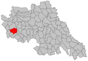
Pașcani
Municipality in Iași, Romania
Distance: Approx. 432 meters
Latitude and longitude: 47.24944444,26.72722222
Pașcani (Romanian pronunciation: [paʃˈkanʲ]) is a city in Iași County in the Western Moldavia region of Romania, on the Siret river. As of 2021, it has a population of 30,766. Five villages are administered by the city: Blăgești, Boșteni, Gâstești, Lunca, and Sodomeni.

Stolniceni (river)
River in Iași County, Romania
Distance: Approx. 5596 meters
Latitude and longitude: 47.294,26.7488
The Stolniceni is a left tributary of the river Siret in Romania. It flows into the Siret in Gura Bâdiliței. The Stolniceni is 13 km (8.1 mi) long and its basin size is 49 km2 (19 sq mi).
Ruja (Siret)
River in Iași County, Romania
Distance: Approx. 4072 meters
Latitude and longitude: 47.275,26.7574
The Ruja is a right tributary of the river Siret in Romania. It flows into the Siret north of Pașcani. Its length is 12 km (7.5 mi) and its basin size 66 km2 (25 sq mi).
Conțeasca
River in Iași County, Romania
Distance: Approx. 6192 meters
Latitude and longitude: 47.3025,26.7203
The Conțeasca is a right tributary of the river Siret in Romania. It discharges into the Siret near Hârtoape. Its length is 17 km (11 mi) and its basin size 73 km2 (28 sq mi).

Hărmănești
Commune in Iași, Romania
Distance: Approx. 6227 meters
Latitude and longitude: 47.26666667,26.8
Hărmănești is a commune in Iași County, Western Moldavia, Romania. It is composed of three villages: Boldești, Hărmăneștii Noi and Hărmăneștii Vechi (the commune center). These were part of Todirești Commune until 2004, when they were split off.

Moțca
Commune in Iași, Romania
Distance: Approx. 8035 meters
Latitude and longitude: 47.25,26.61666667
Moțca is a commune in Iași County, Western Moldavia, Romania. It is composed of two villages, Boureni and Moțca. The commune is situated on the Moldavian Plateau, at an altitude of 295 m (968 ft), on the left bank of the Moldova River.
Stolniceni-Prăjescu
Commune in Iași, Romania
Distance: Approx. 5280 meters
Latitude and longitude: 47.2,26.73333333
Stolniceni-Prăjescu is a commune in Iași County, Western Moldavia, Romania. It is composed of three villages: Brătești, Cozmești and Stolniceni-Prăjescu.

Ruginoasa, Iași
Commune in Iași, Romania
Distance: Approx. 9547 meters
Latitude and longitude: 47.24416667,26.84916667
Ruginoasa is a commune in Iași County, Western Moldavia, Romania. It is composed of four villages: Dumbrăvița, Rediu, Ruginoasa and Vascani.

Valea Seacă, Iași
Commune in Iași, Romania
Distance: Approx. 5873 meters
Latitude and longitude: 47.28333333,26.66666667
Valea Seacă is a commune in Iași County, Western Moldavia, Romania. It is composed of three villages: Conțești, Topile and Valea Seacă.
Dacian fortress of Crivești
Distance: Approx. 7362 meters
Latitude and longitude: 47.3033,26.7738
It was a Dacian fortified town.

Church of the Holy Archangels, Pașcani
Heritage site in Iași County, Romania
Distance: Approx. 502 meters
Latitude and longitude: 47.251359,26.721904
The Church of the Holy Archangels (Romanian: Biserica Sfinții Voievozi) is a Romanian Orthodox church located at Aleea Parcului 5, Pașcani, Romania. Dating from 1664 and dedicated to the Archangels Michael and Gabriel, it is listed as a historic monument by Romania's Ministry of Culture and Religious Affairs.
Weather in this IP's area
overcast clouds
-2 Celsius
-2 Celsius
-2 Celsius
-2 Celsius
1020 hPa
74 %
1020 hPa
984 hPa
10000 meters
1.16 m/s
1.09 m/s
173 degree
100 %