91.90.77.19 - IP Lookup: Free IP Address Lookup, Postal Code Lookup, IP Location Lookup, IP ASN, Public IP
Country:
Region:
City:
Location:
Time Zone:
Postal Code:
ISP:
ASN:
language:
User-Agent:
Proxy IP:
Blacklist:
IP information under different IP Channel
ip-api
Country
Region
City
ASN
Time Zone
ISP
Blacklist
Proxy
Latitude
Longitude
Postal
Route
db-ip
Country
Region
City
ASN
Time Zone
ISP
Blacklist
Proxy
Latitude
Longitude
Postal
Route
IPinfo
Country
Region
City
ASN
Time Zone
ISP
Blacklist
Proxy
Latitude
Longitude
Postal
Route
IP2Location
91.90.77.19Country
Region
slaskie
City
myslowice
Time Zone
Europe/Warsaw
ISP
Language
User-Agent
Latitude
Longitude
Postal
ipdata
Country
Region
City
ASN
Time Zone
ISP
Blacklist
Proxy
Latitude
Longitude
Postal
Route
Popular places and events near this IP address
Mysłowice
Place in Silesian Voivodeship, Poland
Distance: Approx. 3731 meters
Latitude and longitude: 50.23333333,19.13333333
Mysłowice [mɨswɔˈvʲit͡sɛ] (German: Myslowitz; Silesian: Myslowicy) is a city in Silesia in Poland, bordering Katowice. The population of the city as of 2022 is 72,124. It is located in the core of the Metropolis GZM in the Silesian Highlands, on the Przemsza and Brynica rivers (tributaries of the Vistula).
Jaworzno Power Station
Power station in Poland
Distance: Approx. 2723 meters
Latitude and longitude: 50.20827,19.2049
The Jaworzno Power Station is a complex of coal-fired thermal power stations at Jaworzno, Poland. The largest plant of the Jaworzno power plant complex is called Jaworzno III. It has an installed electrical generating capacity of 1,345 MW, as well as thermal heating capacity of 321 MWt.
Jaworzno concentration camp
German concentration camp in Poland during World War II
Distance: Approx. 5218 meters
Latitude and longitude: 50.21342,19.23936
The Jaworzno concentration camp was a concentration camp in WW2, German-occupied Poland and later in Communist Poland. It was first established by the Nazis in 1943 during the Second World War and was later used by the Soviet NKVD in 1945 to 1956. After that it was used by the Ministry of Public Security and other agencies of the Polish communist regime.
Fürstengrube subcamp
Distance: Approx. 5255 meters
Latitude and longitude: 50.19166667,19.09722222
The Fürstengrube subcamp was a subcamp of the Auschwitz concentration camp, operated by Nazi Germany in 1943–1945 in Wesoła near Mysłowice in occupied Poland. It was organized in the summer of 1943 at the Fürstengrube hard coal mine in the town of Wesoła, approximately 30 kilometers (19 mi) from Auschwitz concentration camp. The mine, which IG Farbenindustrie AG acquired in February 1941, was to supply hard coal for the IG Farben factory being built in Auschwitz.

Three Emperors' Corner
Distance: Approx. 2557 meters
Latitude and longitude: 50.2297,19.15749444
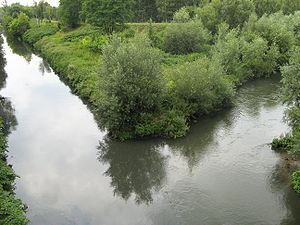
Three Emperors' Corner (Polish: Trójkąt Trzech Cesarzy, German: Dreikaisereck, Russian: Угол трёх императоров, romanized: Ugol tryokh imperatorov) is a former tripoint at the confluence of the Black and White Przemsza rivers, near the towns of Mysłowice, Sosnowiec and Jaworzno in the present-day Silesian Voivodeship of Poland. During the Partitions of Poland, from 1871 to 1918, it marked the place at which the borders of three empires that had divided Poland – the Russian Empire, Austria-Hungary and the German Empire – met.
Biała Przemsza
River in southern Poland
Distance: Approx. 2524 meters
Latitude and longitude: 50.229437,19.157757
The Biała Przemsza is a river of Poland, a tributary of the Przemsza near Mysłowice. It has a length of 63.9 km and a catchment area of 876.6 km². The river forms branches, meanders, urea, sometimes joints.

Brzezinka, Mysłowice
Mysłowice District in Silesian Voivodeship, Poland
Distance: Approx. 611 meters
Latitude and longitude: 50.20333333,19.16111111
Brzezinka (Polish: [bʐɛˈʑiŋka]; German: Birkental) is a dzielnica (district) of Mysłowice, Silesian Voivodeship, southern Poland. It was previously an independent village and gmina, but was absorbed by Mysłowice in 1951. It has an area of 6.69 km2 and in 2012 had a population of 5,146.
Dziećkowice
Mysłowice District in Silesian Voivodeship, Poland
Distance: Approx. 5139 meters
Latitude and longitude: 50.17583333,19.21916667
Dziećkowice (German: Dzietzkowitz) is a dzielnica (district) of Mysłowice, Silesian Voivodeship, southern Poland. It was previously an independent village, but was absorbed first by Tychy, and later in 1976 by Mysłowice. It has an area of 13.04 km2 and in 2012 had a population of 1,461.

Brzęczkowice, Mysłowice
Neighbourhood of Mysłowice in Silesian Voivodeship, Poland
Distance: Approx. 1533 meters
Latitude and longitude: 50.219512,19.156183
Brzęczkowice (German: Brzenskowitz) is a neighbourhood and a part of dzielnica (district) Brzęczkowice and Słupna, in Mysłowice, Silesian Voivodeship, southern Poland. It was previously an independent village and gmina (consisting only of this village), that was absorbed by Mysłowice in 1945 and again in 1951.

Wesoła, Mysłowice
Mysłowice District in Silesian Voivodeship, Poland
Distance: Approx. 4681 meters
Latitude and longitude: 50.18783333,19.10863889
Wesoła (German: Wessolla) is a dzielnica (district) of Mysłowice, Silesian Voivodeship, southern Poland. In years 1962–1975 it was an independent town, but was in 1975 amalgamated with Mysłowice. It has an area of 8,14 km2 and in 2012 had a population of 8,108.

Krasowy
Mysłowice District in Silesian Voivodeship, Poland
Distance: Approx. 5488 meters
Latitude and longitude: 50.17119444,19.11461111
Krasowy (German: Krassow) is a dzielnica (district) of Mysłowice, Silesian Voivodeship, southern Poland. It was amalgamated with Mysłowice in 1975. It has an area of 9.78 km2 and in 2012, had a population of 2,811.

Morgi, Mysłowice
Mysłowice District in Silesian Voivodeship, Poland
Distance: Approx. 3183 meters
Latitude and longitude: 50.205657,19.122111
Morgi is a dzielnica (district) of Mysłowice, Silesian Voivodeship, southern Poland. It has an area of 3.49 km2 and in 2012 had a population of 2,146. In the middle of the 19th century the area was yet covered with a forest belonging to the town of Mysłowice.
Weather in this IP's area
broken clouds
2 Celsius
2 Celsius
1 Celsius
3 Celsius
1017 hPa
93 %
1017 hPa
985 hPa
10000 meters
0.89 m/s
1.79 m/s
45 degree
57 %


