Country:
Region:
City:
Latitude and Longitude:
Time Zone:
Postal Code:
IP information under different IP Channel
ip-api
Country
Region
City
ASN
Time Zone
ISP
Blacklist
Proxy
Latitude
Longitude
Postal
Route
IPinfo
Country
Region
City
ASN
Time Zone
ISP
Blacklist
Proxy
Latitude
Longitude
Postal
Route
MaxMind
Country
Region
City
ASN
Time Zone
ISP
Blacklist
Proxy
Latitude
Longitude
Postal
Route
Luminati
Country
ASN
Time Zone
Europe/Paris
ISP
Celeste SAS
Latitude
Longitude
Postal
db-ip
Country
Region
City
ASN
Time Zone
ISP
Blacklist
Proxy
Latitude
Longitude
Postal
Route
ipdata
Country
Region
City
ASN
Time Zone
ISP
Blacklist
Proxy
Latitude
Longitude
Postal
Route
Popular places and events near this IP address
École des ponts ParisTech
French institution of higher education and research
Distance: Approx. 636 meters
Latitude and longitude: 48.84111111,2.58777778
École nationale des ponts et chaussées; lit. 'National School of Bridges and Roads'; or ENPC, also nicknamed Ponts (formerly known as École des Ponts ParisTech) is a grande école in the field of science, engineering and technology. Founded in 1747 by Daniel-Charles Trudaine, it is one of the oldest and one of the most prestigious French grandes écoles. Historically, its primary mission has been to train engineering officials and civil engineers but the school now offers a wide-ranging education including computer science, applied mathematics, civil engineering, mechanics, finance, economics, innovation, urban studies, environment and transport engineering.

Champs-sur-Marne
Commune in Île-de-France, France
Distance: Approx. 2235 meters
Latitude and longitude: 48.8529,2.6027
Champs-sur-Marne (French pronunciation: [ʃɑ̃ syʁ maʁn] ) is a commune in the eastern outer suburbs of Paris, France. It is located 18.2 km (11.3 mi) from the centre of Paris, on the left bank of the Marne, in the Seine-et-Marne department (on the departmental border with Seine-Saint-Denis) in the Île-de-France region. The commune of Champs-sur-Marne, famous for its château, is part of the Val Maubuée area, one of the four sectors in the "new town" of Marne-la-Vallée.

Canton of Champs-sur-Marne
Canton in Île-de-France, France
Distance: Approx. 1848 meters
Latitude and longitude: 48.83222222,2.6125
The canton of Champs-sur-Marne is a French administrative division, located in the arrondissement of Torcy, in the Seine-et-Marne département (Île-de-France région).
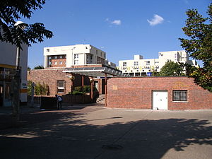
University of Paris-Est Marne-la-Vallée
Distance: Approx. 427 meters
Latitude and longitude: 48.83919444,2.58691667
The Université Paris-Est Marne-la-Vallée, or commonly known as UPEM, was a French university, in the Academy of Créteil. The main campus was located at Champs-sur-Marne. In 2020, UPEM merged with other facilities in the Descartes Campus to become Gustave Eiffel University.
Institut Gaspard Monge
Distance: Approx. 427 meters
Latitude and longitude: 48.8392,2.5869
The Gaspard Monge Institute of electronics and computer science is the research and teaching body of the University of Marne la Vallée in the fields of computer science, electronics, telecommunications and networks. It is named for Gaspard Monge. The Institute is composed of four branches: The Computing research laboratory The fields in which the Institute carries out its research are: text algorithms, combinatorial mathematics, computer science applied to linguistics, image synthesis, networks, signal and communications.
Fort de Villiers
19th c. French fort near Paris
Distance: Approx. 2370 meters
Latitude and longitude: 48.83333333,2.55555556
Fort de Villers was built following the Franco-Prussian War to defend Paris. Located to the east of Paris in Villiers-sur-Marne, the fort was part of an outer ring of eighteen major fortifications built in response to improvements in the range and effectiveness of artillery since the construction of the Thiers fortifications of the 1840s. It was built in accordance with improved principles of fortification developed for the Séré de Rivières system.

ESIEE Paris
Engineering grande école in Marne-la-Vallée, France
Distance: Approx. 585 meters
Latitude and longitude: 48.84,2.58388889
ESIEE Paris (French: École Supérieure d'Ingénieurs en Électrotechnique et Électronique, lit. 'School of Engineering in Electrotechnics and Electronics') is a grande école of engineering located in Marne-la-Vallée. The school was established in 1904 and is part of the ESIEE network of graduate schools. ESIEE Paris offers its students general engineering training with the aim of enabling them to design, produce and oversee complex industrial systems while meeting strict economic constraints and dealing with an international environment.
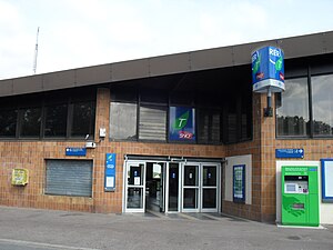
Noisy–Champs station
Railway station in France
Distance: Approx. 1009 meters
Latitude and longitude: 48.8429,2.58
Noisy–Champs station is a railway station on the RER train network at the border between Champs-sur-Marne, Seine-et-Marne and Noisy-le-Grand, Seine-Saint-Denis, France.

Noisiel station
Distance: Approx. 2297 meters
Latitude and longitude: 48.8433,2.6167
Noisiel station is a railway station on the Réseau Express Régional train network in Noisiel, Seine-et-Marne.
Les Yvris–Noisy-le-Grand station
French railway station
Distance: Approx. 1482 meters
Latitude and longitude: 48.823173,2.579743
Les Yvris–Noisy-le-Grand is a French railway station located at kilometric point 23.843 of the Paris-Est–Mulhouse-Ville railway, on branch E4 of RER E, in Noisy-le-Grand, Seine-Saint-Denis, Île-de-France.
Lycée Flora Tristan (Noisy-le-Grand)
Public high school in Noisy-le-Grand, Île-de-France, France
Distance: Approx. 1351 meters
Latitude and longitude: 48.84361111,2.57416667
Lycée Flora Tristan is a French senior high school/sixth-form college in Noisy-le-Grand, in the Paris metropolitan area.

École nationale des sciences géographiques
Engineering college in Champs-sur-Marne, France
Distance: Approx. 655 meters
Latitude and longitude: 48.841277,2.587187
École nationale des sciences géographiques (ENSG or ENSG Géomatique) a French engineering college created in 1941. The ENSG hosts about ten initial training cycles ranging from the Technician level to Masters and Mastères Spécialisés levels, and organizes a large volume of continuing education in all areas of geomatics. Located in Champs-sur-Marne, the ENSG is a public higher education institution.
Weather in this IP's area
clear sky
16 Celsius
16 Celsius
16 Celsius
18 Celsius
1019 hPa
83 %
1019 hPa
1008 hPa
10000 meters
6.26 m/s
6.26 m/s
40 degree
07:32:19
19:54:29


