Country:
 Germany
Region:
City:
Latitude and Longitude:
Time Zone:
Postal Code:
IP information under different IP Channel
ip-api
Country
Region
City
ASN
Time Zone
ISP
Blacklist
Proxy
Latitude
Longitude
Postal
Route
IPinfo
Country
Region
City
ASN
Time Zone
ISP
Blacklist
Proxy
Latitude
Longitude
Postal
Route
MaxMind
Country
Region
City
ASN
Time Zone
ISP
Blacklist
Proxy
Latitude
Longitude
Postal
Route
Luminati
Country
DERegion
nw
City
cologne
ASN
Time Zone
Europe/Berlin
ISP
Samteco Serv Srl
Latitude
Longitude
Postal
db-ip
Country
Region
City
ASN
Time Zone
ISP
Blacklist
Proxy
Latitude
Longitude
Postal
Route
ipdata
Country
Region
City
ASN
Time Zone
ISP
Blacklist
Proxy
Latitude
Longitude
Postal
Route
Popular places and events near this IP address
RAF Butzweilerhof
Distance: Approx. 2089 meters
Latitude and longitude: 50.98480556,6.89141667
Royal Air Force Butzweilerhof, commonly known as RAF Butzweilerhof was a Royal Air Force station in the middle west of Germany situated in the northern suburbs of Cologne (German: Köln). The station's motto was Per Vires Pax, and the station badge depicts the Cologne cathedral rising above the waters.

Dreikönigsgymnasium
Oldest secondary school in Cologne, Germany
Distance: Approx. 1340 meters
Latitude and longitude: 50.967,6.929
The Dreikönigsgymnasium ("Tricoronatum", meaning "Three Kings School", sometimes referred to in English as the College of the Three Crowns) is a regular public Gymnasium located in Cologne, Germany. Founded in 1450 by the city of Cologne, it is the oldest school in Cologne and one of the oldest in Germany. In 1556 it was transferred to Jesuit control through the son of the mayor, who had become a Jesuit.

Cologne-Weidenpesch Racecourse
Horse racing track in Cologne, Germany
Distance: Approx. 2438 meters
Latitude and longitude: 50.98333333,6.95194444
The Cologne-Weidenpesch Racecourse (Galopprennbahn Köln-Weidenpesch) is a horse racing track at Weidenpescher Park in Nippes, Cologne. As the only race course in Germany hosting more than one European pattern Group 1 race, Weidenpesch is one of the most prominent tracks in the country. Cologne-Weidenpesch is also one of Germany's oldest horse-racing tracks, having been established as a race course in 1897.

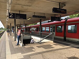
Köln-Longerich station
Railway station in Cologne, Germany
Distance: Approx. 2590 meters
Latitude and longitude: 50.99777778,6.90166667
Köln-Longerich is a railway station situated at Longerich, Cologne in western Germany. It is served by the S11 line of the Rhine-Ruhr S-Bahn.
Köln Geldernstraße/Parkgürtel station
Railway station in Cologne, Germany
Distance: Approx. 1839 meters
Latitude and longitude: 50.96861111,6.94111111
Köln Geldernstraße/Parkgürtel station is a railway station situated at Bilderstöckchen, Cologne in western Germany. It is served by line S11 of the Rhine-Ruhr S-Bahn. An adjacent underground station links the station with the Cologne Stadtbahn KVB light rail network.
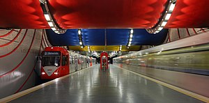
Rochusplatz station
Underground train station in Cologne, Germany
Distance: Approx. 2522 meters
Latitude and longitude: 50.95666667,6.90305556
Rochusplatz is an underground station on the Cologne Stadtbahn lines 3 and 4 in Cologne. The station is located on Venloer Straße at its intersection with Äußere Kanalstraße in the district of Ehrenfeld. The station was opened in 1992 and consists of a mezzanine and one island platform with two rail tracks.

Cologne Butzweilerhof Airport
Former airport of Cologne, West Germany (1912–1995)
Distance: Approx. 2089 meters
Latitude and longitude: 50.98480556,6.89141667
Butzweilerhof was an airport of Cologne in West Germany. It was established as a training airfield in 1912, and saw airline service from 1922 until the 1950s. It was replaced by the Cologne Bonn Airport.

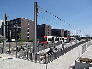
Neusser Straße/Gürtel station
Railway station in Cologne, Germany
Distance: Approx. 2343 meters
Latitude and longitude: 50.97222222,6.95111111
Neusser Straße/Gürtel is an interchange station on the Cologne Stadtbahn lines 12, 13 and 15, located in the Cologne district of Nippes, Germany. The station lies on the Neusser Straße at the place where the Cologne Belt road (Gürtel) would have intersected it, if this section of it had been built. Even though the street was never built, the station carries the street name in its name.
Sparkasse Am Butzweilerhof station
Railway station in Germany
Distance: Approx. 2332 meters
Latitude and longitude: 50.985,6.88777778
Sparkasse Am Butzweilerhof is a terminus station on the Cologne Stadtbahn line 5, located in the Cologne district of Ossendorf. The station lies on Von-Hünefeld-Straße, the center of a large media and business park of Coloneum, RTL Television and NetCologne. Station and the entire neighborhood is named after the former Cologne Butzweilerhof Airport.

Nordfriedhof (Cologne)
Cemetery in Cologne, Germany
Distance: Approx. 1513 meters
Latitude and longitude: 50.97888889,6.94
Nordfriedhof is a cemetery in Cologne, Germany. Opened on 18 May 1896 and after the Second World War the cemetery was significantly expanded. German actress Trude Herr (1927–1991) is buried there.
Escher Straße station
Distance: Approx. 1758 meters
Latitude and longitude: 50.96444444,6.93361111
Escher Straße is one of a few elevated stations on the Cologne Stadtbahn network. It is served by line 13, also known as Gürtellinie (Belt Line). The halt is located on the Cologne Belt at Parkgürtel in the Cologne district of Nippes (Bilderstöckchen).

St Peter's Church (Cologne)
Church in Cologne
Distance: Approx. 2402 meters
Latitude and longitude: 50.95555,6.91689
St Peter's Church (Sankt Peter) is a Roman Catholic church in Cologne, run by the Jesuits. The painter Rubens was baptised in the church and his father was later buried there. Rubens' Crucifixion of St Peter is on display in the church.
Weather in this IP's area
broken clouds
17 Celsius
17 Celsius
15 Celsius
18 Celsius
1017 hPa
85 %
1017 hPa
1012 hPa
10000 meters
0.51 m/s
75 %
08:02:31
18:31:38