91.244.228.200 - IP Lookup: Free IP Address Lookup, Postal Code Lookup, IP Location Lookup, IP ASN, Public IP
Country:
Region:
City:
Location:
Time Zone:
Postal Code:
IP information under different IP Channel
ip-api
Country
Region
City
ASN
Time Zone
ISP
Blacklist
Proxy
Latitude
Longitude
Postal
Route
Luminati
Country
ASN
Time Zone
Europe/Amsterdam
ISP
Afiber B.v.
Latitude
Longitude
Postal
IPinfo
Country
Region
City
ASN
Time Zone
ISP
Blacklist
Proxy
Latitude
Longitude
Postal
Route
IP2Location
91.244.228.200Country
Region
noord-holland
City
heemstede
Time Zone
Europe/Amsterdam
ISP
Language
User-Agent
Latitude
Longitude
Postal
db-ip
Country
Region
City
ASN
Time Zone
ISP
Blacklist
Proxy
Latitude
Longitude
Postal
Route
ipdata
Country
Region
City
ASN
Time Zone
ISP
Blacklist
Proxy
Latitude
Longitude
Postal
Route
Popular places and events near this IP address

Heemstede
Municipality in North Holland, Netherlands
Distance: Approx. 431 meters
Latitude and longitude: 52.35,4.61666667
Heemstede (Dutch pronunciation: [ˈɦeːmsteːdə] ) is a town and a municipality in the Western Netherlands, in the province of North Holland. In 2021, it had a population of 27,545. Located just south of the city of Haarlem on the border with South Holland, it is one of the richest municipalities of the Netherlands.

Cruquius, Netherlands
Village in North Holland, Netherlands
Distance: Approx. 1974 meters
Latitude and longitude: 52.33333333,4.63333333
Cruquius (Dutch pronunciation: [ˈkrykijʏs]) is a village in the Dutch province of North Holland. It is a part of the municipality of Haarlemmermeer and lies about 4 km northwest of Hoofddorp.

Berkenrode
Former Dutch municipality, now part of Heemstede
Distance: Approx. 431 meters
Latitude and longitude: 52.35,4.61666667
Berkenrode, or Berckenroode is a former 'Heerlijkheid' in the Dutch province of North Holland, situated on the southwest side of Haarlem on the leidsevaart, north of Iepenrode and west of Heemstede. The original castle Berkenrode in the center of the moat was burned by the Spanish during the siege of Haarlem in 1572. The castle was rebuilt and despite suffering another fire in 1747 the settlement continued to function as a separate municipality with its own chapel up to 1857, when the town was annexed by Heemstede.
Zuidschalkwijk
Suburban hamlet in Haarlem, Netherlands
Distance: Approx. 1348 meters
Latitude and longitude: 52.34583333,4.64166667
Zuidschalkwijk was a hamlet in the northwestern Netherlands. It has been annexed by the city of Haarlem and is located about 4 km south of the city centre. Zuidschalkwijk was a separate municipality between 1817 and 1863, when it was merged with Haarlemmerliede en Spaarnwoude.

Haarlemmerhout
Oldest public park in the Netherlands
Distance: Approx. 1868 meters
Latitude and longitude: 52.36666667,4.62416667
The Haarlemmerhout is the oldest public park of the Netherlands. It lies on the south side of Haarlem, on the same old sandy sea wall that is shared by the public park Haagse Bos in The Hague and the Alkmaarderhout in Alkmaar.

Groenendaal Park
Distance: Approx. 1265 meters
Latitude and longitude: 52.33972222,4.61472222
Groenendaal park lies at the center of Heemstede, Netherlands. The park includes the grounds of old Heemstede country estates Bosbeek, and Meer en Berg. Along its western borders are the old Heemstede country estates Hartekamp, Huis te Manpad, and Iepenrode.

Museum De Cruquius
Museum in Cruquius, the Netherlands
Distance: Approx. 1681 meters
Latitude and longitude: 52.33805556,4.63833333
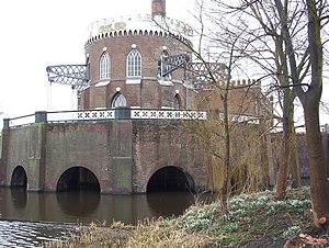
The Museum De Cruquius (or Cruquiusmuseum) occupies the old Cruquius steam pumping station in Cruquius, the Netherlands. It derives its name from Nicolaas Kruik (1678–1754), a Dutch land-surveyor and one of many promoters of a plan to pump the Haarlemmermeer (Haarlem lake) dry. Like many well-educated men of his time, he latinized his name to Nicolaus Samuel Cruquius.

Heemstede-Aerdenhout railway station
Railway station in the Netherlands
Distance: Approx. 1545 meters
Latitude and longitude: 52.35972222,4.60694444
Heemstede-Aerdenhout (Dutch pronunciation: [ˌɦeːmsteːdə ˌʔaːrdə(n)ˈɦʌut]) is a railway station in Heemstede and Aerdenhout, Netherlands. The station opened on 1 October 1891 and is located on the site of the old Toll house for the Leidsevaart canal, which still flows next to the station from Haarlem to Leiden. This canal still follows the Oude Lijn (Amsterdam - Rotterdam) closely.
Sportpark Koninklijke HFC
Distance: Approx. 1529 meters
Latitude and longitude: 52.36349444,4.61976111
Sportpark Koninklijke HFC is a cricket ground in Haarlem, the Netherlands. The first recorded match on the ground came in 1895 when the Haarlem played English club Leicester Ivanhoe. The ground has a long association of holding touring English sides, with the Free Foresters regular visitors, along with other touring English county sides, though none of these matches were rated as first-class.
Iepenrode
Villa in the Netherlands
Distance: Approx. 1161 meters
Latitude and longitude: 52.3475,4.60638889
Iepenrode, or Ipenrode, is the name of a villa in Heemstede, the Netherlands, between the Leidsevaart and Herenweg, located north of Huis te Manpad and south of Berkenrode. It was once the summer home of various mayors (burgemeesters) of Haarlem and is currently privately owned.

De Eenhoorn, Haarlem
Distance: Approx. 1391 meters
Latitude and longitude: 52.358432,4.637938
De Eenhoorn (Dutch pronunciation: [də ˈʔeːnɦoːr(ə)n]; English: The Unicorn) is a paltrok mill in Haarlem, Netherlands which has been restored to working order. As all Dutch paltrok mills it is a windpowered sawmill. The mill is listed as a Rijksmonument, number 19872.
Cheval Blanc (restaurant)
Restaurant in Heemstede, Netherlands
Distance: Approx. 1223 meters
Latitude and longitude: 52.36029167,4.62883611
Cheval Blanc is a restaurant in Heemstede in the Netherlands. It is a fine dining restaurant that is awarded one Michelin star in the period 2007–present. The restaurant was awarded a Bib Gourmand in the period 2002–2006.
Weather in this IP's area
few clouds
2 Celsius
-2 Celsius
1 Celsius
3 Celsius
1012 hPa
93 %
1012 hPa
1012 hPa
9000 meters
3.6 m/s
160 degree
20 %
