91.242.172.245 - IP Lookup: Free IP Address Lookup, Postal Code Lookup, IP Location Lookup, IP ASN, Public IP
Country:
Region:
City:
Location:
Time Zone:
Postal Code:
ISP:
ASN:
language:
User-Agent:
Proxy IP:
Blacklist:
IP information under different IP Channel
ip-api
Country
Region
City
ASN
Time Zone
ISP
Blacklist
Proxy
Latitude
Longitude
Postal
Route
db-ip
Country
Region
City
ASN
Time Zone
ISP
Blacklist
Proxy
Latitude
Longitude
Postal
Route
IPinfo
Country
Region
City
ASN
Time Zone
ISP
Blacklist
Proxy
Latitude
Longitude
Postal
Route
IP2Location
91.242.172.245Country
Region
england
City
arborfield
Time Zone
Europe/London
ISP
Language
User-Agent
Latitude
Longitude
Postal
ipdata
Country
Region
City
ASN
Time Zone
ISP
Blacklist
Proxy
Latitude
Longitude
Postal
Route
Popular places and events near this IP address

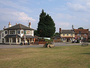
Arborfield
Human settlement in England
Distance: Approx. 288 meters
Latitude and longitude: 51.401,-0.916
Arborfield is a village and former civil parish, now in the parish of Arborfield and Newland, in the Borough of Wokingham in Berkshire, England. It is about 5 miles (8 km) south-east of Reading, about 4 miles (6.4 km) west of Wokingham. It lies about 1 mile (2 km) west of the village of Arborfield Cross and the two villages have become collectively known as Arborfield, with no signs marking their boundary.

Arborfield and Newland
Human settlement in England
Distance: Approx. 586 meters
Latitude and longitude: 51.406,-0.916
Arborfield and Newland is a civil parish in the Wokingham district of Berkshire, England. It had a population of 2,228 according to the 2001 census, increasing to 3,115 at the 2011 Census. It includes Arborfield, Arborfield Cross, part of Arborfield Green, Newland and Carter's Hill.

Lower Earley
Suburb in Berkshire, England
Distance: Approx. 2695 meters
Latitude and longitude: 51.424,-0.934
Lower Earley is a suburb which forms the southern portion of the civil parish of Reading,Berkshire in the Berkshire.England. Along with neighbouring Earley, Winnersh, Woodley and Shinfield, It forms part of a part of the Reading/Wokingham Urban Area.

Shinfield
Village and civil parish in Berkshire, England
Distance: Approx. 2007 meters
Latitude and longitude: 51.408,-0.947
Shinfield is a village and civil parish in the Borough of Wokingham, Berkshire, England. It lies just south of Reading, around 3 miles (4.8 km) from the town centre, and covers an area of 4,313 acres (17.45 km2). Shinfield Park is the northern part of the parish, becoming physically separated from Reading when the M4 motorway was constructed in 1971.

Arborfield Cross
Human settlement in England
Distance: Approx. 1146 meters
Latitude and longitude: 51.396873,-0.905288
Arborfield Cross is a village in the civil parish of Arborfield and Newland in the Borough of Wokingham in the English county of Berkshire.
Hundred of Charlton
Distance: Approx. 769 meters
Latitude and longitude: 51.396,-0.927
Charlton was a hundred in the English county of Berkshire. Like all hundreds, although never abolished, it effectively ceased to function after 1886. Charlton was one of the seven hundreds of Windsor Forest.

Arborfield Green
Former military installation in Berkshire, England
Distance: Approx. 2499 meters
Latitude and longitude: 51.384204,-0.896967
Arborfield Green is a new village approximately 1 mile (1.6 km) south east of the village of Arborfield Cross in the English county of Berkshire, previously a British Army garrison called Arborfield Garrison. The army vacated the site in 2015 and it is now being redeveloped for housing, with a total of 3,500 homes planned. The Garrison and its associated housing estates are split between the civil parishes of Arborfield and Newland, Barkham, Finchampstead, and Swallowfield.
Farley Castle
Distance: Approx. 2333 meters
Latitude and longitude: 51.3805,-0.9225
Farley Castle is an early 19th-century modern house situated at Farley Hill, Swallowfield, Berkshire. The Gothic-styled, two-storey house in red brick with battlements and round turrets, was built for Edward Stephenson Esq in c. 1810 for his youngest son Henry Stephenson who farmed the estate.
L'Ortolan
Restaurant in Berkshire, England
Distance: Approx. 2504 meters
Latitude and longitude: 51.4089,-0.9541
L'Ortolan was a gourmet restaurant in the village of Shinfield, 6 km (4 mi) south of the centre of Reading, Berkshire, England. The restaurant closed its doors for the final time in August 2024. It was located in the village's old vicarage building, which is a Grade-II listed building.
International Cocoa Quarantine Centre
Organisation aiming to reduce the amount of disease affecting cocoa plants
Distance: Approx. 684 meters
Latitude and longitude: 51.40699722,-0.92416111
The International Cocoa Quarantine Centre (ICQC), located in Arborfield, a suburb of Reading, Berkshire, United Kingdom, is an organization aiming to reduce the amount of disease affecting cocoa plants. Cocoa plants are quarantined in a 1,000-square-metre (11,000 sq ft) greenhouse before being transported across the globe. Quarantining cocoa plants is considered important because over 70% of the global cocoa supply originates from West Africa, and therefore the cocoa market is susceptible to any catastrophic effects that should occur in that region.

Arborfield Hall
Former country house in Southern England
Distance: Approx. 656 meters
Latitude and longitude: 51.406,-0.926
Arborfield Hall was a large country house on the banks of the River Loddon near the village of Arborfield in Berkshire.

Earley and Woodley (UK Parliament constituency)
Parliamentary constituency in the United Kingdom, 2024 onwards
Distance: Approx. 2071 meters
Latitude and longitude: 51.42,-0.92
Earley and Woodley is a constituency of the House of Commons in the UK Parliament. Following the completion of the 2023 periodic review of Westminster constituencies, it was first contested at the 2024 general election. It is represented by Yuan Yang of the Labour Party.
Weather in this IP's area
broken clouds
7 Celsius
5 Celsius
7 Celsius
8 Celsius
1034 hPa
76 %
1034 hPa
1024 hPa
10000 meters
2.57 m/s
180 degree
75 %