Country:
Region:
City:
Latitude and Longitude:
Time Zone:
Postal Code:
IP information under different IP Channel
ip-api
Country
Region
City
ASN
Time Zone
ISP
Blacklist
Proxy
Latitude
Longitude
Postal
Route
IPinfo
Country
Region
City
ASN
Time Zone
ISP
Blacklist
Proxy
Latitude
Longitude
Postal
Route
MaxMind
Country
Region
City
ASN
Time Zone
ISP
Blacklist
Proxy
Latitude
Longitude
Postal
Route
Luminati
Country
ASN
Time Zone
Europe/Paris
ISP
Free Pro SAS
Latitude
Longitude
Postal
db-ip
Country
Region
City
ASN
Time Zone
ISP
Blacklist
Proxy
Latitude
Longitude
Postal
Route
ipdata
Country
Region
City
ASN
Time Zone
ISP
Blacklist
Proxy
Latitude
Longitude
Postal
Route
Popular places and events near this IP address

Saint-Lazare station (Paris Métro)
Paris Métro station
Distance: Approx. 88 meters
Latitude and longitude: 48.87549,2.32664
Saint-Lazare station (French pronunciation: [sɛ̃ lazaʁ]) is a station on Line 3, Line 12, Line 13 and Line 14 of the Paris Métro. Line 9 also stops at Saint Augustin and RER E stops at Haussmann–Saint-Lazare. A tunnel connects both of these stations.

Gare Saint-Lazare
Terminal railway station in Paris, France
Distance: Approx. 215 meters
Latitude and longitude: 48.87694444,2.32444444
The Gare Saint-Lazare (lit. 'Saint Lazarus station'), officially Paris Saint Lazare, is one of the seven large mainline railway station terminals in Paris, France. It was the first train station built in Paris, opening in 1837. It mostly serves train services to western suburbs, as well as intercity services toward Normandy using the Paris–Le Havre railway.

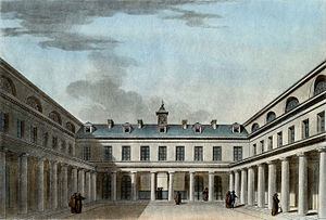
Jardin de Tivoli, Paris
Park in Paris, France (1766 to 1842)
Distance: Approx. 113 meters
Latitude and longitude: 48.87631,2.3287
The Tivoli gardens of Paris were amusement parks located near the current site of the Saint-Lazare station, named after the gardens of the Villa d'Este in Tivoli near Rome. There were several such gardens in succession between 1795 and 1842, none of which remain today.

Chemins de fer de Paris à Lyon et à la Méditerranée
French railway company (1857–1937)
Distance: Approx. 124 meters
Latitude and longitude: 48.87596,2.328807
The Compagnie des chemins de fer de Paris à Lyon et à la Méditerranée ("Railway Company of Paris to Lyon and the Mediterranean"), also known as the Chemins de fer Paris-Lyon-Méditerranée or simply PLM, established in 1857, was one of France’s main railway companies until the nationalization of all French railways and establishment of the Société nationale des chemins de fer français (SNCF) on 1 January 1938.

Haussmann–Saint-Lazare station
Railway station in Paris, France
Distance: Approx. 179 meters
Latitude and longitude: 48.875055,2.328868
Haussmann–Saint-Lazare station is a station on the RER in Paris, France. Opened on 14 July 1999 as the terminus of the new Line E, it is situated beneath Boulevard Haussmann and directly connected to Gare Saint-Lazare, Auber, and two metro stations.
Passage du Havre
Arcade in Paris, France
Distance: Approx. 141 meters
Latitude and longitude: 48.875,2.32777778
The Passage du Havre is one of the covered passages of Paris. Formerly geared towards fish shops and railway modelling (e.g. Hornby, La Maison du Train), the arcade was rebuilt in the late 1990s as a modern mall at the time as the construction of Paris' RER E underground railway line, to welcome new shops more in keeping with the Quartier de l'Opéra-Saint Lazare, the heart of Paris major business district.

Lycée Condorcet
School in Paris, Île-de-France, France
Distance: Approx. 159 meters
Latitude and longitude: 48.87477778,2.32732222
The Lycée Condorcet (French: [lise kɔ̃dɔʁsɛ]) is a school founded in 1803 in Paris, France, located at 8, rue du Havre, in the city's 9th arrondissement. It is one of the four oldest high schools in Paris and also one of the most prestigious. Since its inception, various political eras have seen it given a number of different names, but its identity today honors the memory of the Marquis de Condorcet.

Edgar Morin Centre
French research and teaching centre
Distance: Approx. 230 meters
Latitude and longitude: 48.87826389,2.32731944
The Edgar Morin Centre (French: Centre Edgar-Morin), formerly CETSAH (Centre d'Études Transdisciplinaires, Sociologie, Anthropologie, Histoire), is a graduate teaching and research unit of the École des Hautes Études en Sciences Sociales (EHESS) and of the French Centre National de la Recherche Scientifique, Paris. The centre, named after social theorist and intellectual Edgar Morin, is part of the Institut Interdisciplinaire d'Anthropologie du Contemporain (Interdisciplinary Institute of Contemporary Anthropology, known as IIAC).

Café Terminus
Distance: Approx. 139 meters
Latitude and longitude: 48.8756,2.3255
The Café Terminus was a popular cafe in the late 19th century near the Gare Saint-Lazare, located in Paris, France. It is infamously known as the target of a bomb attack by French Anarchist Émile Henry on February 12, 1894.

Au roi de la bière
Historic Monument in Paris, France
Distance: Approx. 156 meters
Latitude and longitude: 48.87527778,2.32555556
Au roi de la bière is a former brasserie in the 8th arrondissement of Paris, France. It has been an official Historic Monument since 1997.

Saint-Louis-d'Antin
Church located in Paris, in France
Distance: Approx. 196 meters
Latitude and longitude: 48.87455,2.32811
Saint-Louis-d'Antin is a Roman Catholic parish church located at 63 rue Caumartin in the 9th arrondissement of Paris, next to Place Georges-Berry, close to the major Paris department stores Printemps and Galeries Lafayette, and the Gare Saint-Lazare railway station. It was originally built in 1783 as a monastery chapel, then became a parish church in 1802. It is known for its lavish Neclassical interior and its collection of 19th century paintings and stained glass.

Hilton Paris Opéra
Hilton-branded hotel in Paris
Distance: Approx. 145 meters
Latitude and longitude: 48.8754,2.3256
The Hilton Paris Opéra is a historic hotel in the 8th arrondissement of Paris, France. It was initially opened as the Hotel Terminus on May 7, 1889 for the 1889 World's Fair in Paris, the same event the Eiffel Tower was originally built for. It was built by French architect Juste Lisch and originally designed to accommodate transatlantic travelers arriving from Normandy by train.
Weather in this IP's area
overcast clouds
15 Celsius
15 Celsius
14 Celsius
16 Celsius
1015 hPa
93 %
1015 hPa
1009 hPa
10000 meters
2.57 m/s
320 degree
100 %
08:15:53
18:55:20
