Country:
 Poland
Region:
City:
Latitude and Longitude:
Time Zone:
Postal Code:
IP information under different IP Channel
ip-api
Country
Region
City
ASN
Time Zone
ISP
Blacklist
Proxy
Latitude
Longitude
Postal
Route
IPinfo
Country
Region
City
ASN
Time Zone
ISP
Blacklist
Proxy
Latitude
Longitude
Postal
Route
MaxMind
Country
Region
City
ASN
Time Zone
ISP
Blacklist
Proxy
Latitude
Longitude
Postal
Route
Luminati
Country
PLRegion
26
City
skarzyskokamienna
ASN
Time Zone
Europe/Warsaw
ISP
UNINET Sp. z o.o.
Latitude
Longitude
Postal
db-ip
Country
Region
City
ASN
Time Zone
ISP
Blacklist
Proxy
Latitude
Longitude
Postal
Route
ipdata
Country
Region
City
ASN
Time Zone
ISP
Blacklist
Proxy
Latitude
Longitude
Postal
Route
Popular places and events near this IP address
Skarżysko-Kamienna
Place in Świętokrzyskie Voivodeship, Poland
Distance: Approx. 3164 meters
Latitude and longitude: 51.11666667,20.91666667
Skarżysko-Kamienna pronounced [skarˈʐɨskɔ kaˈmʲɛnːa] is a city in northern Świętokrzyskie Voivodeship in south-central Poland by Kamienna river, to the north of Świętokrzyskie Mountains; one of the voivodship's major cities. Prior to 1928, it bore the name of Kamienna; in less formal contexts usually only the first part of the name (Skarżysko) is used. It belongs to historic Polish province of Lesser Poland.
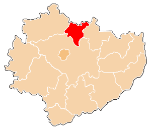
Skarżysko County
County in Świętokrzyskie Voivodeship, Poland
Distance: Approx. 3164 meters
Latitude and longitude: 51.11666667,20.91666667
Skarżysko County (Polish: powiat skarżyski) is a unit of territorial administration and local government (powiat) in Świętokrzyskie Voivodeship, south-central Poland. It came into being on January 1, 1999, as a result of the Polish local government reforms passed in 1998. Its administrative seat and largest town is Skarżysko-Kamienna, which lies 34 kilometres (21 mi) north-east of the regional capital Kielce.

Skarżysko Kościelne
Place in Świętokrzyskie Voivodeship, Poland
Distance: Approx. 3915 meters
Latitude and longitude: 51.1375,20.91416667
Skarżysko Kościelne [skarˈʐɨskɔ kɔˈɕt͡ɕɛlnɛ] is a village in Skarżysko County, Świętokrzyskie Voivodeship, Poland. It is the seat of the administrative district of Gmina Skarżysko Kościelne. It should not be confused with the nearby town of Skarżysko-Kamienna.
Gmina Skarżysko Kościelne
Gmina in Świętokrzyskie Voivodeship, Poland
Distance: Approx. 3915 meters
Latitude and longitude: 51.1375,20.91416667
Gmina Skarżysko Kościelne is a rural gmina (administrative district) in Skarżysko County, Świętokrzyskie Voivodeship, in south-central Poland. Its seat is the village of Skarżysko Kościelne, which lies approximately 3 kilometres (2 mi) north of Skarżysko-Kamienna and 36 km (22 mi) north-east of the regional capital Kielce. The gmina covers an area of 53.24 square kilometres (20.6 sq mi), and as of 2006 its total population is 6,188.
Bugaj, Skarżysko County
Village in Świętokrzyskie Voivodeship, Poland
Distance: Approx. 5298 meters
Latitude and longitude: 51.09888889,20.8
Bugaj [ˈbuɡai̯] is a village in the administrative district of Gmina Bliżyn, within Skarżysko County, Świętokrzyskie Voivodeship, in south-central Poland. It lies approximately 4 kilometres (2 mi) east of Bliżyn, 9 km (6 mi) west of Skarżysko-Kamienna, and 28 km (17 mi) north-east of the regional capital Kielce.
Wołów, Świętokrzyskie Voivodeship
Village in Świętokrzyskie Voivodeship, Poland
Distance: Approx. 5716 meters
Latitude and longitude: 51.09361111,20.79694444
Wołów [ˈvɔwuf] is a village in the administrative district of Gmina Bliżyn, within Skarżysko County, Świętokrzyskie Voivodeship, in south-central Poland. It lies approximately 4 kilometres (2 mi) south-east of Bliżyn, 9 km (6 mi) west of Skarżysko-Kamienna, and 27 km (17 mi) north-east of the regional capital Kielce.
Zagórze, Gmina Bliżyn
Village in Świętokrzyskie Voivodeship, Poland
Distance: Approx. 5502 meters
Latitude and longitude: 51.11416667,20.79277778
Zagórze [zaˈɡuʐɛ] is a village in the administrative district of Gmina Bliżyn, within Skarżysko County, Świętokrzyskie Voivodeship, in south-central Poland. It lies approximately 3 kilometres (2 mi) east of Bliżyn, 9 km (6 mi) west of Skarżysko-Kamienna, and 29 km (18 mi) north-east of the regional capital Kielce.
Lipowe Pole Plebańskie
Village in Świętokrzyskie Voivodeship, Poland
Distance: Approx. 4775 meters
Latitude and longitude: 51.15472222,20.89611111
Lipowe Pole Plebańskie [liˈpɔvɛ ˈpɔlɛ plɛˈbaɲskʲɛ] is a village in the administrative district of Gmina Skarżysko Kościelne, within Skarżysko County, Świętokrzyskie Voivodeship, in south-central Poland. It lies approximately 3 kilometres (2 mi) north-west of Skarżysko Kościelne, 5 km (3 mi) north of Skarżysko-Kamienna, and 36 km (22 mi) north-east of the regional capital Kielce.
Lipowe Pole Skarbowe
Village in Świętokrzyskie Voivodeship, Poland
Distance: Approx. 3648 meters
Latitude and longitude: 51.14583333,20.88777778
Lipowe Pole Skarbowe [liˈpɔvɛ ˈpɔlɛ skarˈbɔvɛ] is a village in the administrative district of Gmina Skarżysko Kościelne, within Skarżysko County, Świętokrzyskie Voivodeship, in south-central Poland. It lies approximately 3 kilometres (2 mi) north-west of Skarżysko Kościelne, 4 km (2 mi) north-west of Skarżysko-Kamienna, and 35 km (22 mi) north-east of the regional capital Kielce.
Majków, Świętokrzyskie Voivodeship
Village in Świętokrzyskie Voivodeship, Poland
Distance: Approx. 3601 meters
Latitude and longitude: 51.09444444,20.91166667
Majków (Polish pronunciation: [ˈmajkuf]) is a village in the administrative district of Gmina Skarżysko Kościelne, within Skarżysko County, Świętokrzyskie Voivodeship, in south-central Poland. It lies approximately 5 kilometres (3 mi) south of Skarżysko Kościelne, 3 km (2 mi) south of Skarżysko-Kamienna, and 32 km (20 mi) north-east of the regional capital Kielce.

Michałów, Skarżysko County
Village in Świętokrzyskie Voivodeship, Poland
Distance: Approx. 4631 meters
Latitude and longitude: 51.09888889,20.93277778
Michałów [miˈxawuf] is a village in the administrative district of Gmina Skarżysko Kościelne, within Skarżysko County, Świętokrzyskie Voivodeship, in south-central Poland. It lies approximately 5 kilometres (3 mi) south of Skarżysko Kościelne, 3 km (2 mi) south-east of Skarżysko-Kamienna, and 33 km (21 mi) north-east of the regional capital Kielce.

White Eagle Museum
Military museum in Skarżysko-Kamienna, Poland
Distance: Approx. 3349 meters
Latitude and longitude: 51.087728,20.850264
The White Eagle Museum (Polish: Muzeum im. Orła Białego) is a Polish military museum located in the town of Skarżysko-Kamienna in the central Świętokrzyskie Voivodeship, opened in 1969.
Weather in this IP's area
few clouds
12 Celsius
10 Celsius
11 Celsius
13 Celsius
1027 hPa
62 %
1027 hPa
997 hPa
10000 meters
2.5 m/s
8.49 m/s
81 degree
21 %
06:18:21
18:42:13