91.237.134.34 - IP Lookup: Free IP Address Lookup, Postal Code Lookup, IP Location Lookup, IP ASN, Public IP
Country:
 Slovenia
Region:
City:
Location:
Time Zone:
Postal Code:
ISP:
ASN:
language:
User-Agent:
Proxy IP:
Blacklist:
IP information under different IP Channel
ip-api
Country
Region
City
ASN
Time Zone
ISP
Blacklist
Proxy
Latitude
Longitude
Postal
Route
db-ip
Country
Region
City
ASN
Time Zone
ISP
Blacklist
Proxy
Latitude
Longitude
Postal
Route
IPinfo
Country
Region
City
ASN
Time Zone
ISP
Blacklist
Proxy
Latitude
Longitude
Postal
Route
IP2Location
91.237.134.34Country
siRegion
hoce-slivnica
City
rogoza
Time Zone
Europe/Ljubljana
ISP
Language
User-Agent
Latitude
Longitude
Postal
ipdata
Country
Region
City
ASN
Time Zone
ISP
Blacklist
Proxy
Latitude
Longitude
Postal
Route
Popular places and events near this IP address

Maribor Edvard Rusjan Airport
Airport in Slovenia
Distance: Approx. 2268 meters
Latitude and longitude: 46.47972222,15.68611111
Maribor Edvard Rusjan Airport (Slovene: Letališče Edvarda Rusjana Maribor) (IATA: MBX, ICAO: LJMB) is an international airport in Maribor, Slovenia. The second biggest and second most important Slovenian airport, it is the only other airport besides the airport in Ljubljana suitable for international commercial aviation, equipped with ILS. At this location, the airport Skoke has been for sports purposes since 1953, and in 1976 it was complemented for international traffic. It is located in Hoče–Slivnica which is about 5 km (3.1 mi) south from Maribor.

Miklavž na Dravskem Polju
Place in Styria, Slovenia
Distance: Approx. 1385 meters
Latitude and longitude: 46.50574722,15.69933333
Miklavž na Dravskem Polju (pronounced [miˈkláːwʃ na ˈdɾàːwskɛm ˈpóːlju]; Slovene: Miklavž na Dravskem polju) is the largest settlement and the seat of the Municipality of Miklavž na Dravskem Polju in northeastern Slovenia. It lies on the right bank of the Drava River southeast of Maribor. The area is part of the traditional region of Styria.
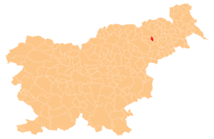
Municipality of Hoče-Slivnica
Municipality of Slovenia
Distance: Approx. 2251 meters
Latitude and longitude: 46.48333333,15.66666667
The Municipality of Hoče-Slivnica (pronounced [ˈxòːtʃɛ ˈslíːwnitsa, ˈxóː-]; Slovene: Občina Hoče-Slivnica) is a municipality south of Maribor in northeastern Slovenia. Its administrative seat is Spodnje Hoče.

Dogoše
Place in Styria, Slovenia
Distance: Approx. 3113 meters
Latitude and longitude: 46.52353333,15.70525556
Dogoše (pronounced [dɔˈɡoːʃɛ]) is a village and a suburb of Maribor on the right bank of the Drava River in northeastern Slovenia in the City Municipality of Maribor.
Dobrovce
Place in Styria, Slovenia
Distance: Approx. 2601 meters
Latitude and longitude: 46.48080556,15.70265833
Dobrovce (pronounced [ˈdoːbɾɔu̯tsɛ]) is a village in the Municipality of Miklavž na Dravskem Polju in northeastern Slovenia. It lies on the right bank of the Drava River southeast of Maribor. The area is part of the traditional region of Styria.
Skoke
Place in Styria, Slovenia
Distance: Approx. 1897 meters
Latitude and longitude: 46.48498889,15.69502778
Skoke (pronounced [ˈskoːkɛ]) is a village in the Municipality of Miklavž na Dravskem Polju in northeastern Slovenia. The area is part of the traditional region of Styria. The municipality is now included in the Drava Statistical Region.

Spodnje Hoče
Place in Styria, Slovenia
Distance: Approx. 2771 meters
Latitude and longitude: 46.49957778,15.64713889
Spodnje Hoče (pronounced [ˈspóːdnjɛ ˈxòːtʃɛ, - ˈxóː-]) is a settlement in and the administrative centre of the Municipality of Hoče–Slivnica in northeastern Slovenia. It lies below the eastern Pohorje Hills on the edge of the flatlands on the right bank of the Drava River south of Maribor. The area is part of the traditional region of Styria.
Bohova, Hoče–Slivnica
Place in Styria, Slovenia
Distance: Approx. 2274 meters
Latitude and longitude: 46.50915,15.65676389
Bohova (pronounced [bɔˈxɔːʋa]) is a settlement in the Municipality of Hoče–Slivnica south of Maribor in northeastern Slovenia. The area is part of the traditional region of Styria. The municipality is now included in the Drava Statistical Region.
Orehova Vas, Hoče–Slivnica
Place in Styria, Slovenia
Distance: Approx. 3424 meters
Latitude and longitude: 46.47157778,15.66620833
Orehova Vas (pronounced [ɔˈɾeːxɔʋa ˈʋaːs]; Slovene: Orehova vas) is a settlement in the Municipality of Hoče–Slivnica in northeastern Slovenia. It lies on the edge of the flatlands on the right bank of the Drava River south of Maribor. The area is part of the traditional region of Styria.
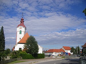
Rogoza
Place in Styria, Slovenia
Distance: Approx. 65 meters
Latitude and longitude: 46.49999167,15.68414444
Rogoza (pronounced [ɾɔˈɡoːza]) is a settlement in the Municipality of Hoče-Slivnica in northeastern Slovenia. It lies on the flatlands on the right bank of the Drava River between Spodnje Hoče and Miklavž na Dravskem Polju. The area is part of the traditional region of Styria.

Tezno massacre
Mass killing of POWs and civilians of the Independent State of Croatia
Distance: Approx. 2097 meters
Latitude and longitude: 46.51782778,15.692125
The Tezno massacre (Croatian: Pokolj u Teznom) was the mass killing of POWs and civilians of the Independent State of Croatia (NDH) that took place in Tezno near Maribor after the end of World War II in Yugoslavia. The killings were perpetrated by units of the Yugoslav Partisans in May 1945, in the Bleiburg repatriations. Summary executions began on 19 May, when the first prisoners arrived in the Tezno Forest from nearby prison camps, and they continued until 26 May.
Municipality of Miklavž na Dravskem Polju
Municipality of Slovenia
Distance: Approx. 1280 meters
Latitude and longitude: 46.5,15.7
The Municipality of Miklavž na Dravskem Polju (Slovene: Občina Miklavž na Dravskem polju) is a small municipality in northeastern Slovenia. It lies on the right bank of the Drava River southeast of Maribor. The seat of the municipality is the settlement of Miklavž na Dravskem Polju.
Weather in this IP's area
mist
1 Celsius
-1 Celsius
1 Celsius
2 Celsius
1024 hPa
86 %
1024 hPa
974 hPa
2000 meters
2.06 m/s
120 degree
100 %