91.236.25.194 - IP Lookup: Free IP Address Lookup, Postal Code Lookup, IP Location Lookup, IP ASN, Public IP
Country:
Region:
City:
Location:
Time Zone:
Postal Code:
ISP:
ASN:
language:
User-Agent:
Proxy IP:
Blacklist:
IP information under different IP Channel
ip-api
Country
Region
City
ASN
Time Zone
ISP
Blacklist
Proxy
Latitude
Longitude
Postal
Route
db-ip
Country
Region
City
ASN
Time Zone
ISP
Blacklist
Proxy
Latitude
Longitude
Postal
Route
IPinfo
Country
Region
City
ASN
Time Zone
ISP
Blacklist
Proxy
Latitude
Longitude
Postal
Route
IP2Location
91.236.25.194Country
Region
normandie
City
francheville
Time Zone
Europe/Paris
ISP
Language
User-Agent
Latitude
Longitude
Postal
ipdata
Country
Region
City
ASN
Time Zone
ISP
Blacklist
Proxy
Latitude
Longitude
Postal
Route
Popular places and events near this IP address

Pays d'Ouche
Historical region of France
Distance: Approx. 6126 meters
Latitude and longitude: 48.84,0.83
The Pays d'Ouche (French pronunciation: [pe.i duʃ], literally Land of Ouche) is an historical and geographical region in Normandy. It extends from the southwest of Évreux up to Bernay and Beaumont-le-Roger as a northern limit, and down to L'Aigle and to Gacé in the south. Additional cities are Breteuil-sur-Iton, Conches and Rugles.
Bourth
Commune in Normandy, France
Distance: Approx. 3498 meters
Latitude and longitude: 48.7708,0.8083
Bourth (French pronunciation: [buʁt]) is a commune in the Eure department in Normandy in northern France.

Les Barils
Commune in Normandy, France
Distance: Approx. 6384 meters
Latitude and longitude: 48.7325,0.8203
Les Barils (French pronunciation: [le baʁil]) is a commune in the Eure department in Normandy in northern France.
Bémécourt
Commune in Normandy, France
Distance: Approx. 6828 meters
Latitude and longitude: 48.8453,0.8761
Bémécourt (French pronunciation: [bemekuʁ]) is a commune in the Eure department and Normandy region of France.
Chaise-Dieu-du-Theil
Commune in Normandy, France
Distance: Approx. 6725 meters
Latitude and longitude: 48.7689,0.7619
Chaise-Dieu-du-Theil (French pronunciation: [ʃɛz djø dy tɛj]) is a commune in the Eure department in northern France.
Cintray, Eure
Part of Breteuil in Normandy, France
Distance: Approx. 3267 meters
Latitude and longitude: 48.7961,0.8917
Cintray (French pronunciation: [sɛ̃tʁɛ]) is a former commune in the Eure department in northern France. On 1 January 2016, it was merged into the commune of Breteuil.
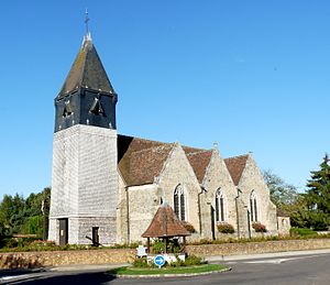
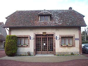
Francheville, Eure
Part of Verneuil d'Avre et d'Iton in Normandy, France
Distance: Approx. 250 meters
Latitude and longitude: 48.7886,0.8508
Francheville (French pronunciation: [fʁɑ̃ʃvil] ) is a former commune in the Eure department in the Normandy region in northern France. On 1 January 2017, it was merged into the new commune Verneuil d'Avre et d'Iton.
La Guéroulde
Part of Breteuil in Normandy, France
Distance: Approx. 4306 meters
Latitude and longitude: 48.8156,0.8883
La Guéroulde (French pronunciation: [la ɡeʁuld]) is a former commune in the Eure department and Haute-Normandie region of France. On 1 January 2016, it was merged into the commune of Breteuil.
Mandres, Eure
Commune in Normandy, France
Distance: Approx. 3888 meters
Latitude and longitude: 48.7539,0.8686
Mandres (French pronunciation: [mɑ̃dʁ]) is a commune in the Eure department in Normandy in northern France.

Pullay
Commune in Normandy, France
Distance: Approx. 6400 meters
Latitude and longitude: 48.7319,0.8769
Pullay (French pronunciation: [pylɛ]) is a commune in the Eure department in Normandy in northern France.
Saint-Nicolas-d'Attez
Part of Sainte-Marie-d'Attez in Normandy, France
Distance: Approx. 6999 meters
Latitude and longitude: 48.8078,0.9394
Saint-Nicolas-d'Attez is a former commune in the Eure department in Normandy in northern France. On 1 January 2016, it was merged into the new commune of Sainte-Marie-d'Attez.

Siege of Breteuil
Siege during the Hundred Years' War
Distance: Approx. 7366 meters
Latitude and longitude: 48.8369,0.9147
The siege of Breteuil was the investment (surrounding) of the Norman town of Breteuil, held by partisans of Charles II, King of Navarre, by French forces between April and about 20 August 1356. It was interrupted on 5 July when a small English army commanded by Henry, Earl of Lancaster, relieved and resupplied the town. The French king, John II, attempted to bring Lancaster to battle with the much larger French royal army, but Lancaster avoided this.
Weather in this IP's area
scattered clouds
5 Celsius
-1 Celsius
5 Celsius
5 Celsius
993 hPa
83 %
993 hPa
968 hPa
10000 meters
10.71 m/s
18.81 m/s
211 degree
27 %

