91.236.138.124 - IP Lookup: Free IP Address Lookup, Postal Code Lookup, IP Location Lookup, IP ASN, Public IP
Country:
Region:
City:
Location:
Time Zone:
Postal Code:
IP information under different IP Channel
ip-api
Country
Region
City
ASN
Time Zone
ISP
Blacklist
Proxy
Latitude
Longitude
Postal
Route
Luminati
Country
Region
68
City
khmelnytskyi
ASN
Time Zone
Europe/Kyiv
ISP
Global Technologies of Ukraine LLC
Latitude
Longitude
Postal
IPinfo
Country
Region
City
ASN
Time Zone
ISP
Blacklist
Proxy
Latitude
Longitude
Postal
Route
IP2Location
91.236.138.124Country
Region
khmelnytska oblast
City
khmel'nyts'kyy
Time Zone
Europe/Kiev
ISP
Language
User-Agent
Latitude
Longitude
Postal
db-ip
Country
Region
City
ASN
Time Zone
ISP
Blacklist
Proxy
Latitude
Longitude
Postal
Route
ipdata
Country
Region
City
ASN
Time Zone
ISP
Blacklist
Proxy
Latitude
Longitude
Postal
Route
Popular places and events near this IP address

Khmelnytskyi
City and administrative center of Khmelnytskyi Oblast, Ukraine
Distance: Approx. 605 meters
Latitude and longitude: 49.41666667,27
Khmelnytskyi (Ukrainian: Хмельницький, IPA: [xmelʲˈnɪtsʲkɪj] ) is a city in western Ukraine. Located on the Southern Bug, it serves as the administrative centre of Khmelnytskyi Oblast as well as Khmelnytskyi Raion within the oblast. With a population of 274,452 (2022 estimate), Khmelnytskyi is the second-largest city in the historical region of Podolia, after Vinnytsia.

Khmelnytskyi Airport
Airport in Khmelnytskyi Oblast, Ukraine
Distance: Approx. 8244 meters
Latitude and longitude: 49.36,26.93333333
Khmelnytskyi Airport (Міжнародний аеропорт "Хмельницький) (IATA: HMJ, ICAO: UKLH) is an airport in Ukraine located 7 km southwest of Khmelnytskyi. It services general aviation.

Sport Complex Podillia
Distance: Approx. 135 meters
Latitude and longitude: 49.420556,26.995556
The Sport Complex Podillia (also known as the Podillia Stadium; Ukrainian: Спортивний комплекс «Поділля»; Sportyvnyĭ kompleks "Podillia") is a sports facility in Khmelnytskyi, Ukraine. The stadium is the central stadium in Khmelnytskyi Oblast and a home stadium of Ukrainian football club Podillia Khmelnytskyi. The stadium is located in the city's centre near the Franko City Park, a city hospital, and the Border Service Academy.

State Archives of Khmelnytskyi Oblast
Distance: Approx. 1114 meters
Latitude and longitude: 49.41765,26.98236
The State Archives of Khmelnytskyi Oblast is a state archival institution in Khmelnytskyi, Ukraine.
Khmelnytskyi urban hromada
Urban hromada of Khmelnytskyi Oblast, Ukraine
Distance: Approx. 605 meters
Latitude and longitude: 49.41666667,27
Khmelnytskyi urban hromada (Ukrainian: Хмельницька міська територіальна громада, romanized: Khmelnytska miska terytorialna hromada) is one of the hromadas of Ukraine, located in Khmelnytskyi Raion within Khmelnytskyi Oblast. Its capital is the city of Khmelnytskyi. Khmelnytskyi urban hromada has an area of 493.9 km2 (190.7 sq mi), as well as a population of 279,663 (as of 2023).

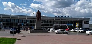
Khmelnytskyi railway station
Main railway station in the Ukrainian city of Khmelnytskyi
Distance: Approx. 1120 meters
Latitude and longitude: 49.41638889,27.00972222
Khmelnytskyi railway station (Ukrainian: Станція Хмельницький) is the main railway station in the Ukrainian city of Khmelnytskyi. It first opened in 1870, and is a part of Southwestern Railways. According to the "Investment Atlas of Ukraine", the station receives around 1.6 million passengers every year.
Weather in this IP's area
overcast clouds
-2 Celsius
-9 Celsius
-2 Celsius
-2 Celsius
1013 hPa
74 %
1013 hPa
977 hPa
10000 meters
7.34 m/s
12.58 m/s
284 degree
99 %