91.234.9.240 - IP Lookup: Free IP Address Lookup, Postal Code Lookup, IP Location Lookup, IP ASN, Public IP
Country:
Region:
City:
Location:
Time Zone:
Postal Code:
IP information under different IP Channel
ip-api
Country
Region
City
ASN
Time Zone
ISP
Blacklist
Proxy
Latitude
Longitude
Postal
Route
Luminati
Country
ASN
Time Zone
Europe/Paris
ISP
Free Pro SAS
Latitude
Longitude
Postal
IPinfo
Country
Region
City
ASN
Time Zone
ISP
Blacklist
Proxy
Latitude
Longitude
Postal
Route
IP2Location
91.234.9.240Country
Region
provence-alpes-cote-d'azur
City
marseille
Time Zone
Europe/Paris
ISP
Language
User-Agent
Latitude
Longitude
Postal
db-ip
Country
Region
City
ASN
Time Zone
ISP
Blacklist
Proxy
Latitude
Longitude
Postal
Route
ipdata
Country
Region
City
ASN
Time Zone
ISP
Blacklist
Proxy
Latitude
Longitude
Postal
Route
Popular places and events near this IP address

Arrondissement of Marseille
Arrondissement in Provence-Alpes-Côte d'Azur, France
Distance: Approx. 319 meters
Latitude and longitude: 43.2975,5.37722222
The arrondissement of Marseille is an arrondissement of France in the Bouches-du-Rhône department in the Provence-Alpes-Côte d'Azur region. It has 21 communes. Its population is 1,090,221 (2021), and its area is 683.2 km2 (263.8 sq mi).
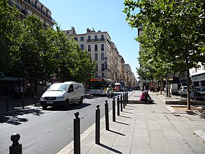
Canebière
Thoroughfare in Marseille, France
Distance: Approx. 71 meters
Latitude and longitude: 43.2975,5.38055556
La Canebière is a historic high street in the old quarter of Marseille, France.
Académie de Marseille
Distance: Approx. 342 meters
Latitude and longitude: 43.29722222,5.38530833
The Académie de Marseille, officially the Académie des sciences, lettres et arts de Marseille, is a French learned society based in Marseille. It was founded in 1726 and includes those in the city involved in the arts, letters, and sciences.

1st arrondissement of Marseille
Municipal arrondissement in Provence-Alpes-Côte d'Azur, France
Distance: Approx. 67 meters
Latitude and longitude: 43.2976,5.381
The 1st arrondissement of Marseille is one of the 16 arrondissements of Marseille. It is governed locally together with the 7th arrondissement, with which it forms the 1st sector of Marseille.

Cours Saint-Louis
Street in Marseille, France
Distance: Approx. 266 meters
Latitude and longitude: 43.29611111,5.37805556
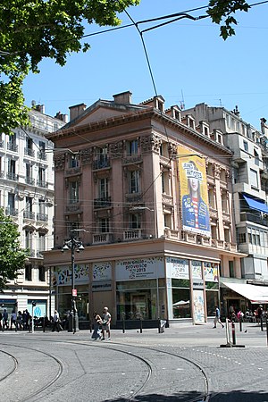
The Cours Saint-Louis is a street in Marseille, named after Louis of Toulouse (elder brother of Robert of Naples) rather than Saint Louis. It is the location of small pavilions to designs by Pascal Coste from which flowers are sold. It is located just off a crossroads, with the route to the Place Castellane (via the Rue de Rome) leading off from one side, the route to the Porte d'Aix and its triumphal arch, completed in 1839 (the route also passes near the library Bibliothèque de L'Alcazar) leading off from the opposite side, two routes leading towards the Old Port (one of which being the famous La Canebière built in 1666 by King Louis XIV), a route towards Palais Longchamp (with a simple right turn onto the Canebèire).

Hôtel Louvre et Paix
Distance: Approx. 211 meters
Latitude and longitude: 43.2969,5.3785
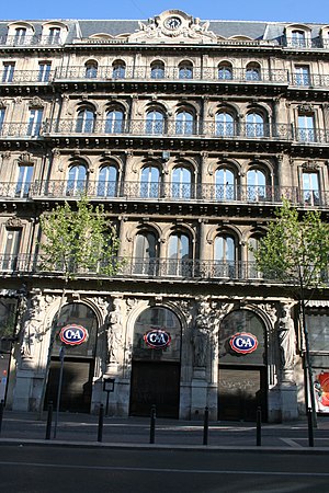
The Hôtel Louvre et Paix (a.k.a. Hôtel de la Marine) is a historic building in Marseille, France. Dedicated in 1863 as a luxury hotel, it was used by the Kriegsmarine during World War II. It now houses city administration offices and a C&A store.

Couvent des Bernardines
Convent in Marseille, France
Distance: Approx. 83 meters
Latitude and longitude: 43.2964,5.3817
The Couvent des Bernardines (French pronunciation: [kuvɑ̃ de bɛʁnaʁdin]) is a historic building in the 1st arrondissement of Marseille, France. It was a Roman Catholic convent for the Bernardines from its construction in 1743 to the French Revolution. It has been home to a high school, the Lycée Thiers, since 1802.
Or Thora Synagogue (Marseille)
Former synagogue, now mosque, in Marseille, France
Distance: Approx. 365 meters
Latitude and longitude: 43.3002,5.3801
The Or Thora Synagogue, also referred to as the Or Torah Synagogue ("Light of the Torah synagogue"), is a former Jewish synagogue, located in the 1st arrondissement of Marseille, France. Established by pieds-noirs in 1962, it was acquired by an Islamic community in 2016 and was scheduled to become a mosque.

Boulevard d'Athènes
Distance: Approx. 357 meters
Latitude and longitude: 43.3002,5.3808
The Boulevard d'Athènes is a historic boulevard in Marseille, France. Situated in the 1st arrondissement of Marseille, it runs from the Rue Marcel Sembat (off the Gare de Marseille-Saint-Charles) to the Allée Léon Gambetta, where it becomes the Boulevard Dugommier and finally meets the Canebière.

Maison du Figaro
Building in Marseille, France
Distance: Approx. 245 meters
Latitude and longitude: 43.29635,5.37821
The Maison du Figaro is a historic building in the 1st arrondissement of Marseille in France. It was designed by architect Pierre Pavillon, and it was completed in 1675. It has been listed as an official historical monument since 1992.
Thiers, Marseille
Administrative quarter of the 1st arrondissement of Marseille, Provence-Alpes-Côte d'Azur, France
Distance: Approx. 114 meters
Latitude and longitude: 43.29694444,5.3825
Thiers (French pronunciation: [tjɛʁ] ) is a neighbourhood (French: quartier) of the 1st arrondissement of Marseille. A cultural and student quarter in the centre of Marseille, it is located between Place Jean-Jaurès and La Canebière, near the Vieux-Port.

Alcazar (Marseille)
Former theatre and municipal library in Marseille
Distance: Approx. 416 meters
Latitude and longitude: 43.29888889,5.37666667
The Théâtre de l'Alcazar was a famous theatre, founded in the mid-19th century, that was located in the heart of Marseille's Bourse district, on Cours Belsunce, near the Canebière. From the 1960s the site was gradually abandoned, before being converted into a municipal library in 2004.
Weather in this IP's area
clear sky
-1 Celsius
-4 Celsius
-3 Celsius
2 Celsius
1030 hPa
38 %
1030 hPa
1028 hPa
10000 meters
2.01 m/s
1.96 m/s
50 degree
