91.233.172.10 - IP Lookup: Free IP Address Lookup, Postal Code Lookup, IP Location Lookup, IP ASN, Public IP
Country:
Region:
City:
Location:
Time Zone:
Postal Code:
ISP:
ASN:
language:
User-Agent:
Proxy IP:
Blacklist:
IP information under different IP Channel
ip-api
Country
Region
City
ASN
Time Zone
ISP
Blacklist
Proxy
Latitude
Longitude
Postal
Route
db-ip
Country
Region
City
ASN
Time Zone
ISP
Blacklist
Proxy
Latitude
Longitude
Postal
Route
IPinfo
Country
Region
City
ASN
Time Zone
ISP
Blacklist
Proxy
Latitude
Longitude
Postal
Route
IP2Location
91.233.172.10Country
Region
avtonomna respublika krym
City
bilohirs'k
Time Zone
ISP
Language
User-Agent
Latitude
Longitude
Postal
ipdata
Country
Region
City
ASN
Time Zone
ISP
Blacklist
Proxy
Latitude
Longitude
Postal
Route
Popular places and events near this IP address

Bilohirsk
Place in Crimea, Ukraine
Distance: Approx. 37 meters
Latitude and longitude: 45.05444444,34.60222222
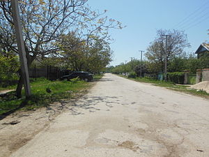
Bilohirsk (until 1944 – Karasubazar, Ukrainian: Білогірськ; Russian: Белогорск, romanized: Belogorsk, Crimean Tatar: Qarasuvbazar/Къарасувбазар) is a city and the administrative centre of Bilohirsk Raion, one of the raions (districts) of the Autonomous Republic of Crimea, which is recognised by a majority of countries as part of Ukraine, but is occupied by Russia. Population: 16,354 (2014 Census).
Bilohirsk Raion
Raion in Crimea
Distance: Approx. 37 meters
Latitude and longitude: 45.05444444,34.60222222
Bilohirsk Raion (Ukrainian: Білогірський район, Russian: Белогорский район, Crimean Tatar: Qarasuvbazar rayonı) is one of the 25 regions of Crimea, currently occupied by Russian Federation. Population: 60,445 (2014 Census). This landlocked region is situated in the foothills of the central Crimea.
Aq Qaya
Rock in Crimea
Distance: Approx. 5960 meters
Latitude and longitude: 45.106,34.623
Aq Qaya (Crimean Tatar: Aq Qaya, Ukrainian: Ак-Кая, Russian: Белая скала) — is a rock in Crimea, situated near the village of Belaya Skala/Ak-Kaya of the Bilohirsk Raion. The vertical white rocky wall rises above the valley of the Biyuk-Karasu river. The height above sea level is 325 m, the height difference between the valley and the top of the rock is 100 m.
Krynychne, Crimea
Village in Crimea
Distance: Approx. 3461 meters
Latitude and longitude: 45.02444444,34.6125
Krynychne (Ukrainian: Криничне; Russian: Криничное; Crimean Tatar: Kriniçnoye) is a village in the Bilohirsk Raion of Crimea. Population: 431 (2014 Census).
Weather in this IP's area
broken clouds
2 Celsius
-1 Celsius
2 Celsius
2 Celsius
1026 hPa
79 %
1026 hPa
974 hPa
10000 meters
2.32 m/s
1.87 m/s
4 degree
57 %


