Country:
Region:
City:
Latitude and Longitude:
Time Zone:
Postal Code:
IP information under different IP Channel
ip-api
Country
Region
City
ASN
Time Zone
ISP
Blacklist
Proxy
Latitude
Longitude
Postal
Route
Luminati
Country
ASN
Time Zone
Europe/Helsinki
ISP
Avarn Security Oy
Latitude
Longitude
Postal
IPinfo
Country
Region
City
ASN
Time Zone
ISP
Blacklist
Proxy
Latitude
Longitude
Postal
Route
db-ip
Country
Region
City
ASN
Time Zone
ISP
Blacklist
Proxy
Latitude
Longitude
Postal
Route
ipdata
Country
Region
City
ASN
Time Zone
ISP
Blacklist
Proxy
Latitude
Longitude
Postal
Route
Popular places and events near this IP address

Helsingin Suomalainen Yhteiskoulu
Secondary, sixth form school in Finland
Distance: Approx. 810 meters
Latitude and longitude: 60.2119537,24.8891857
Helsingin Suomalainen Yhteiskoulu, commonly abbreviated SYK (English: "Helsinki Finnish co-educational school"), is a prestigious free elementary, middle and high school in the Etelä-Haaga district of Helsinki, Finland.
Pitäjänmäki
District of Helsinki, Finland
Distance: Approx. 988 meters
Latitude and longitude: 60.22083333,24.8625
Pitäjänmäki (Swedish: Sockenbacka) is a district located on the westernmost district of Helsinki, Finland, near the border with Espoo. There are many IT and machine manufacturing companies in the area, especially around the Valimo railway station. Such companies include Nokia, Nokia Siemens Networks, ABB, Fujitsu Siemens, Digia, Martela as well as Nordea Bank, Stockmann Auto Oy and Sweco Industry Oy.

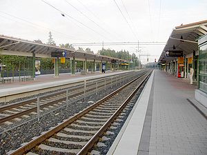
Huopalahti railway station
Railway station in Helsinki, Finland
Distance: Approx. 1124 meters
Latitude and longitude: 60.21777778,24.89527778
Huopalahti railway station (Finnish: Huopalahden rautatieasema, Swedish: Hoplax järnvägsstation) is a railway station on the Helsinki commuter rail network located in western Helsinki, Finland. It is located about 6 kilometres (4 mi) north/northwest of Helsinki Central railway station. Huopalahti station is situated in the district of Etelä-Haaga, but it was named for the municipality of Huopalahti, which was annexed to the city of Helsinki in 1946.
Valimo railway station
Railway station in Helsinki, Finland
Distance: Approx. 815 meters
Latitude and longitude: 60.22222222,24.87611111
Valimo railway station (Finnish: Valimon rautatieasema, Swedish: Gjuteriets järnvägsstation) is a station on the Helsinki commuter rail network located in the western part of Helsinki, Finland, between Huopalahti and Pitäjanmäki stations. It is located about 7 kilometres (4.3 mi) to the northwest/west of Helsinki Central railway station, in the core of the Pitäjänmäki industrial area.

Lycée franco-finlandais d'Helsinki
Bilingual school in Munkkivuori, Helsinki, Finland
Distance: Approx. 861 meters
Latitude and longitude: 60.2077,24.8701
Lycée franco-finlandais d'Helsinki (Finnish: Helsingin ranskalais-suomalainen koulu HRSK) is a Franco-Finnish school in Munkkivuori, Helsinki, Finland, founded by French Catherine Servé in 1947. It is run by the Finnish state since 1977 with a Finnish school system, the Republic of France paying wages of 7-10 teachers. Students graduating there receive the Finnish matriculation examination and French government give to students the diplomas of equal value of French baccalauréat.

Munkkivuori
Helsinki Subdivision in Uusimaa, Finland
Distance: Approx. 1009 meters
Latitude and longitude: 60.20583333,24.87611111
Munkkivuori (Swedish: Munkshöjden, literally 'Monk Mountain') is a quarter of the Munkkiniemi neighbourhood in Helsinki. The buildings and the plan of site are typical of the late 1950s. Most of the residential buildings in Munkkivuori are within a loop formed by Ulvilantie ring road.

Etelä-Haaga
Helsinki Subdivision in Uusimaa, Finland
Distance: Approx. 461 meters
Latitude and longitude: 60.21666667,24.88333333
Etelä-Haaga (Finnish), Södra Haga (Swedish) is a neighborhood of Helsinki, Finland.

Tali, Helsinki
Helsinki Subdivision in Uusimaa, Finland
Distance: Approx. 1115 meters
Latitude and longitude: 60.213,24.856
Tali (Swedish: Tali) is a neighbourhood located in Pitäjänmäki district of Western Helsinki, Finland. As of 2008, Tali has 1,078 inhabitants living in an area of 1.01 km2. The race track hosted the steeplechase eventing equestrian competition for the 1952 Summer Olympics.

Pitäjänmäki industrial area
Helsinki Subdivision in Uusimaa, Finland
Distance: Approx. 797 meters
Latitude and longitude: 60.222,24.874
The Pitäjänmäki industrial area (Finnish: Pitäjänmäen yritysalue, Swedish: Sockenbacka företagsområde) is a western neighborhood of Helsinki, Finland. It is located in Pitäjänmäki district. As of 2008, the Pitäjänmäki industrial area, has 2,415 inhabitants living in an area of 1.38 km2.
Huopalahti
Former municipality in Uusimaa, Finland
Distance: Approx. 956 meters
Latitude and longitude: 60.21,24.89
Huopalahti (Swedish: Hoplax) was a municipality during the years 1920–1945 in Uusimaa, Finland. Areas of Munkkiniemi, Lauttasaari and parts of northern Pasila were parts of Huopalahti. The area was separated from former Helsinki parish in 1920.
2010 IPP Open
Tennis tournament
Distance: Approx. 196 meters
Latitude and longitude: 60.21313889,24.87572222
The 2010 IPP Open was a professional tennis tournament played on indoor carpet courts. It was the tenth edition of the tournament which was part of the 2010 ATP Challenger Tour. It took place in Helsinki, Finland between 22 and 28 November 2010.
Haaga executions of 1918
Distance: Approx. 712 meters
Latitude and longitude: 60.21555556,24.88861111
The Haaga executions of 1918 took place in Etelä-Haaga (‘South Haaga’) in what was then the Rural Municipality of Helsinge during the Battle of Helsinki of the Finnish Civil War on 12 April 1918. A total of 45 persons suspected of belonging to the Red Guards were executed by German troops at a bog at 8 o’clock p.m. at the site of the present Eliel Saarisen tie, halfway from the Pitäjänmäki roundabout to the tunnel leading to the Huopalahti Station, at the site of a pedestrian crossing.
Weather in this IP's area
broken clouds
6 Celsius
3 Celsius
5 Celsius
7 Celsius
1009 hPa
90 %
1009 hPa
1006 hPa
10000 meters
4.12 m/s
250 degree
75 %
08:17:54
15:52:15

