Country:
Region:
City:
Latitude and Longitude:
Time Zone:
Postal Code:
IP information under different IP Channel
ip-api
Country
Region
City
ASN
Time Zone
ISP
Blacklist
Proxy
Latitude
Longitude
Postal
Route
Luminati
Country
ASN
Time Zone
Europe/Warsaw
ISP
GTnet sp.j. Tomasz Gajewski Grzegorz Mazurek
Latitude
Longitude
Postal
IPinfo
Country
Region
City
ASN
Time Zone
ISP
Blacklist
Proxy
Latitude
Longitude
Postal
Route
db-ip
Country
Region
City
ASN
Time Zone
ISP
Blacklist
Proxy
Latitude
Longitude
Postal
Route
ipdata
Country
Region
City
ASN
Time Zone
ISP
Blacklist
Proxy
Latitude
Longitude
Postal
Route
Popular places and events near this IP address

Zamość
Place in Lublin Voivodeship, Poland
Distance: Approx. 718 meters
Latitude and longitude: 50.71666667,23.25277778
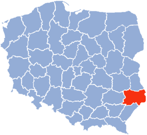
Zamość (Polish: [ˈzamɔɕt͡ɕ] ; Yiddish: זאמאשטש, romanized: Zamoshtsh; Latin: Zamoscia) is a historical city in southeastern Poland. It is situated in the southern part of Lublin Voivodeship, about 90 km (56 mi) from Lublin, 247 km (153 mi) from Warsaw. In 2021, the population of Zamość was 62,021.

Zamość Voivodeship
Distance: Approx. 545 meters
Latitude and longitude: 50.720556,23.258611
Zamość Voivodeship (Polish: województwo zamojskie) was a unit of administrative division and local government in Poland in years 1975–1998, superseded by Lublin Voivodeship.

Zamość County
County in Lublin Voivodeship, Poland
Distance: Approx. 545 meters
Latitude and longitude: 50.72055556,23.25861111
Zamość County (Polish: powiat zamojski) is a unit of territorial administration and local government (powiat) in Lublin Voivodeship, eastern Poland. It was established on January 1, 1999, as a result of the Polish local government reforms passed in 1998. Its administrative seat is the city of Zamość, although the city is not part of the county (it constitutes a separate city county).
Zamoyski Academy
Distance: Approx. 512 meters
Latitude and longitude: 50.718503,23.251654
The Zamoyski Academy (Polish: Akademia Zamojska; Latin: Hippaeum Zamoscianum; 1594–1784) was an academy founded in 1594 by Polish Crown Chancellor Jan Zamoyski. It was the third institution of higher education to be founded in the Polish–Lithuanian Commonwealth. After his death it slowly lost its importance, and in 1784 it was downgraded to a lyceum.

Zamość Synagogue
Former Orthodox synagogue in Zamość, Poland
Distance: Approx. 585 meters
Latitude and longitude: 50.718,23.254
The Zamość Synagogue (Polish: Synagoga Dawna w Zamościu), also the Zamość Old Synagogue or the Great Synagogue of Zamość, is a former Jewish congregation and synagogue, located in Zamość, in Lublin Voivodeship, Poland. Completed in 1618 in the Renaissance style, the synagogue is a UNESCO-protected World Heritage Site of Poland. Erected during the times of the Polish–Lithuanian Commonwealth, it functioned as a place of worship for Polish Jews until World War II, when the Nazis turned the interior into a carpenters' workshop.
Zamość Fortress
Deconstructed fortress, museum and heritage site
Distance: Approx. 687 meters
Latitude and longitude: 50.71694444,23.25277778
Zamość Fortress (Polish: Twierdza Zamość) is a set of fortifications constructed together with the city of Zamość (southeastern Poland). It was built between 1579 and 1618, and the construction was initiated by Chancellor and Hetman Jan Zamoyski. It was one of the biggest fortresses of the Polish–Lithuanian Commonwealth, built so solidly that it was able to resist the attacks of both the Cossacks and the Swedes during the Deluge.
Gmina Zamość
Gmina in Lublin Voivodeship, Poland
Distance: Approx. 545 meters
Latitude and longitude: 50.72055556,23.25861111
Gmina Zamość is a rural gmina (administrative district) in Zamość County, Lublin Voivodeship, in eastern Poland. Its seat is the town of Zamość, although the town is not part of the territory of the gmina. The gmina covers an area of 197 square kilometres (76.1 sq mi), and as of 2006 its total population is 20,482 (22,305 in 2013).
Roman Catholic Diocese of Zamość–Lubaczów
Roman Catholic diocese in Poland
Distance: Approx. 741 meters
Latitude and longitude: 50.716518,23.250406
The Diocese of Zamość-Lubaczów (Latin: Dioecesis Zamosciensis-Lubaczoviensis) is a suffragan Latin diocese of the Catholic Church in the ecclesiastical province of Przemyśl in Poland. Its cathedral episcopal see is Katedra Zmartwychwstania Pańskiego i św. Tomasza Apostoła, a World Heritage Site dedicated to Resurrection and the St.

Museum of Zamość
National museum in Zamość, Poland
Distance: Approx. 545 meters
Latitude and longitude: 50.72055556,23.25861111
The Museum of Zamość (Polish: Muzeum Zamojskie) is a registered museum in Poland, founded in the historic city of Zamość in 1926 during the interbellum. It is located in the centre of the Old City, a UNESCO World Heritage Site. The exhibition spaces are arranged at the upper floors of the meticulously restored tenement houses (kamienice) built during the Renaissance by immigrant Armenians in Poland who settled there in 1585, thanks to privileges granted by the Grand Hetman of the Crown Jan Zamoyski.
Zamość Cathedral
Church in Zamość, Poland
Distance: Approx. 755 meters
Latitude and longitude: 50.7164,23.2503
The Cathedral of the Resurrection and St. Thomas the Apostle (Polish: Katedra Zmartwychwstania Pańskiego i św. Tomasza Apostoła ), commonly known as Zamość Cathedral, is a religious building that is affiliated with the Catholic Church and is located in the old town of Zamość, a city in southeastern Poland.
Siege of Zamość
1656 siege
Distance: Approx. 5 meters
Latitude and longitude: 50.72314,23.25196
Siege of Zamość was part of The Deluge, a series of campaigns in the Polish–Lithuanian Commonwealth, that took place in early 1656.

Zamość Town Hall
Building in Zamość, Poland
Distance: Approx. 618 meters
Latitude and longitude: 50.71755556,23.25252778
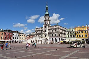
The Town Hall in Zamość is a Baroque building in the Old Town area of Zamość, Poland. It is located on the northern side of the market square and features a 52-meter clocktower. The area in which the town hall resides is a UNESCO World Hertiage Site, and the town hall itself is on the register of monuments in Poland.
Weather in this IP's area
overcast clouds
0 Celsius
-5 Celsius
0 Celsius
0 Celsius
1011 hPa
70 %
1011 hPa
985 hPa
10000 meters
5.62 m/s
11.14 m/s
256 degree
100 %
06:47:43
15:37:01


