91.229.194.200 - IP Lookup: Free IP Address Lookup, Postal Code Lookup, IP Location Lookup, IP ASN, Public IP
Country:
Region:
City:
Location:
Time Zone:
Postal Code:
IP information under different IP Channel
ip-api
Country
Region
City
ASN
Time Zone
ISP
Blacklist
Proxy
Latitude
Longitude
Postal
Route
Luminati
Country
ASN
Time Zone
Europe/Berlin
ISP
Sascha Bielski
Latitude
Longitude
Postal
IPinfo
Country
Region
City
ASN
Time Zone
ISP
Blacklist
Proxy
Latitude
Longitude
Postal
Route
IP2Location
91.229.194.200Country
Region
bayern
City
berneck
Time Zone
Europe/Berlin
ISP
Language
User-Agent
Latitude
Longitude
Postal
db-ip
Country
Region
City
ASN
Time Zone
ISP
Blacklist
Proxy
Latitude
Longitude
Postal
Route
ipdata
Country
Region
City
ASN
Time Zone
ISP
Blacklist
Proxy
Latitude
Longitude
Postal
Route
Popular places and events near this IP address
Hunding
Municipality in Bavaria, Germany
Distance: Approx. 2965 meters
Latitude and longitude: 48.85,13.18333333
Hunding is a municipality in the district of Deggendorf in Bavaria in Germany.
Lalling
Municipality in Bavaria, Germany
Distance: Approx. 6446 meters
Latitude and longitude: 48.85,13.13333333
Lalling is a municipality in the Lower Bavarian district of Deggendorf in Germany. It is a nationally recognized resort town.
Eppenschlag
Municipality in Bavaria, Germany
Distance: Approx. 6357 meters
Latitude and longitude: 48.88333333,13.3
Eppenschlag is a municipality in the district of Freyung-Grafenau in Bavaria in Germany.

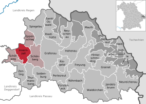
Innernzell
Municipality in Bavaria, Germany
Distance: Approx. 3715 meters
Latitude and longitude: 48.85,13.26666667
Innernzell (Central Bavarian: Innanzej) is a municipality in the district of Freyung-Grafenau in Bavaria in Germany.
Schöfweg
Municipality in Bavaria, Germany
Distance: Approx. 3361 meters
Latitude and longitude: 48.83333333,13.23333333
Schöfweg is a municipality in the district of Freyung-Grafenau in Bavaria in Germany.

Kirchberg im Wald
Municipality in Bavaria, Germany
Distance: Approx. 4977 meters
Latitude and longitude: 48.9,13.18333333
Kirchberg im Wald is a municipality in the district of Regen, in Bavaria, Germany.
Aschenstein
Mountain in Germany
Distance: Approx. 5580 meters
Latitude and longitude: 48.8184,13.2567
The Aschenstein is a 945-metre-high mountain in the western chain of the Bavarian Forest above the village of Zenting.

Brotjacklriegel
Mountain in Germany
Distance: Approx. 5021 meters
Latitude and longitude: 48.81700833,13.21753333
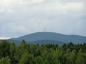
Seen from the River Danube, the Brotjacklriegel is the first high mountain in the Bavarian Forest. It is 1,011 m above NHN and lies in the county of Freyung-Grafenau in the German federal state of Bavaria. It is a symbol of the Sonnenwald region which comprises the municipalities of Schöfweg, Zenting, Innernzell, Grattersdorf and Market Schöllnach.
Fürberg (Bavarian Forest)
Mountain in Germany
Distance: Approx. 1073 meters
Latitude and longitude: 48.8706,13.2125
The 880-metre-high Fürberg is one of the smaller mountains in the Danube Hills, the lower part of the Bavarian Forest. It rises in the municipality of Kirchberg im Wald. At the summit is the Plattenstein, an interesting rock formation with a summit cross and view southwards to the higher Brotjacklriegel.
Geißlstein
Mountain in Germany
Distance: Approx. 6308 meters
Latitude and longitude: 48.8142,13.2654
The Geißlstein, at 906 metres, is one of the smaller mountains in the Bavarian Forest. It lies east of the Brotjacklriegel and next to the Aschenstein. Its summit has no views.

Bavarian Forest Nature Park
Distance: Approx. 6253 meters
Latitude and longitude: 48.895356,13.150574
The Bavarian Forest Nature Park (German: Naturpark Bayerischer Wald) covers an area north of the Danube as far as the border ridge with the Czech Republic. Its sponsor organisation is the Naturpark Bayerischer Wald whose head office is in Zwiesel, Bavaria. It was established in 1967 and is thus the oldest nature park in Bavaria.
Guntherstein
Distance: Approx. 5354 meters
Latitude and longitude: 48.864689,13.146396
The Guntherstein (c.700 m above sea level (NHN)) is a crag in the Bavarian Forest with good views, high above the bowl of the Lallinger Winkel and village of Lalling in Bavaria, Germany. The name comes from Saint Gunther, who once moved from Niederalteich Abbey to the then empty and primeval Bavarian Forest, cleared parts of the forests for settlement and later settled himself in the Bohemian Forest. The Gunthersteig, a hiking trail that leads in several days from Niederalteich via the Guntherstein and the border crossing at Gsenget to St.
Weather in this IP's area
broken clouds
-5 Celsius
-7 Celsius
-6 Celsius
-3 Celsius
1040 hPa
87 %
1040 hPa
944 hPa
10000 meters
1.36 m/s
1.17 m/s
58 degree
54 %


