91.227.123.48 - IP Lookup: Free IP Address Lookup, Postal Code Lookup, IP Location Lookup, IP ASN, Public IP
Country:
 Poland
Region:
City:
Location:
Time Zone:
Postal Code:
ISP:
ASN:
language:
User-Agent:
Proxy IP:
Blacklist:
IP information under different IP Channel
ip-api
Country
Region
City
ASN
Time Zone
ISP
Blacklist
Proxy
Latitude
Longitude
Postal
Route
db-ip
Country
Region
City
ASN
Time Zone
ISP
Blacklist
Proxy
Latitude
Longitude
Postal
Route
IPinfo
Country
Region
City
ASN
Time Zone
ISP
Blacklist
Proxy
Latitude
Longitude
Postal
Route
IP2Location
91.227.123.48Country
plRegion
dolnoslaskie
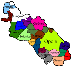
City
jawor
Time Zone
Europe/Warsaw
ISP
Language
User-Agent
Latitude
Longitude
Postal
ipdata
Country
Region
City
ASN
Time Zone
ISP
Blacklist
Proxy
Latitude
Longitude
Postal
Route
Popular places and events near this IP address

Jawor
Place in Lower Silesian Voivodeship, Poland
Distance: Approx. 477 meters
Latitude and longitude: 51.05,16.2
Jawor [ˈjavɔr] (German: Jauer) is a town in south-western Poland with 22,890 inhabitants (2019). It is situated in the Lower Silesian Voivodeship (from 1975 to 1998 it was in the former Legnica Voivodeship). It is the seat of Jawor County, and lies approximately 61 kilometres (38 mi) west of the regional capital Wrocław.

Jawor County
County in Lower Silesian Voivodeship, Poland
Distance: Approx. 726 meters
Latitude and longitude: 51.05,16.18333333
Jawor County (Polish: powiat jaworski) is a unit of territorial administration and local government (powiat) in Lower Silesian Voivodeship, south-western Poland. It came into being on January 1, 1999, as a result of the Polish local government reforms passed in 1998. The county covers an area of 581.2 square kilometres (224.4 sq mi).

Piotrowice, Jawor County
Village in Lower Silesian Voivodeship, Poland
Distance: Approx. 3630 meters
Latitude and longitude: 51.06083333,16.14388889
Piotrowice [pjɔtrɔˈvit͡sɛ] is a village in the administrative district of Gmina Męcinka, within Jawor County, Lower Silesian Voivodeship, in south-western Poland. It lies approximately 4 kilometres (2 mi) east of Męcinka, 4 km (2 mi) north-west of Jawor, and 63 km (39 mi) west of the regional capital Wrocław.

Grzegorzów, Jawor County
Village in Lower Silesian Voivodeship, Poland
Distance: Approx. 3124 meters
Latitude and longitude: 51.05777778,16.23694444
Grzegorzów [ɡʐɛˈɡɔʐuf] is a village in the administrative district of Gmina Mściwojów, within Jawor County, Lower Silesian Voivodeship, in south-western Poland. It lies approximately 3 km (2 mi) north-west of Mściwojów, 4 km (2 mi) east of Jawor, and 57 km (35 mi) west of the regional capital Wrocław.
Niedaszów
Village in Lower Silesian Voivodeship, Poland
Distance: Approx. 4432 meters
Latitude and longitude: 51.03333333,16.25
Niedaszów [ɲɛˈdaʂuf] (German: Herzogswaldau) is a village in the administrative district of Gmina Mściwojów, within Jawor County, Lower Silesian Voivodeship, in south-western Poland. It lies approximately 2 kilometres (1 mi) south-west of Mściwojów, 6 km (4 mi) east of Jawor, and 57 km (35 mi) west of the regional capital Wrocław.

Siekierzyce
Village in Lower Silesian Voivodeship, Poland
Distance: Approx. 3939 meters
Latitude and longitude: 51.02666667,16.23388889
Siekierzyce [ɕɛkʲɛˈʐɨt͡sɛ] (German: Seckerwitz) is a village in the administrative district of Gmina Mściwojów, within Jawor County, Lower Silesian Voivodeship, in south-western Poland. It is around 3 km (1.9 mi) south-east of the town of Jawor, and 55 km (34 mi) from the city of Wroclaw. It has a cold and temperate climate with significant rainfall, and precipitation during the driest month.
Gmina Paszowice
Gmina in Lower Silesian Voivodeship, Poland
Distance: Approx. 2978 meters
Latitude and longitude: 51.02555556,16.18194444
Gmina Paszowice is a rural area - gmina (administrative district) in Jawor County, Lower Silesian Voivodeship, in south-western Poland. Its seat is the village of Paszowice, which lies approximately 4 kilometres (2 mi) south of Jawor and 63 km (39 mi) west of the regional capital Wrocław. The gmina covers an area of 100.84 square kilometres (38.93 sq mi), and as of 2019 its total population is 3,976.

Paszowice
Village in Lower Silesian Voivodeship, Poland
Distance: Approx. 4289 meters
Latitude and longitude: 51.01666667,16.16666667
Paszowice [paʂɔˈvit͡sɛ] is a village in Jawor County, Lower Silesian Voivodeship, in south-western Poland. It is the seat of the administrative district (gmina) called Gmina Paszowice. It lies approximately 4 kilometres (2 mi) south of Jawor and 63 km (39 mi) west of the regional capital Wrocław.
Zębowice, Lower Silesian Voivodeship
Village in Lower Silesian Voivodeship, Poland
Distance: Approx. 2356 meters
Latitude and longitude: 51.03611111,16.21694444
Zębowice [zɛmbɔˈvit͡sɛ] is a village in the administrative district of Gmina Paszowice, within Jawor County, Lower Silesian Voivodeship, in south-western Poland. It lies approximately 5 kilometres (3 mi) north-east of Paszowice, 3 km (2 mi) south-east of Jawor, and 59 km (37 mi) west of the regional capital Wrocław.
Duchy of Jawor
Silesian duchy (1274–1392)
Distance: Approx. 477 meters
Latitude and longitude: 51.05,16.2
Duchy of Jawor (Polish: Księstwo Jaworskie, Czech: Javorské knížectví) was one of the Duchies of Silesia and medieval Poland established in 1274 as a subdivision of the Duchy of Legnica. It was ruled by the Silesian Piasts, with its capital at Jawor in Lower Silesia. It was the southwesternmost duchy of Poland at the time, with the exception of the 1281–1286 period, when the more southwestern was the temporarily split off Duchy of Lwówek.

Jawor Castle
Historic site in Jawor, Lower Silesian Voivodeship; in Poland
Distance: Approx. 271 meters
Latitude and longitude: 51.04972222,16.19055556
Jawor Castle (Polish: Zamek w Jaworze, German: Schloss Jauer) is a castle in Jawor, Poland. The first castle was a wooden stronghold; later, Duke Bolesław the Tall built a stone tower house. The castle has been a seat of both the Piast dynasty and the Duchy of Jawor-Świdnica.

Church of Peace in Jawor
Church in Jawor, Poland
Distance: Approx. 432 meters
Latitude and longitude: 51.05396,16.18901
The Church of Peace in Jawor (Polish: Kościół Pokoju) is a wooden Evangelical Lutheran church of a wattle and daub structure, located in Jawor, Poland. It is a historic sacral building built under the agreements of the Peace of Westphalia concluded in 1648, which ended the Thirty Years' War.
Weather in this IP's area
overcast clouds
2 Celsius
-5 Celsius
1 Celsius
3 Celsius
1033 hPa
92 %
1033 hPa
1001 hPa
10000 meters
14.31 m/s
28.61 m/s
98 %