91.227.111.149 - IP Lookup: Free IP Address Lookup, Postal Code Lookup, IP Location Lookup, IP ASN, Public IP
Country:
Region:
City:
Location:
Time Zone:
Postal Code:
IP information under different IP Channel
ip-api
Country
Region
City
ASN
Time Zone
ISP
Blacklist
Proxy
Latitude
Longitude
Postal
Route
Luminati
Country
ASN
Time Zone
Europe/Ljubljana
ISP
KRONTRON d.o.o.
Latitude
Longitude
Postal
IPinfo
Country
Region
City
ASN
Time Zone
ISP
Blacklist
Proxy
Latitude
Longitude
Postal
Route
IP2Location
91.227.111.149Country
Region
kranj
City
kranj
Time Zone
Europe/Ljubljana
ISP
Language
User-Agent
Latitude
Longitude
Postal
db-ip
Country
Region
City
ASN
Time Zone
ISP
Blacklist
Proxy
Latitude
Longitude
Postal
Route
ipdata
Country
Region
City
ASN
Time Zone
ISP
Blacklist
Proxy
Latitude
Longitude
Postal
Route
Popular places and events near this IP address

Kranj
Town in Upper Carniola, Slovenia
Distance: Approx. 1054 meters
Latitude and longitude: 46.23333333,14.36666667
Kranj (pronounced [ˈkɾàːn] , German: Krainburg) is the fourth-largest city in Slovenia and the largest town and urban center of the traditional region of Upper Carniola (northwestern Slovenia) and the Slovene Alps. It is located approximately 20 kilometres (12 miles) northwest of the national capital Ljubljana, acting as the seat of the City Municipality of Kranj.

Cantius, Cantianus, and Cantianilla
Distance: Approx. 69 meters
Latitude and longitude: 46.23830833,14.35587222
Saints Cantius, Cantianus, and Cantianilla (all died May 31, circa 304 AD) are venerated as saints and martyrs by the Christian church.
Kokra
River in Slovenia
Distance: Approx. 559 meters
Latitude and longitude: 46.2339,14.3562
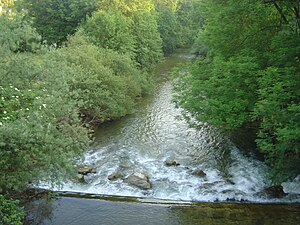
The Kokra (pronounced [ˈkoːkɾa]) is a river of Slovenia. Originating in the Karawanks, the river is 34 km (21 mi) long. It flows into the Sava in Kranj.

Kieselstein Castle
Distance: Approx. 111 meters
Latitude and longitude: 46.23839167,14.35435833
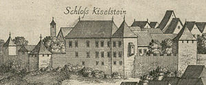
Kieselstein Castle, also known as Khislstein, (Slovene: Grad Kieselstein / Khislstein) is a 13th-century castle in the city of Kranj, in the Upper Carniola region of Slovenia. The castle stands at what was once a defensible point, guarding the city pier and crossing over the river Sava, and was predated on the site by a round 11th-century keep. The current structure was built in 1256 by the Counts of Ortenburg, by an arrangement with the lord of Kranj, Ulrich III, Duke of Carinthia.

Kranj railway station
Railway station in City Municipality of Kranj, Slovenia
Distance: Approx. 559 meters
Latitude and longitude: 46.23888889,14.34833333
Kranj railway station (Slovene: Železniška postaja Kranj) is the railway station in Kranj, the third largest municipality and fourth largest city in Slovenia. The station is located on the railway line between Ljubljana, the capital city of Slovenia, and Villach, Austria.

Schrottenturn Manor
Distance: Approx. 1317 meters
Latitude and longitude: 46.23540833,14.33926111
The Schrottenturn Manor (Slovene: Šrotenturn, Grad Schrottenturn) is a manor in Stražišče, a neighborhood of the town of Kranj in northwestern Slovenia. It was built or owned in the 16th century by the Schrott family. In 1902, it was bought by the politician Oto von Detela and became known as the Detela Manor (Slovene: Detelova graščina).

Stražišče, Kranj
Place in Upper Carniola, Slovenia
Distance: Approx. 1355 meters
Latitude and longitude: 46.23114167,14.34203333
Stražišče (pronounced [stɾaˈʒiːʃtʃɛ]; German: Straschische) is a former settlement in the Municipality of Kranj in the Upper Carniola region of Slovenia. It is now part of the city of Kranj. It includes the hamlet of Gaštej (German: Gehesteig).

Klanec, Kranj
Place in Upper Carniola, Slovenia
Distance: Approx. 728 meters
Latitude and longitude: 46.24266944,14.36331944
Klanec (pronounced [ˈklaːnəts]; occasionally Klanc, German: Klanz) is a former settlement in the Municipality of Kranj in the Upper Carniola region of Slovenia. It is now part of the city of Kranj. Klanec lies above the left bank of the Kokra River, connected to the center of Kranj by a bridge.

Urban Municipality of Kranj
Urban municipality of Slovenia
Distance: Approx. 755 meters
Latitude and longitude: 46.23333333,14.35
The Urban Municipality of Kranj (pronounced [ˈkɾaːn]; Slovene: Mestna občina Kranj) is one of twelve urban municipalities of Slovenia. It lies in northwestern Slovenia and was established in 1994. Its seat is the town of Kranj.

Huje, Kranj
Place in Upper Carniola, Slovenia
Distance: Approx. 397 meters
Latitude and longitude: 46.24123333,14.35949444
Huje (pronounced [ˈxuːjɛ]) is a former settlement in the Municipality of Kranj in the Upper Carniola region of Slovenia. It now corresponds to the neighborhood of Huje in Kranj. Huje lies on left bank of the Kokra River directly east of the old town center of Kranj, which it is connected to by two bridges.

Labore
Place in Upper Carniola, Slovenia
Distance: Approx. 1024 meters
Latitude and longitude: 46.22972222,14.35472222
Labore (pronounced [ˈlaːbɔɾɛ]) is a former settlement in the Municipality of Kranj in the Upper Carniola region of Slovenia. It now corresponds to the neighborhood of Labore in Kranj.

Kalvarija, Kranj
Place in Upper Carniola, Slovenia
Distance: Approx. 694 meters
Latitude and longitude: 46.23805556,14.34666667
Kalvarija (pronounced [kalˈʋaːɾija]) is a former settlement in the Municipality of Kranj in the Upper Carniola region of Slovenia. It is now part of the city of Kranj.
Weather in this IP's area
overcast clouds
-3 Celsius
-7 Celsius
-6 Celsius
-2 Celsius
1014 hPa
97 %
1014 hPa
938 hPa
10000 meters
2.91 m/s
7.5 m/s
344 degree
92 %
