Country:
Region:
City:
Latitude and Longitude:
Time Zone:
Postal Code:
IP information under different IP Channel
ip-api
Country
Region
City
ASN
Time Zone
ISP
Blacklist
Proxy
Latitude
Longitude
Postal
Route
Luminati
Country
Region
20
City
lapy
ASN
Time Zone
Europe/Warsaw
ISP
FALCONN Falkowski Tomasz
Latitude
Longitude
Postal
IPinfo
Country
Region
City
ASN
Time Zone
ISP
Blacklist
Proxy
Latitude
Longitude
Postal
Route
db-ip
Country
Region
City
ASN
Time Zone
ISP
Blacklist
Proxy
Latitude
Longitude
Postal
Route
ipdata
Country
Region
City
ASN
Time Zone
ISP
Blacklist
Proxy
Latitude
Longitude
Postal
Route
Popular places and events near this IP address

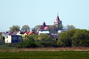
Łapy
Place in Podlaskie Voivodeship, Poland
Distance: Approx. 907 meters
Latitude and longitude: 52.98333333,22.88333333
Łapy [ˈwapɨ] is a town in north-eastern Poland, in Białystok County, Podlaskie Voivodeship; the administrative centre of the urban-rural gmina Łapy. It is situated in the North Podlasie Lowland, on the river Narew. According to data from 31 December 2010, the town had 16,049 inhabitants.

Gmina Łapy
Gmina in Podlaskie Voivodeship, Poland
Distance: Approx. 907 meters
Latitude and longitude: 52.98333333,22.88333333
Gmina Łapy is an urban-rural gmina (administrative district) in Białystok County, Podlaskie Voivodeship, in north-eastern Poland. Its seat is the town of Łapy, which lies approximately 25 kilometres (16 mi) south-west of the regional capital Białystok. The gmina covers an area of 127.57 square kilometres (49.3 sq mi), and as of 2006 its total population is 23,132 (out of which the population of Łapy amounts to 16,583, and the population of the rural part of the gmina is 6,549).
Gąsówka-Osse
Village in Gmina Łapy, Poland
Distance: Approx. 3151 meters
Latitude and longitude: 52.9625,22.8875
Gąsówka-Osse [ɡɔ̃ˈsufka ˈɔssɛ] is a village in the administrative district of Gmina Łapy, within Białystok County, Podlaskie Voivodeship, in north-eastern Poland.

Łapy-Dębowina
Village in Podlaskie Voivodeship, Poland
Distance: Approx. 2667 meters
Latitude and longitude: 52.97166667,22.90111111
Łapy-Dębowina [ˈwapɨ dɛmbɔˈvina] is a village in the administrative district of Gmina Łapy, within Białystok County, Podlaskie Voivodeship, in north-eastern Poland.
Łapy-Kołpaki
Village in Gmina Łapy, Poland
Distance: Approx. 2195 meters
Latitude and longitude: 52.97166667,22.86222222
Łapy-Kołpaki [ˈwapɨ kɔu̯ˈpaki] is a village in the administrative district of Gmina Łapy, within Białystok County, Podlaskie Voivodeship, in north-eastern Poland.
Łapy-Łynki
Village in Gmina Łapy, Poland
Distance: Approx. 1711 meters
Latitude and longitude: 52.97583333,22.86444444
Łapy-Łynki [ˈwapɨ ˈwɨnki] is a village in the administrative district of Gmina Łapy, within Białystok County, Podlaskie Voivodeship, in north-eastern Poland.
Łapy-Pluśniaki
Village in Podlaskie Voivodeship, Poland
Distance: Approx. 3390 meters
Latitude and longitude: 52.9625,22.8975
Łapy-Pluśniaki [ˈwapɨ pluɕˈɲaki] is a village in the administrative district of Gmina Łapy, within Białystok County, Podlaskie Voivodeship, in north-eastern Poland.
Łapy-Szołajdy
Village in Gmina Łapy, Poland
Distance: Approx. 2264 meters
Latitude and longitude: 52.97888889,22.90361111
Łapy-Szołajdy [ˈwapɨ ʂɔˈwai̯dɨ] is a village in the administrative district of Gmina Łapy, within Białystok County, Podlaskie Voivodeship, in north-eastern Poland.

Płonka Kościelna
Village in Podlaskie Voivodeship, Poland
Distance: Approx. 3020 meters
Latitude and longitude: 53,22.83333333
Płonka Kościelna [ˈpwɔŋka kɔɕˈt͡ɕɛlna] is a village in the administrative district of Gmina Łapy, within Białystok County, Podlaskie Voivodeship, in north-eastern Poland. It lies approximately 4 kilometres (2 mi) north-west of Łapy and 26 km (16 mi) south-west of the regional capital Białystok.
Płonka-Kozły
Village in Podlaskie Voivodeship, Poland
Distance: Approx. 3045 meters
Latitude and longitude: 53.00833333,22.84166667
Płonka-Kozły [ˈpwɔŋka ˈkɔzwɨ] is a village in the administrative district of Gmina Łapy. It is within Białystok County, Podlaskie Voivodeship, in north-eastern Poland.
Płonka-Strumianka
Village in Podlaskie Voivodeship, Poland
Distance: Approx. 2530 meters
Latitude and longitude: 53.00416667,22.84583333
Płonka-Strumianka [ˈpwɔŋka struˈmjaŋka] is a village in the administrative district of Gmina Łapy, within Białystok County, Podlaskie Voivodeship, in north-eastern Poland.
Barwiki (Łapy)
Village in Podlaskie Voivodeship, Poland
Distance: Approx. 915 meters
Latitude and longitude: 52.98333333,22.86666667
Barwiki [barviki] (formerly Łapy-Barwiki) is a village in the administrative district of Gmina Łapy, within Białystok County, Podlaskie Voivodeship, in north-eastern Poland. Until the end of 1924, it was an independent village in the Poświętne commune in Wysokie Mazowieckie County, and from 1919 in the Białystok Voivodeship.
Weather in this IP's area
overcast clouds
2 Celsius
-2 Celsius
2 Celsius
4 Celsius
1004 hPa
66 %
1004 hPa
990 hPa
10000 meters
5.32 m/s
10.43 m/s
248 degree
95 %
06:58:06
15:29:39


