91.225.120.47 - IP Lookup: Free IP Address Lookup, Postal Code Lookup, IP Location Lookup, IP ASN, Public IP
Country:
Region:
City:
Location:
Time Zone:
Postal Code:
ISP:
ASN:
language:
User-Agent:
Proxy IP:
Blacklist:
IP information under different IP Channel
ip-api
Country
Region
City
ASN
Time Zone
ISP
Blacklist
Proxy
Latitude
Longitude
Postal
Route
db-ip
Country
Region
City
ASN
Time Zone
ISP
Blacklist
Proxy
Latitude
Longitude
Postal
Route
IPinfo
Country
Region
City
ASN
Time Zone
ISP
Blacklist
Proxy
Latitude
Longitude
Postal
Route
IP2Location
91.225.120.47Country
Region
kyivska oblast
City
hnidyn
Time Zone
Europe/Kiev
ISP
Language
User-Agent
Latitude
Longitude
Postal
ipdata
Country
Region
City
ASN
Time Zone
ISP
Blacklist
Proxy
Latitude
Longitude
Postal
Route
Popular places and events near this IP address

Darnytskyi District
Urban district in Kyiv in Kyiv City Municipality, Ukraine
Distance: Approx. 8916 meters
Latitude and longitude: 50.40611111,30.67666667
Darnytskyi District is an urban district of the Ukrainian capital Kyiv. It is the southeastern district of Kyiv, located on the left bank of the Dnipro river. It borders the Holosiivskyi District of the city to its west, across the river, Dniprovskyi District of city to its north, and the Brovary Raion of the Kyiv Oblast to its east and Boryspil Raion of Kyiv Oblast to its east and south.

Vyrlytsia (Kyiv Metro)
Kyiv Metro Station
Distance: Approx. 8857 meters
Latitude and longitude: 50.40333333,30.66611111
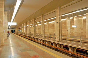
Vyrlytsia (Ukrainian: Вирлиця, ) is a station on the Kyiv Metro's Syretsko-Pecherska Line. It was opened on 4 March 2006 on the already functioning stretch, Kharkivska-Boryspilska. The station is by far the most unusual in the system.

Boryspilska (Kyiv Metro)
Kyiv Metro Station
Distance: Approx. 8507 meters
Latitude and longitude: 50.40333333,30.68277778
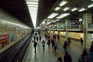
Boryspilska (Ukrainian: Бориспільська, ) is a station on Kyiv Metro's Syretsko-Pecherska Line. Designed by architects V. Gnevyshev, T. Tselikovska and A. Yukhnovsky, the station is a shallow level single-vault (Kharkiv Technology). Although planned to open in the late 1990s, financial offsets put off the date to 23 August 2005, when it was opened to the public.

Chervonyi Khutir (Kyiv Metro)
Kyiv Metro Station
Distance: Approx. 8967 meters
Latitude and longitude: 50.40888889,30.69444444
Chervonyi Khutir (Ukrainian: Червоний хутір, ) is the terminus station of the Kyiv Metro's Syretsko-Pecherska Line. It opened on May 23, 2008. The station's name originates from an old village of Chervonyi Khutir, which was later absorbed into Kyiv city limits and is now an industrial neighbourhood.

Kharkivska (Kyiv Metro)
Kyiv Metro Station
Distance: Approx. 9007 meters
Latitude and longitude: 50.40083333,30.65222222
Kharkivska (Ukrainian: Харківська, ) is a station of Kyiv Metro's Syretsko-Pecherska Line. It is between the Pozniaky and Vyrlytsia stations. This station was opened on 28 December 1994.

Pozniaky (Kyiv Metro)
Kyiv Metro Station
Distance: Approx. 9445 meters
Latitude and longitude: 50.39805556,30.63333333
Pozniaky (Ukrainian: Позняки, ) is a station of Kyiv Metro's Syretsko–Pecherska line. It is situated between Osokorky and Kharkivska stations. This station was opened on 28 December 1994.

Bortnychi
Neighbourhood in Kyiv, Ukraine
Distance: Approx. 6205 meters
Latitude and longitude: 50.38389444,30.69545833
Bortnychi (Ukrainian: Бортничі) is a historic neighbourhood in the southern part of Kyiv. Its southern and eastern boundaries are bordered with forests. Now Bortnychi is included in the Darnytsia Raion.
Chervonyi Khutir
Historic neighbourhood in Kyiv, Ukraine
Distance: Approx. 9166 meters
Latitude and longitude: 50.40846667,30.67679167
Chervonyi Khutir (Ukrainian: Червоний Хутір) is a historic neighbourhood in the Darnytskyi District of Kyiv, the capital of Ukraine. It is located between Kharkivske Highway, Kronshtadtska Street, Borova Street, Yalynkova Street, and forest. Most of the buildings are low-rise private homes, while some are industrial enterprises.
Prolisky
Rural locality in Kyiv Oblast, Ukraine
Distance: Approx. 9042 meters
Latitude and longitude: 50.39333333,30.78833333
Prolisky (Ukrainian: Проліски) is a settlement on the eastern edge of the city of Kyiv, in Boryspil Raion, Kyiv Oblast of Ukraine. It belongs to Prystolychna rural hromada, one of the hromadas of Ukraine. The name of the village is derived from the Ukrainian word "Пролісок", which can be translated as "snowdrop" or "Galanthus".

Shchaslyve, Boryspil Raion, Kyiv Oblast
Rural locality in Kyiv Oblast, Ukraine
Distance: Approx. 7886 meters
Latitude and longitude: 50.3789,30.7894
Shchaslyve (Ukrainian: Щасливе) is a village in Boryspil Raion, Kyiv Oblast that borders Kyiv city. It hosts the administration of Prystolychna rural hromada, one of the hromadas of Ukraine. Along with a settlement Prolisky, it composes the Shchaslyve rural council which is the biggest council in the district.

Kharkivska Square
Square in Kyiv, Ukraine
Distance: Approx. 8401 meters
Latitude and longitude: 50.4024,30.6831
Kharkivska Square is a square in the Darnytskyi District of Kyiv in Chervonyi Khutir. It is located between Kharkiv Highway, Tashkentska Street, Boryspil Highway, Svitla Street, Kollektorna Street and Mykola Bazhan Avenue.

Arena Livyi Bereh
Stadium in Hnidyn, Ukraine
Distance: Approx. 4343 meters
Latitude and longitude: 50.32443333,30.64990833
Arena Livyi Bereh (Ukrainian: Арена Лівий берег) is a football stadium in Kyiv Oblast, Ukraine. It is the home stadium of FC Livyi Bereh. The football stadium was opened on October 15, 2022.
Weather in this IP's area
broken clouds
7 Celsius
4 Celsius
7 Celsius
7 Celsius
1017 hPa
91 %
1017 hPa
1003 hPa
10000 meters
4.97 m/s
9.16 m/s
189 degree
64 %