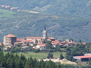
Country:
Region:
City:
Latitude and Longitude:
Time Zone:
Postal Code:
IP information under different IP Channel
ip-api
Country
Region
City
ASN
Time Zone
ISP
Blacklist
Proxy
Latitude
Longitude
Postal
Route
Luminati
Country
Region
ara
City
saintpaulenjarez
ASN
Time Zone
Europe/Paris
ISP
KOESIO Networks SAS
Latitude
Longitude
Postal
IPinfo
Country
Region
City
ASN
Time Zone
ISP
Blacklist
Proxy
Latitude
Longitude
Postal
Route
db-ip
Country
Region
City
ASN
Time Zone
ISP
Blacklist
Proxy
Latitude
Longitude
Postal
Route
ipdata
Country
Region
City
ASN
Time Zone
ISP
Blacklist
Proxy
Latitude
Longitude
Postal
Route
Popular places and events near this IP address
Saint-Chamond, Loire
Commune in Auvergne-Rhône-Alpes, France
Distance: Approx. 4132 meters
Latitude and longitude: 45.4775,4.5153
Saint-Chamond (French pronunciation: [sɛ̃ ʃamɔ̃]) is a commune in the Loire department in the Auvergne-Rhône-Alpes region in central France. Situated 13 km northeast of the city of Saint-Étienne and 50 km southwest of Lyon, the town dates back to the Roman period. It lies in an iron and coal region, which were the basis of industrial growth during the 19th and 20th centuries.

Farnay
Commune in Auvergne-Rhône-Alpes, France
Distance: Approx. 2557 meters
Latitude and longitude: 45.49305556,4.59777778
Farnay (French pronunciation: [faʁnɛ]) is a commune in the Loire department in central France.
La Grand-Croix
Commune in Auvergne-Rhône-Alpes, France
Distance: Approx. 2135 meters
Latitude and longitude: 45.5039,4.5697
La Grand-Croix (French pronunciation: [la ɡʁɑ̃ kʁwa]) is a commune and the seat of a canton in the Loire department in central France. It lies in the Gier valley. The commune was the main town of the former canton of La Grand-Croix, arrondissement of Saint-Étienne.
L'Horme
Commune in Auvergne-Rhône-Alpes, France
Distance: Approx. 1707 meters
Latitude and longitude: 45.4872,4.5456
L'Horme (French pronunciation: [lɔʁm]) is a commune in the Loire department in central France.
Saint-Paul-en-Jarez
Commune in Auvergne-Rhône-Alpes, France
Distance: Approx. 617 meters
Latitude and longitude: 45.4839,4.575
Saint-Paul-en-Jarez (French pronunciation: [sɛ̃ pɔl ɑ̃ ʒaʁɛ]) is a commune in the Loire department in central France.

La Terrasse-sur-Dorlay
Commune in Auvergne-Rhône-Alpes, France
Distance: Approx. 4172 meters
Latitude and longitude: 45.4492,4.5839
La Terrasse-sur-Dorlay (French pronunciation: [la tɛʁas syʁ dɔʁlɛ]) is a commune in the Loire department in central France. La Terrasse-sur-Dorlay takes its name from the Dorlay river, a tributary of the Gier, which flows through the commune.
Lorette, Loire
Commune in Auvergne-Rhône-Alpes, France
Distance: Approx. 3321 meters
Latitude and longitude: 45.5128,4.5819
Lorette (French pronunciation: [lɔʁɛt]) is a commune in the Loire department in central France, in the Gier valley.
Jardin botanique de Saint-Chamond
Distance: Approx. 4133 meters
Latitude and longitude: 45.4775,4.51527778
The Jardin botanique de Saint-Chamond (7,000 m²) is a botanical garden located at 4 chemin du Jardin Botanique, Saint-Chamond, Loire, Auvergne-Rhône-Alpes, France. It is open by appointment. The garden was created by Michel Manevy on the site of a former peach nursery.
Dorlay
River in Auvergne-Rhône-Alpes, France
Distance: Approx. 2785 meters
Latitude and longitude: 45.50972222,4.57027778
The Dorlay (French pronunciation: [dɔʁlɛ]) is a river that flows through the Loire department, France. It is a tributary of the Gier, which in turn is a tributary of the Rhône. The Gier valley was formerly heavily industrialized with coal and iron mines and factories.
Janon
River in Auvergne-Rhône-Alpes, France
Distance: Approx. 4178 meters
Latitude and longitude: 45.4762,4.5151
The Janon is a small river that rises in Mont Pilat in the Massif Central of France near to Saint-Étienne. It runs for 13.9 kilometres (8.6 mi) through mostly built-up country to join the Gier at Saint-Chamond. The valley of the Janon and the Gier is a natural line of communication between the coal mines of Saint-Étienne and the port of Givors on the Rhône.
Canton of La Grand-Croix
Former canton in Auvergne-Rhône-Alpes, France
Distance: Approx. 1072 meters
Latitude and longitude: 45.4938,4.5623
The canton of La Grand-Croix is a French former administrative division located in the department of Loire and the Rhone-Alpes region. It was disbanded following the French canton reorganisation which came into effect in March 2015. It had 24,646 inhabitants (2012).

Sainte Marie La Grand'Grange
Jesuit, catholic school in Route du Coin, Saint Chamond, Loire, France
Distance: Approx. 3771 meters
Latitude and longitude: 45.47168889,4.52265556
Sainte Marie La Grand’Grange in Saint-Chamond, Loire, France, is a primary through secondary school founded by the Marist Fathers in 1850, and currently run by the Society of Jesus.
Weather in this IP's area
overcast clouds
9 Celsius
8 Celsius
7 Celsius
9 Celsius
1019 hPa
72 %
1019 hPa
971 hPa
10000 meters
1.54 m/s
3.53 m/s
316 degree
100 %
07:45:20
17:08:54