91.223.247.48 - IP Lookup: Free IP Address Lookup, Postal Code Lookup, IP Location Lookup, IP ASN, Public IP
Country:
Region:
City:
Location:
Time Zone:
Postal Code:
IP information under different IP Channel
ip-api
Country
Region
City
ASN
Time Zone
ISP
Blacklist
Proxy
Latitude
Longitude
Postal
Route
Luminati
Country
ASN
Time Zone
Europe/Berlin
ISP
equada network GmbH
Latitude
Longitude
Postal
IPinfo
Country
Region
City
ASN
Time Zone
ISP
Blacklist
Proxy
Latitude
Longitude
Postal
Route
IP2Location
91.223.247.48Country
Region
bayern
City
alzenau in unterfranken
Time Zone
Europe/Berlin
ISP
Language
User-Agent
Latitude
Longitude
Postal
db-ip
Country
Region
City
ASN
Time Zone
ISP
Blacklist
Proxy
Latitude
Longitude
Postal
Route
ipdata
Country
Region
City
ASN
Time Zone
ISP
Blacklist
Proxy
Latitude
Longitude
Postal
Route
Popular places and events near this IP address

Spessart-Gymnasium Alzenau
Gymnasium school in Alzenau, Aschaffenburg , Bavaria, Germany
Distance: Approx. 566 meters
Latitude and longitude: 50.09194444,9.07083333
The Spessart-Gymnasium Alzenau (or SGA) is a public scientific-technological, linguistic and humanistic gymnasium in Alzenau, Bavaria. It is named after the Spessart, a wooded range of hills which stretches about 60 kilometers east of the town. The gymnasium was founded 1962 to address the need for higher education in the prospering area.

Kahl am Main
Municipality in Bavaria, Germany
Distance: Approx. 4739 meters
Latitude and longitude: 50.06805556,9.00666667
Kahl am Main (officially Kahl a. Main) is a community in the Aschaffenburg district in the Regierungsbezirk of Lower Franconia (Unterfranken) in Bavaria, Germany. It has around 7,500 inhabitants.
Alzenau
Town in Bavaria, Germany
Distance: Approx. 2468 meters
Latitude and longitude: 50.06666667,9.06666667
Alzenau (German: [ˈaltsənaʊ] ; until 31 December 2006 officially Alzenau i.UFr.) is a town in the north of the Aschaffenburg district in the Regierungsbezirk of Lower Franconia (Unterfranken) in Bavaria, Germany. Until 1 July 1972, Alzenau was the district seat of the now abolished district of the same name and has a population of around 19,000.

Hahnenkamm (Spessart)
Distance: Approx. 3409 meters
Latitude and longitude: 50.07833333,9.10944444
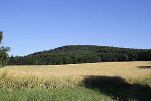
Hahnenkamm (Spessart) is a ridge of hills in the northwest of the Spessart range of Bavaria, Germany.

Hohe Mark (Spessart)
Distance: Approx. 4200 meters
Latitude and longitude: 50.08694444,9.12333333
Hohe Mark (Spessart) is a wooded hill of Bavaria, Germany. It is part of the Mittelgebirge Spessart and lies in the district of Aschaffenburg, near Alzenau. Hohe Mark has an elevation of up to 414 metres (1,358 ft) and is located just to the northeast of the highest point of the Hahnenkamm ridge.

Schanzenkopf (Spessart)
Mountain in Germany
Distance: Approx. 2796 meters
Latitude and longitude: 50.07083333,9.09194444
Schanzenkopf (Spessart) is a wooded hill of Bavaria, Germany. It lies in the Mittelgebirge Spessart in the district of Aschaffenburg. Schanzenkopf has a maximum elevation of 343 metres.
Einfallsgraben
River in Germany
Distance: Approx. 1864 meters
Latitude and longitude: 50.1037,9.0527
Einfallsgraben is a small river of Bavaria, Germany. After a course of about 2 km it enters a sink near Alzenau.
Goldbach (Kahl)
River in Germany
Distance: Approx. 2735 meters
Latitude and longitude: 50.0996,9.099
Goldbach is a small river of Bavaria, Germany. It is a tributary of the Kahl near Alzenau.
Krebsbach (Kahl)
River in Bavaria, Germany
Distance: Approx. 808 meters
Latitude and longitude: 50.0874,9.0757
Krebsbach is a small river of Bavaria, Germany. It is a left tributary of the Kahl near Alzenau.

Neuwiesenbach
River in Germany
Distance: Approx. 701 meters
Latitude and longitude: 50.0849,9.0723
Neuwiesenbach is a small river of Bavaria, Germany. It flows into the Kahl in Alzenau.
Wehmig
River in Germany
Distance: Approx. 4930 meters
Latitude and longitude: 50.1183,9.1161
Wehmig is a small river of Bavaria, Germany. It is the left headwater of the Weibersbach in Albstadt.
Weibersbach (Kahl, Michelbach)
River in Bavaria, Germany
Distance: Approx. 3060 meters
Latitude and longitude: 50.101,9.103
Weibersbach is a small river of Bavaria, Germany. It is right tributary of the Kahl in Michelbach, a district of Alzenau.
Weather in this IP's area
overcast clouds
1 Celsius
1 Celsius
1 Celsius
1 Celsius
1033 hPa
89 %
1033 hPa
1011 hPa
10000 meters
0.97 m/s
0.94 m/s
112 degree
95 %


