91.221.113.12 - IP Lookup: Free IP Address Lookup, Postal Code Lookup, IP Location Lookup, IP ASN, Public IP
Country:
 Slovakia
Region:
City:
Location:
Time Zone:
Postal Code:
ISP:
ASN:
language:
User-Agent:
Proxy IP:
Blacklist:
IP information under different IP Channel
ip-api
Country
Region
City
ASN
Time Zone
ISP
Blacklist
Proxy
Latitude
Longitude
Postal
Route
db-ip
Country
Region
City
ASN
Time Zone
ISP
Blacklist
Proxy
Latitude
Longitude
Postal
Route
IPinfo
Country
Region
City
ASN
Time Zone
ISP
Blacklist
Proxy
Latitude
Longitude
Postal
Route
IP2Location
91.221.113.12Country
skRegion
zilinsky kraj
City
turzovka
Time Zone
Europe/Bratislava
ISP
Language
User-Agent
Latitude
Longitude
Postal
ipdata
Country
Region
City
ASN
Time Zone
ISP
Blacklist
Proxy
Latitude
Longitude
Postal
Route
Popular places and events near this IP address

Podvysoká
Village and municipality in Slovakia
Distance: Approx. 3476 meters
Latitude and longitude: 49.41666667,18.66666667
Podvysoká is a village and municipality in Čadca District in the Žilina Region of northern Slovakia.

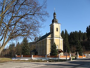
Turzovka
Town in Slovakia
Distance: Approx. 176 meters
Latitude and longitude: 49.40277778,18.62194444
Turzovka (Hungarian: Turzófalva) is a town in the Čadca District, Žilina Region in north-western Slovakia.
Klokočov, Čadca District
Distance: Approx. 6307 meters
Latitude and longitude: 49.45,18.571111
Klokočov (Hungarian: Klokocsóvölgy) is a village and municipality in Čadca District in the Žilina Region of northern Slovakia.
Dlhá nad Kysucou
Village and municipality in Slovakia
Distance: Approx. 2117 meters
Latitude and longitude: 49.389444,18.640833
Dlhá nad Kysucou (Hungarian: Dlhavölgy) is a village and municipality in Čadca District in the Žilina Region of northern Slovakia.

Vysoká nad Kysucou
Village and municipality in Slovakia
Distance: Approx. 5755 meters
Latitude and longitude: 49.38333333,18.55
Vysoká nad Kysucou (Hungarian: Hegyeshely) is a village and municipality in Čadca District in the Žilina Region of northern Slovakia.

Korňa
Municipality in Žilina Region, Slovakia
Distance: Approx. 5988 meters
Latitude and longitude: 49.4133,18.5411
Korňa (Hungarian: Kornyavölgy) is a village and municipality in Čadca District in the Žilina Region of northern Slovakia.
Olešná, Čadca District
Distance: Approx. 3792 meters
Latitude and longitude: 49.43333333,18.65
Olešná (Hungarian: Berekfalu) is a village and municipality in Čadca District in the Žilina Region of northern Slovakia.

Raková, Čadca District
Village in Slovakia
Distance: Approx. 9176 meters
Latitude and longitude: 49.44305556,18.73444444
Raková (Hungarian: Trencsénrákó) is a village and municipality in Čadca District in the Žilina Region of northern Slovakia.

Staškov
Village in Slovakia
Distance: Approx. 5773 meters
Latitude and longitude: 49.41666667,18.7
Staškov (Hungarian: Szaniszlófalva, until 1899 Sztaskó) is a village and municipality in Čadca District in the Žilina Region of northern Slovakia.
Zákopčie
Distance: Approx. 8036 meters
Latitude and longitude: 49.4,18.73333333
Zákopčie (Hungarian: Dombelve) is a village and municipality in Čadca District in the Žilina Region of northern Slovakia. The village is a collection of small hamlets spreading through a number of valleys. The main industries are based on wood harvested from the surrounding woods and forests.
Weather in this IP's area
clear sky
5 Celsius
2 Celsius
5 Celsius
6 Celsius
1032 hPa
39 %
1032 hPa
956 hPa
10000 meters
3.6 m/s
140 degree