Country:
 Russian Federation
Region:
City:
Latitude and Longitude:
Time Zone:
Postal Code:
IP information under different IP Channel
ip-api
Country
Region
City
ASN
Time Zone
ISP
Blacklist
Proxy
Latitude
Longitude
Postal
Route
IPinfo
Country
Region
City
ASN
Time Zone
ISP
Blacklist
Proxy
Latitude
Longitude
Postal
Route
MaxMind
Country
Region
City
ASN
Time Zone
ISP
Blacklist
Proxy
Latitude
Longitude
Postal
Route
Luminati
Country
RUASN
Time Zone
Europe/Moscow
ISP
Link Telecom NN Ltd.
Latitude
Longitude
Postal
db-ip
Country
Region
City
ASN
Time Zone
ISP
Blacklist
Proxy
Latitude
Longitude
Postal
Route
ipdata
Country
Region
City
ASN
Time Zone
ISP
Blacklist
Proxy
Latitude
Longitude
Postal
Route
Popular places and events near this IP address
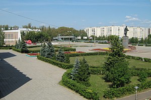
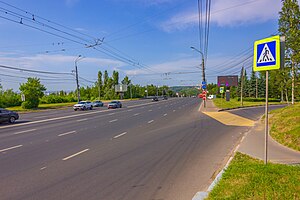
Kstovo
Town in Nizhny Novgorod Oblast, Russia
Distance: Approx. 5863 meters
Latitude and longitude: 56.16666667,44.16666667
Kstovo (‹See Tfd›Russian: Кстово) is a town and the administrative center of Kstovsky District in Nizhny Novgorod Oblast, Russia, located on the right bank of the Volga River, 22 kilometers (14 mi) southeast of Nizhny Novgorod, the administrative center of the oblast. Population: 66,657 (2010 Census); 66,944 (2002 Census); 62,414 (1989 Soviet census).

Kstovsky District
District in Nizhny Novgorod Oblast, Russia
Distance: Approx. 8074 meters
Latitude and longitude: 56.15166667,44.19555556
Kstovsky District (‹See Tfd›Russian: Ксто́вский райо́н) is an administrative district (raion), one of the forty in Nizhny Novgorod Oblast, Russia. Municipally, it is incorporated as Kstovsky Municipal District. It is located in the center of the oblast.
Prioksky City District
District in Nizhny Novgorod Oblast, Russia
Distance: Approx. 9055 meters
Latitude and longitude: 56.2408,43.9808
Prioksky City District (‹See Tfd›Russian: Прио́кский райо́н) is one of the eight districts of the city of Nizhny Novgorod, Russia. It is located in the upper part of the city on the high right bank of the Oka River and has a land border only with Sovetsky City District along Meditsinskaya Street. It is also connected by the Myza Bridge with Avtozavodsky City District in the lower part of Nizhny Novgorod across the Oka.
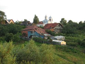
Fedyakovo, Nizhny Novgorod Oblast
Distance: Approx. 6310 meters
Latitude and longitude: 56.23333333,44.05
Fedyakovo (‹See Tfd›Russian: Федяко́во) is a rural locality (a selo) in Kstovsky District of Nizhny Novgorod Oblast, Russia, located just a few kilometers outside of the Nizhny Novgorod's city line, with the apartment blocks on the south-eastern edge of the city being easily visible from the village. The village church is that of Transfiguration of the Lord (Спасо-Преображенская церковь).

Zelyony Gorod
Urban-type settlement in Nizhny Novgorod Oblast, Russia
Distance: Approx. 1408 meters
Latitude and longitude: 56.16666667,44.08333333
Zelyony Gorod (‹See Tfd›Russian: Зелёный Го́род, lit. green city) is an urban locality (a resort settlement under the administrative jurisdiction of the city of oblast significance of Nizhny Novgorod) in Nizhny Novgorod Oblast, Russia, located in a forested area to the southeast of Nizhny Novgorod and surrounded by the territory of Kstovsky District. Population: 2,716 (2010 Census); 2,437 (2002 Census); 4,234 (1989 Soviet census).

Kstovo Refinery
Oil refinery in Kstovo, Russia
Distance: Approx. 9146 meters
Latitude and longitude: 56.10583333,44.14388889
The Kstovo Refinery, also known as Lukoil-Nizhegorodnefteorgsintez (‹See Tfd›Russian: Лукойл-Нижегороднефтеоргсинтез) is a oil refinery plant in the Russian city of Kstovo, one of the largest in the country. This refinery has belonged to the Russian company Lukoil since 2001.
Weather in this IP's area
light rain
12 Celsius
11 Celsius
12 Celsius
12 Celsius
1012 hPa
94 %
1012 hPa
998 hPa
10000 meters
3 m/s
220 degree
75 %
06:15:01
17:28:52