Country:
Region:
City:
Latitude and Longitude:
Time Zone:
Postal Code:
IP information under different IP Channel
ip-api
Country
Region
City
ASN
Time Zone
ISP
Blacklist
Proxy
Latitude
Longitude
Postal
Route
Luminati
Country
ASN
Time Zone
Europe/Moscow
ISP
Company Tensor LLC
Latitude
Longitude
Postal
IPinfo
Country
Region
City
ASN
Time Zone
ISP
Blacklist
Proxy
Latitude
Longitude
Postal
Route
db-ip
Country
Region
City
ASN
Time Zone
ISP
Blacklist
Proxy
Latitude
Longitude
Postal
Route
ipdata
Country
Region
City
ASN
Time Zone
ISP
Blacklist
Proxy
Latitude
Longitude
Postal
Route
Popular places and events near this IP address

Yaroslavl
City in Yaroslavl Oblast, Russia
Distance: Approx. 2767 meters
Latitude and longitude: 57.61666667,39.85
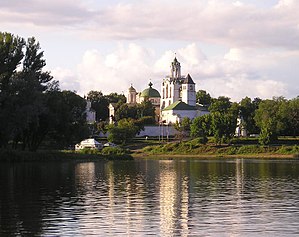
Yaroslavl (; Russian: Ярославль, IPA: [jɪrɐˈsɫavlʲ]) is a city and the administrative center of Yaroslavl Oblast, Russia, located 250 kilometers (160 mi) northeast of Moscow. The historic part of the city is a World Heritage Site, and is located at the confluence of the Volga and the Kotorosl rivers. It is part of the Golden Ring, a group of historic cities northeast of Moscow that have played an important role in Russian history.
Kotorosl
River in Russia
Distance: Approx. 3606 meters
Latitude and longitude: 57.6161,39.9058
The Kotorosl (Russian: Ко́торосль) is a right tributary of the Volga in Yaroslavl Oblast, Russia. The river flows from Lake Nero near Rostov past Karabikha and enters the Volga in Yaroslavl. It is 132 kilometres (82 mi) long, and has a drainage basin of 6,370 square kilometres (2,460 sq mi).
Arena 2000
Distance: Approx. 973 meters
Latitude and longitude: 57.58944444,39.84861111
Arena 2000 (Russian: Универсальный Культурно-Спортивный Комплекс Арена-2000) is an arena, in Yaroslavl, Russia. It opened in 2001 and holds approximately 9,000 people. It is primarily used for ice hockey and is the home arena for Lokomotiv Yaroslavl team.

Fyodorovskaya Church
Distance: Approx. 1871 meters
Latitude and longitude: 57.60967,39.865608
The Fyodorovskaya Church (Фёдоровская церковь) is a penticupolar parish Russian Orthodox church built by ordinary parishioners on the right bank of the Kotorosl River in Yaroslavl between 1682 and 1687. It is dedicated to Theotokos Feodorovskaya, a miraculous icon from nearby Kostroma. The building is notable as the first church in the region to be returned by the Soviets to the Russian Orthodox Church (in 1987).
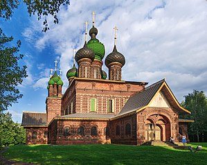
St. John the Baptist Church, Yaroslavl
Distance: Approx. 2033 meters
Latitude and longitude: 57.61082222,39.85701667
St. John the Baptist Church (Russian: Церковь Иоанна Предтечи) in Yaroslavl is considered to be the acme of the Yaroslavl school of architecture. It was built during 1671–1687 on the bank of Kotorosl river in the Tolchkovo sloboda (district) which at that time was the largest and wealthiest part of the town.

Church of St. Nicholas Pensky
Distance: Approx. 1940 meters
Latitude and longitude: 57.610302,39.865372
The Church of St. Nicholas "Pensky" ("Nicholas-on-the-Stumps") is a smaller (winter) church of Fyodorovsky parish on the right bank of the Kotorosl River in Yaroslavl, in the district formerly known as Tolchkovo. The tiny brick church represents a type of design known as the "ship", with an ornate bell tower in the west, connected by a low vestibule to the central cube with a single dome.

Church of Saint Nicetas, Yaroslavl
Distance: Approx. 3453 meters
Latitude and longitude: 57.623781,39.868998
The Church of St. Nicetas (церковь Никиты Столпника) is a Russian Orthodox church of St. Nicetas the Goth on Victory Street in Yaroslavl.

Church of St. Nicholas in Tropino
Distance: Approx. 2800 meters
Latitude and longitude: 57.613101,39.891561
The Church of St. Nicholas in Tropino (Николо-Тропинская церковь) is a ruined 17th-century church on the right bank of the Kotorosl River in Yaroslavl. It has been expanded and renovated on several occasions in the 18th and 19th centuries.
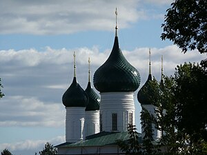
Ascension Church, Yaroslavl
Distance: Approx. 3730 meters
Latitude and longitude: 57.62619,39.87067
The Church of the Ascension of Christ (Вознесенская церковь) is a four-piered penticupolar Orthodox church erected in Kondakovo, a western suburb of Yaroslavl between 1677 and 1682. The first church on the site was commissioned in 1584 by Basil Kondaki, a wealthy Greek merchant, in order to prevent the planned construction of a Lutheran church in Kondakovo. A smaller parish church is dedicated to the Presentation of Jesus at the Temple.
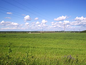
Yaroslavsky District, Yaroslavl Oblast
District in Yaroslavl Oblast, Russia
Distance: Approx. 2767 meters
Latitude and longitude: 57.61666667,39.85
Yaroslavsky District (Russian: Яросла́вский райо́н) is an administrative and municipal district (raion), one of the seventeen in Yaroslavl Oblast, Russia. It is located in the east of the oblast. The area of the district is 1,936.7 square kilometers (747.8 sq mi).
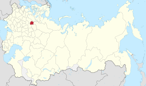
Yaroslavl Governorate
1777–1929 unit of Russia
Distance: Approx. 2771 meters
Latitude and longitude: 57.6167,39.85
Yaroslavl Governorate (Russian: Ярославская губерния, romanized: Yaroslavskaya guberniya) was an administrative-territorial unit (guberniya) of the Russian Empire and the Russian SFSR, located in European Russia in the Upper Volga Region. It existed from 1777 to 1929; its seat was in the city of Yaroslavl.

Yaroslavl railway station
Railway station in Yaroslavl Oblast, Russia
Distance: Approx. 995 meters
Latitude and longitude: 57.60055556,39.87222222
Yaroslavl (Russian: Ярославль), also known as Yaroslavl-Moskovsky (Russian: Ярославль-Московский) is the one of 2 passenger railway stations for the city of Yaroslavl in Russia, and an stop along the Trans-Siberian Railway. Passenger terminal - Moskovsky station, so with respect to the station is also sometimes used the name Yaroslavl-Moskovsky or Yaroslavl-passenger to distinguish it from another major station of the city - Yaroslavl-Glavny.
Weather in this IP's area
overcast clouds
-0 Celsius
-3 Celsius
-0 Celsius
-0 Celsius
1007 hPa
80 %
1007 hPa
991 hPa
10000 meters
2 m/s
210 degree
100 %
08:05:25
16:05:10
