Country:
 Denmark
Region:
City:
Latitude and Longitude:
Time Zone:
Postal Code:
IP information under different IP Channel
ip-api
Country
Region
City
ASN
Time Zone
ISP
Blacklist
Proxy
Latitude
Longitude
Postal
Route
IPinfo
Country
Region
City
ASN
Time Zone
ISP
Blacklist
Proxy
Latitude
Longitude
Postal
Route
MaxMind
Country
Region
City
ASN
Time Zone
ISP
Blacklist
Proxy
Latitude
Longitude
Postal
Route
Luminati
Country
DKASN
Time Zone
Europe/Copenhagen
ISP
EG A/S
Latitude
Longitude
Postal
db-ip
Country
Region
City
ASN
Time Zone
ISP
Blacklist
Proxy
Latitude
Longitude
Postal
Route
ipdata
Country
Region
City
ASN
Time Zone
ISP
Blacklist
Proxy
Latitude
Longitude
Postal
Route
Popular places and events near this IP address
Ikast Municipality
Distance: Approx. 2653 meters
Latitude and longitude: 56.14083333,9.15166667
Ikast municipality was a municipality (Danish, kommune) in Ringkøbing on the Jutland peninsula in west Denmark. The municipality covered an area of 294.3 km2, and had a total population of 23,283 (2005). Its last mayor was Carsten Kissmeyer, a member of the Venstre (Liberal Party) political party.

Ikast
Place in Central Denmark, Denmark
Distance: Approx. 2125 meters
Latitude and longitude: 56.13333333,9.15
Ikast is a Danish town in Central Denmark Region (Region Midtjylland). It is the seat of Ikast-Brande Municipality since 2007. It was the seat of the former Ikast Municipality.
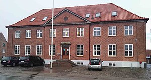
Ikast-Brande Municipality
Municipality in Central Denmark, Denmark
Distance: Approx. 2648 meters
Latitude and longitude: 56.1408,9.1517
Ikast-Brande Municipality (Danish: Ikast-Brande Kommune) is a municipality (Danish: kommune) in Region Midtjylland in Denmark. It covers an area of 733.69 km2 and has a population of 42,737 (1. January 2024).
Ikast Stadium
Distance: Approx. 3202 meters
Latitude and longitude: 56.144848,9.146501
Ikast Stadion, known as Wunderelf Arena for sponsorship reasons, is a multi-use stadium in Ikast, Denmark. It is currently used mostly for football matches and is the home stadium of Ikast FC and it also hosts selected matches of the FC Midtjylland Academy. The stadium holds 12,750 people.

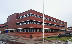
Department of Business Development and Technology
Distance: Approx. 9325 meters
Latitude and longitude: 56.12944444,9.0275
Department of Business Development and Technology (or BTECH for short) is a university department centre for research and higher education under Aarhus University, located in Herning, Denmark. BTECH's focus is on education excellence and offers six undergraduate and two graduate study programmes as well as a number of part-time studies all within the fields of engineering, business economics, management and communication and multimedia. The department has seen some heavy administrational re-organisations in the last decade or so.
Ikast-Brande Arena
Distance: Approx. 3255 meters
Latitude and longitude: 56.14444444,9.14416667
IBF Arena is an indoor sports arena in Ikast, Denmark primarily used for handball. It can hold 2,550 spectators (with a further 300 in a standing area if needed) and is home to Herning-Ikast Håndbold. Until June 2008 it was called Sportscenter Ikast.

Storå (Denmark)
Distance: Approx. 7999 meters
Latitude and longitude: 56.1,9.3
The Storå (lit. 'Large Creek') or Storåen is Denmark's second longest river, spanning 104 kilometres (65 mi).

Birk Centerpark railway halt
Railway halt in Herning, Denmark
Distance: Approx. 9210 meters
Latitude and longitude: 56.12555556,9.02888889
Birk Centerpark railway halt is a railway halt serving the district of Birk in the eastern part of the city of Herning in Central Jutland, Denmark. The halt serves several businesses, educational institutions and a residential area for students in the eastern part of Herning. Birk Centerpark station is located on the Skanderborg–Skjern line.
Hammerum railway station
Railway station in Jutland, Denmark
Distance: Approx. 7165 meters
Latitude and longitude: 56.13166667,9.06305556
Hammerum station is a railway station serving the railway town of Hammerum east of the city of Herning in Jutland, Denmark. Hammerum station is located on the Skanderborg–Skjern railway line. The station opened in 1877.

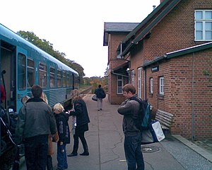
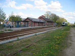
Ikast railway station
Railway station in Jutland, Denmark
Distance: Approx. 2900 meters
Latitude and longitude: 56.14472222,9.15527778
Ikast station is a railway station serving the railway town of Ikast east of the city of Herning in Jutland, Denmark. Ikast station is located on the Skanderborg–Skjern line. The station opened in 1877.
Bording railway station
Railway station in Jutland, Denmark
Distance: Approx. 6849 meters
Latitude and longitude: 56.14666667,9.27805556
Bording station is a railway station serving the railway town of Bording in Central Jutland, Denmark. Bording station is located on the Skanderborg–Skjern line. The station opened in 1877.

Kølkær Parish
Parish in Herning Municipality, Denmark
Distance: Approx. 9142 meters
Latitude and longitude: 56.06,9.08
Kølkær Parish (Danish: Kølkær Sogn) is a parish in the Diocese of Viborg in Herning Municipality, Denmark. The parish contains the town of Kølkær.
Weather in this IP's area
broken clouds
7 Celsius
4 Celsius
7 Celsius
8 Celsius
1013 hPa
100 %
1013 hPa
1005 hPa
10000 meters
3.6 m/s
200 degree
75 %
07:46:54
18:32:41