91.205.67.236 - IP Lookup: Free IP Address Lookup, Postal Code Lookup, IP Location Lookup, IP ASN, Public IP
Country:
 Ukraine
Region:
City:
Location:
Time Zone:
Postal Code:
ISP:
ASN:
language:
User-Agent:
Proxy IP:
Blacklist:
IP information under different IP Channel
ip-api
Country
Region
City
ASN
Time Zone
ISP
Blacklist
Proxy
Latitude
Longitude
Postal
Route
db-ip
Country
Region
City
ASN
Time Zone
ISP
Blacklist
Proxy
Latitude
Longitude
Postal
Route
IPinfo
Country
Region
City
ASN
Time Zone
ISP
Blacklist
Proxy
Latitude
Longitude
Postal
Route
IP2Location
91.205.67.236Country
uaRegion
khersonska oblast
City
heniches'k
Time Zone
Europe/Kiev
ISP
Language
User-Agent
Latitude
Longitude
Postal
ipdata
Country
Region
City
ASN
Time Zone
ISP
Blacklist
Proxy
Latitude
Longitude
Postal
Route
Popular places and events near this IP address

Henichesk
Town in Kherson Oblast, Ukraine
Distance: Approx. 1061 meters
Latitude and longitude: 46.16666667,34.8
Henichesk (Ukrainian: Генічеськ, IPA: [ɦeˈn⁽ʲ⁾i.t͡ʃesʲk]; Russian: Геническ, IPA: [ɡʲɪˈnʲit͡ɕɪsk]) is a port city along the Sea of Azov in Kherson Oblast, southern Ukraine. It serves as the administrative centre of Henichesk Raion. Since 9 November 2022, it has served as the temporary administrative centre of the Russian occupation administration in the region.
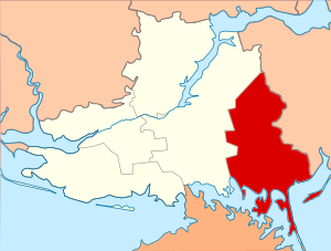
Henichesk Raion
Subdivision of Kherson Oblast, Ukraine
Distance: Approx. 6125 meters
Latitude and longitude: 46.22961983,34.78618983
Henichesk Raion (Ukrainian: Генічеський район) is one of the five administrative raions (districts) of Kherson Oblast in southern Ukraine. Its administrative centre is located in the city of Henichesk. Population: 118,059 (2022 estimate).

Henichesk Strait
Body of water in Ukraine
Distance: Approx. 1926 meters
Latitude and longitude: 46.16026944,34.7927
The Henichesk Strait (alternatively Genichesk Strait; Ukrainian: Генічеська протока, Crimean Tatar: Ceniske, Cengięke, Russian: Генический пролив,) is a narrow strait which connects the Syvash (the shallow lagoon system separating the Crimea from the rest of Ukraine east of the Isthmus of Perekop) with the Sea of Azov. It separates the Arabat Spit from the Ukrainian mainland. The strait is about 4 kilometres (2.5 mi) long and the width varies from 80 to 150 metres (260 to 490 ft), with a depth of 4.6 metres (15 ft).

Henicheska Hirka
Rural locality in Kherson Oblast, Ukraine
Distance: Approx. 8635 meters
Latitude and longitude: 46.10055556,34.83
Henicheska Hirka (Ukrainian: Генічеська Гірка) is a village located in the Arabat Spit, in the Henichesk Raion of the Kherson Oblast, Ukraine. It belongs to Henichesk urban hromada, one of the hromadas of Ukraine. Henicheska Hirka has a population of 495 inhabitants.

Henichesk Bridge
Bridge in Kherson Oblast, Ukraine
Distance: Approx. 1490 meters
Latitude and longitude: 46.162961,34.798462
Henichesk Bridge (Ukrainian: Генічеський залізний міст, romanized: Henichesʹkyy zaliznyy mist) is a rail and road bridge located in southern Ukraine. It was designed by Waagner-Biro and built in 1915. The bridge is an icon of the European architecture style that this group utilizes.
Weather in this IP's area
broken clouds
-1 Celsius
-6 Celsius
-1 Celsius
-1 Celsius
1024 hPa
88 %
1024 hPa
1023 hPa
10000 meters
5.72 m/s
8.6 m/s
312 degree
70 %