91.205.199.39 - IP Lookup: Free IP Address Lookup, Postal Code Lookup, IP Location Lookup, IP ASN, Public IP
Country:
Region:
City:
Location:
Time Zone:
Postal Code:
ISP:
ASN:
language:
User-Agent:
Proxy IP:
Blacklist:
IP information under different IP Channel
ip-api
Country
Region
City
ASN
Time Zone
ISP
Blacklist
Proxy
Latitude
Longitude
Postal
Route
db-ip
Country
Region
City
ASN
Time Zone
ISP
Blacklist
Proxy
Latitude
Longitude
Postal
Route
IPinfo
Country
Region
City
ASN
Time Zone
ISP
Blacklist
Proxy
Latitude
Longitude
Postal
Route
IP2Location
91.205.199.39Country
Region
syunik'
City
goris
Time Zone
Asia/Yerevan
ISP
Language
User-Agent
Latitude
Longitude
Postal
ipdata
Country
Region
City
ASN
Time Zone
ISP
Blacklist
Proxy
Latitude
Longitude
Postal
Route
Popular places and events near this IP address

Goris
Town in Syunik, Armenia
Distance: Approx. 571 meters
Latitude and longitude: 39.50777778,46.33861111
Goris (Armenian: Գորիս [ɡɔˈɾis]) is a town and the centre of the Goris Municipality in the Syunik Province in southern Armenia. Located in the valley of the Goris (or Vararak) River, it is 254 kilometres from the Armenian capital Yerevan and 67 kilometres from the provincial capital Kapan. Goris is the second largest city in Syunik in terms of population.

Karahunj
Place in Syunik, Armenia
Distance: Approx. 4154 meters
Latitude and longitude: 39.47916667,46.35888889
Karahunj (Armenian: Քարահունջ) is a village in the Goris Municipality of the Syunik Province in Armenia.

Verishen
Place in Syunik, Armenia
Distance: Approx. 3406 meters
Latitude and longitude: 39.53583333,46.31194444
Verishen (Armenian: Վերիշեն) is a village in the Goris Municipality of the Syunik Province in Armenia.
Akner, Syunik
Place in Syunik, Armenia
Distance: Approx. 2634 meters
Latitude and longitude: 39.50666667,46.30861111
Akner (Armenian: Ակներ) is a village in the Goris Municipality of the Syunik Province in Armenia.
Hartashen, Syunik
Place in Syunik, Armenia
Distance: Approx. 7623 meters
Latitude and longitude: 39.48583333,46.41972222
Hartashen (Armenian: Հարթաշեն) is a village in the Goris Municipality of the Syunik Province in Armenia.

Karashen
Place in Syunik, Armenia
Distance: Approx. 6714 meters
Latitude and longitude: 39.54,46.40805556
Karashen (Armenian: Քարաշեն) is a village in the Tegh Municipality of the Syunik Province in Armenia.

Khndzoresk
Place in Syunik, Armenia
Distance: Approx. 8194 meters
Latitude and longitude: 39.51222222,46.43361111
Khndzoresk (Armenian: Խնձորեսկ, pronounced [χəndzɔˈɾɛsk]) is a village in the Goris Municipality of the Syunik Province in Armenia. The village is located to the east of the Goris-Stepanakert highway, on the steep slopes of Khor Dzor (Deep Gorge), which the village is named after, according to tradition. Crossing the bridge at the entrance of the village, the road continues towards the towns of Lachin and Stepanakert.

Khot, Armenia
Place in Syunik, Armenia
Distance: Approx. 8117 meters
Latitude and longitude: 39.44,46.33611111
Khot (Armenian: Խոտ) is a village in the Tatev Municipality of the Syunik Province in Armenia. It is located on the left side of the Vorotan river, 67 kilometers from the regional center of Kapan. On the cliffs below Khot are the ruins of Hin Khot (Old Khot), the previous location of the village until the 1970s.
Goris Airport
Armenian airport
Distance: Approx. 6945 meters
Latitude and longitude: 39.45083333,46.34638889
Goris Airport, also known as Shinuyar Airport or Shinuhayr Airport is located to the south of Goris, near the village of Shinuhayr, Syunik Province, Armenia. It has been closed since the collapse of the USSR in 1991. However, the government of Armenia planned on reconstructing the airport and opening it to public and private service.

Goris State University
Distance: Approx. 813 meters
Latitude and longitude: 39.5175,46.34555556
Goris State University (GorSU) (Armenian: Գորիսի պետական համալսարան) is a university in Goris, Syunik Province, Armenia. With 4 faculties, it is the largest university in Syunik Province. It provides degrees in Philology, History and Geography, Pedagogy, Biology and Chemistry, and Physics and Mathematics.

Goris Municipality
Urban Community in Syunik, Armenia
Distance: Approx. 1758 meters
Latitude and longitude: 39.5,46.35
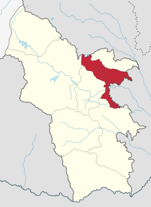
Goris Municipality, referred to as Goris Community (Armenian: Գորիս Համայնք Goris Hamaynk), is an urban community and administrative subdivision of Syunik Province of Armenia, at the south of the country. Consisted of a group of settlements, its administrative centre is the town of Goris.

Zangezur uezd
Uezd in Caucasus, Russian Empire
Distance: Approx. 571 meters
Latitude and longitude: 39.50777778,46.33861111
The Zangezur uezd was a county (uezd) of the Elizavetpol Governorate of the Russian Empire with its administrative center in Gerusy (present-day Goris) from 1868 until its formal abolition and partition between the Soviet republics of Armenia and Azerbaijan in 1921. The area of the Zangezur uezd corresponded to most of the contemporary Syunik province of Armenia, and Lachin, Gubadly, Zangilan, and the westernmost parts of Shusha districts of Azerbaijan.
Weather in this IP's area
overcast clouds
-1 Celsius
-1 Celsius
-1 Celsius
-1 Celsius
1029 hPa
50 %
1029 hPa
834 hPa
10000 meters
0.15 m/s
0.63 m/s
127 degree
100 %
