Country:
 Russian Federation
Region:
City:
Latitude and Longitude:
Time Zone:
Postal Code:
IP information under different IP Channel
ip-api
Country
Region
City
ASN
Time Zone
ISP
Blacklist
Proxy
Latitude
Longitude
Postal
Route
IPinfo
Country
Region
City
ASN
Time Zone
ISP
Blacklist
Proxy
Latitude
Longitude
Postal
Route
MaxMind
Country
Region
City
ASN
Time Zone
ISP
Blacklist
Proxy
Latitude
Longitude
Postal
Route
Luminati
Country
RURegion
mos
City
reutov
ASN
Time Zone
Europe/Moscow
ISP
PJSC MegaFon
Latitude
Longitude
Postal
db-ip
Country
Region
City
ASN
Time Zone
ISP
Blacklist
Proxy
Latitude
Longitude
Postal
Route
ipdata
Country
Region
City
ASN
Time Zone
ISP
Blacklist
Proxy
Latitude
Longitude
Postal
Route
Popular places and events near this IP address
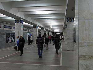
Novogireyevo (Moscow Metro)
Moscow Metro station
Distance: Approx. 2937 meters
Latitude and longitude: 55.7517,37.8166
Novogireyevo (‹See Tfd›Russian: Новогиреево) is a Moscow Metro station on the Kalininsko-Solntsevskaya Line. It was constructed in 1979 in Moscow's Novogireyevo District, as the final terminus of the Kalininsky radius. The status of terminus ended following the inauguration of Novokosino, extension to the east, on August 30, 2012.
Izmaylovsky Park
Distance: Approx. 4310 meters
Latitude and longitude: 55.777,37.789
Izmaylovsky Park or Izmaylovo Park is one of the largest parks in Moscow, Russia. The park consists of two areas: Izmaylovsky forest and Izmaylovsky Park for recreation. It is situated in the Izmaylovo District in the northeast of the city.
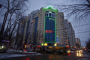
Reutov
Town in Moscow Oblast, Russia
Distance: Approx. 495 meters
Latitude and longitude: 55.76222222,37.85666667
Reutov (‹See Tfd›Russian: Ре́утов) is a town in Moscow Oblast, Russia, located east of Moscow. Population: 113,871 (2021 Census); 87,314 (2010 Census); 76,805 (2002 Census); 68,326 (1989 Soviet census).
Yuzhnoye Izmaylovo
Distance: Approx. 1960 meters
Latitude and longitude: 55.77777778,37.83111111
Yuzhnoye Izmaylovo (‹See Tfd›Russian: Ю́жное Изма́йлово, Southern Izmaylovo) is an area located in the eastern part of Moscow, Russia, just north of the Shosse Entuziastov (шоссе Энтузиастов) Route and west of the Moscow Ring Highway (МКАД). It borders Izmaylovo District in the south and Izmaylovsky Park in the north and west. In 1960, it became a part of Moscow, after all territories inside the Moscow Ring Highway were incorporated into Moscow proper.

Moscow Radio Centre 13
Distance: Approx. 3687 meters
Latitude and longitude: 55.79277778,37.89138889
Moscow Radio Center 13 is a transmission facility near Balashikha, approximately 3.5 km east of the ringbelt motorway of Moscow. Moscow Radio Centre 13 served in the Cold War era as jammer to block transmissions of western shortwave radio programs. Although the radio wave jammer activities ceased in the middle of the 1980s, some occasional continuing of the jammer use occurred on March 14, 1989 to block incoming transmissions to the Lithuanian minority in Moscow area.
Lebedyansky Ponds
Distance: Approx. 3139 meters
Latitude and longitude: 55.7756,37.8078
Lebedyansky pond is one in the cascade Izmaylovsky ponds in the east of Moscow (Yuzhnoe Izmailovo) in a valley of the Serebrianka on the territory of Izmailovsky Urban Forest Park. Ponds are known from the end of 17th century and Lebedyansky is a largest of them (16 hectares). The origin of the pond's name is not entirely clear, one of the theories that name originated from Russian word "lebyad'" - (Ru - лебедь) swan.
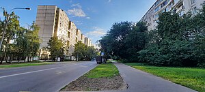
Chelyabinskaya Street
Distance: Approx. 2014 meters
Latitude and longitude: 55.77777778,37.83
Chelyabinskaya Street is located in the residential community of Yuzhnoye Izmaylovo in the Eastern Administrative Okrug of Moscow. The street was built in the mid 1970s as a central street for Yuzhnoye Izmaylovo. Named in 1975 for the city of Chelyabinsk, the regional center of Russia, due to its location in the east of Moscow.

Ivanovskoye District
District in Moscow, Russia
Distance: Approx. 1412 meters
Latitude and longitude: 55.76722222,37.83277778
Ivanovskoye District (‹See Tfd›Russian: райо́н Ива́новское) is an administrative district (raion) of Eastern Administrative Okrug, and one of the 125 raions of Moscow, Russia.

Novogireyevo District
District in Moscow, Russia
Distance: Approx. 3213 meters
Latitude and longitude: 55.75,37.81333333
Novogireyevo District (‹See Tfd›Russian: Новогиреево райо́н) is an administrative district (raion) of Eastern Administrative Okrug, and one of the 125 raions of Moscow, Russia. The area of the district is 4.45 square kilometers (1.72 sq mi).

Novokosino District
District in Moscow, Russia
Distance: Approx. 3023 meters
Latitude and longitude: 55.74,37.865
Novokosino District (‹See Tfd›Russian: райо́н Новокосино́) is an administrative district (raion) of Eastern Administrative Okrug, and one of the 125 raions of Moscow, Russia. The area of the district is 3.60 square kilometers (1.39 sq mi).

Vostochnoye Izmaylovo District
District in federal city of Moscow, Russia
Distance: Approx. 4064 meters
Latitude and longitude: 55.79638889,37.81777778
Vostochnoye Izmaylovo District (‹See Tfd›Russian: райо́н Восто́чное Изма́йлово) is an administrative district (raion), one of the sixteen in Eastern Administrative Okrug of the federal city of Moscow, Russia. The area is 3.84 square kilometres (1.48 sq mi). As of the 2010 Census, its population was 76,312, up from 75,450 recorded during the 2002 Census.

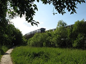
Novokosino (Moscow Metro)
Moscow Metro station
Distance: Approx. 2452 meters
Latitude and longitude: 55.7451,37.8638
Novokosino (‹See Tfd›Russian: Новокосино) is a station on the Kalininsko-Solntsevskaya Line of the Moscow Metro. The station is situated at the northern edge of Novokosino District, adjacent to the Reutov town of Moscow Oblast. After its inauguration in 2012, it replaced Novogireyevo as the eastern terminus of Kalininskaya Line.
Weather in this IP's area
overcast clouds
8 Celsius
6 Celsius
7 Celsius
10 Celsius
1020 hPa
76 %
1020 hPa
1000 hPa
10000 meters
2.62 m/s
4.11 m/s
27 degree
100 %
06:41:31
17:51:29