91.200.82.24 - IP Lookup: Free IP Address Lookup, Postal Code Lookup, IP Location Lookup, IP ASN, Public IP
Country:
Region:
City:
Location:
Time Zone:
Postal Code:
ISP:
ASN:
language:
User-Agent:
Proxy IP:
Blacklist:
IP information under different IP Channel
ip-api
Country
Region
City
ASN
Time Zone
ISP
Blacklist
Proxy
Latitude
Longitude
Postal
Route
db-ip
Country
Region
City
ASN
Time Zone
ISP
Blacklist
Proxy
Latitude
Longitude
Postal
Route
IPinfo
Country
Region
City
ASN
Time Zone
ISP
Blacklist
Proxy
Latitude
Longitude
Postal
Route
IP2Location
91.200.82.24Country
Region
volynska oblast
City
novovolyns'k
Time Zone
Europe/Kiev
ISP
Language
User-Agent
Latitude
Longitude
Postal
ipdata
Country
Region
City
ASN
Time Zone
ISP
Blacklist
Proxy
Latitude
Longitude
Postal
Route
Popular places and events near this IP address
Kryłów
Village in Lublin Voivodeship, Poland
Distance: Approx. 8972 meters
Latitude and longitude: 50.68166667,24.05611111
Kryłów ([ˈkrɨwuf]) is a village in the administrative district of Gmina Mircze, within Hrubieszów County, Lublin Voivodeship, in eastern Poland, close to the border with Ukraine. It lies approximately, 20 km (12 mi) south-east of Hrubieszów, and 122 km (76 mi) south-east of the regional capital Lublin.
Prehoryłe
Village in Lublin Voivodeship, Poland
Distance: Approx. 8252 meters
Latitude and longitude: 50.68333333,24.06666667
Prehoryłe [prɛxɔˈrɨwɛ] is a village in the administrative district of Gmina Mircze, within Hrubieszów County, Lublin Voivodeship, in eastern Poland, close to the border with Ukraine. It lies approximately 12 kilometres (7 mi) east of Mircze, 20 km (12 mi) south-east of Hrubieszów, and 123 km (76 mi) south-east of the regional capital Lublin.

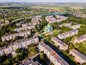
Novovolynsk
City in Volyn Oblast, Ukraine
Distance: Approx. 886 meters
Latitude and longitude: 50.73333333,24.16666667
Novovolynsk (Ukrainian: Нововолинськ, IPA: [nowowoˈlɪnsʲk] ) is a city in Volyn Oblast, Ukraine. Novovolynsk, together with the rural settlement of Blahodatne and six villages, is incorporated into Novovolynsk urban hromada. Population: 49,772 (2022 estimate).
Budiatychi
Place in Volyn Oblast, Ukraine
Distance: Approx. 2217 meters
Latitude and longitude: 50.7075,24.175
Budiatychi (Ukrainian: Будятичі) is a village in the Volodymyr Raion (district) of the Volyn Oblast (province) in western Ukraine near Novovolynsk.
Blahodatne, Volyn Oblast
Rural locality in Volyn Oblast, Ukraine
Distance: Approx. 9400 meters
Latitude and longitude: 50.6625,24.25083333
Blahodatne (Ukrainian: Благодатне), formerly Zhovtneve (Ukrainian: Жовтневе), is a rural settlement in Novovolynsk urban hromada, Volodymyr Raion, Volyn Oblast, western Ukraine. Population: 4,575 (2022 estimate).
Chrynów massacre
1943 massacre of Polish worshippers
Distance: Approx. 7376 meters
Latitude and longitude: 50.68833333,24.24888889
Chrynów massacre (Polish: Zbrodnia w Chrynowie) was a massacre of Polish worshipers which took place in the Volhynian village of Chrynów, Gmina Grzybowica, Powiat Włodzimierz, Wołyń Voivodeship of the Second Polish Republic (Volyn Oblast since 1945, modern Грибовицька волость, Ukraine). It took place on Sunday, July 11, 1943, when the Ukrainian Insurgent Army (UPA) as well as armed deserters from the Ukrainian Auxiliary Police (formed by Nazi Germany), supported by local Ukrainian peasants, surrounded the local Roman-Catholic church where the Poles had gathered for a religious ceremony. The parish priest Jan Kotwicki was shot along with a group of women, when attempting to escape through the vestry.
Gurów massacre
Distance: Approx. 7376 meters
Latitude and longitude: 50.68833333,24.24888889
Gurów massacre was a wartime massacre of the Polish population of Gurów, committed on 11 July 1943 by the Ukrainian Insurgent Army death squad from Group "Piwnicz" and Ukrainian peasants, during the Massacres of Poles in Volhynia and Eastern Galicia. The crime scene was the prewar village of Gurów located in Gmina Grzybowica, Powiat Włodzimierz in the Wołyń Voivodeship of the Second Polish Republic (since 1945: Volodymyr-Volynskyi Raion in the Volyn Oblast, modern Грибовицька волость, Ukraine). Gurów village no longer exists.
Hrybovytsia
Rural locality in Volyn Oblast, Ukraine
Distance: Approx. 7376 meters
Latitude and longitude: 50.68833333,24.24888889
Hrybovytsia (Ukrainian: Грибовиця) is a village in the Novovolynsk urban hromada of the Volodymyr Raion of Volyn Oblast in Ukraine.
Weather in this IP's area
scattered clouds
-0 Celsius
-4 Celsius
-0 Celsius
-0 Celsius
1020 hPa
95 %
1020 hPa
995 hPa
10000 meters
3.63 m/s
7.32 m/s
186 degree
38 %