Country:
 Poland
Region:
City:
Latitude and Longitude:
Time Zone:
Postal Code:
IP information under different IP Channel
ip-api
Country
Region
City
ASN
Time Zone
ISP
Blacklist
Proxy
Latitude
Longitude
Postal
Route
IPinfo
Country
Region
City
ASN
Time Zone
ISP
Blacklist
Proxy
Latitude
Longitude
Postal
Route
MaxMind
Country
Region
City
ASN
Time Zone
ISP
Blacklist
Proxy
Latitude
Longitude
Postal
Route
Luminati
Country
PLRegion
32
City
szczecin
ASN
Time Zone
Europe/Warsaw
ISP
Shentel Sp. z o.o.
Latitude
Longitude
Postal
db-ip
Country
Region
City
ASN
Time Zone
ISP
Blacklist
Proxy
Latitude
Longitude
Postal
Route
ipdata
Country
Region
City
ASN
Time Zone
ISP
Blacklist
Proxy
Latitude
Longitude
Postal
Route
Popular places and events near this IP address
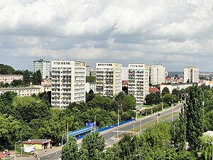
Pomorzany, Szczecin
Municipal neighbourhood in Szczecin, West Pomeranian Voivodeship, Poland
Distance: Approx. 2103 meters
Latitude and longitude: 53.39944444,14.52611111
Pomorzany is a municipal neighbourhood of the city of Szczecin, Poland situated on the left bank of Oder river, south of the Szczecin Old Town. It borders Gumieńce to the west, Turzyn to the northwest, Nowe Miasto to the north, Międzyodrze-Wyspa Pucka to the east, and Gmina Kołbaskowo (Ustowo village) to the south. As of January 2011 it had a population of 21,957.

Gumieńce
Municipal neighbourhood in Szczecin, West Pomeranian Voivodeship, Poland
Distance: Approx. 794 meters
Latitude and longitude: 53.40416667,14.50333333
Gumieńce (German: Scheune) is a municipal neighbourhood of the city of Szczecin, Poland situated on the left bank of Oder river, west of the Szczecin Old Town, Middle Town and Pomorzany. As of January 2011 it had a population of 19,120. The Central Cemetery is located in eastern part of Gumieńce.

Turzyn, Szczecin
Municipal neighbourhood in Szczecin, West Pomeranian Voivodeship, Poland
Distance: Approx. 2348 meters
Latitude and longitude: 53.42833333,14.52194444
Turzyn is a municipal neighbourhood of the city of Szczecin, Poland situated on the left bank of Oder river, west of the Szczecin Old Town and Middle Town. As of January 2011 it had a population of 20,373.

Świerczewo, Szczecin
Municipal neighbourhood in Szczecin, West Pomeranian Voivodeship, Poland
Distance: Approx. 1940 meters
Latitude and longitude: 53.42861111,14.5025
Świerczewo is a municipal neighborhood of the city of Szczecin, Poland situated on the left bank of Oder river, west of the Szczecin Old Town and Middle Town, in Zachód (West) District. As of January 2011 it had a population of 16,860. The area became part of the emerging Polish state under its first ruler Mieszko I around 967, and following Poland's fragmentation it formed part of the Duchy of Pomerania.

Szczecin University of Technology
Polish university
Distance: Approx. 2711 meters
Latitude and longitude: 53.42482,14.53517
Szczecin University of Technology (Polish: Politechnika Szczecińska) was one of the biggest universities in Szczecin, Poland.

Florian Krygier Municipal Stadium
Distance: Approx. 3051 meters
Latitude and longitude: 53.43657611,14.51865806
Stadion Miejski im. Floriana Krygiera (Florian Krygier Municipal Stadium) is a football stadium in Szczecin, Poland. It is the home ground of Pogoń Szczecin.

West Pomeranian University of Technology
Technical university in Szczecin, Poland
Distance: Approx. 2694 meters
Latitude and longitude: 53.42444444,14.53527778
West Pomeranian University of Technology, Szczecin (Polish: Zachodniopomorski Uniwersytet Technologiczny w Szczecinie, ZUT) is a technical university in Szczecin, Poland. The university was established on January 1. 2009 in Szczecin, from the merger of the Agricultural University in Szczecin and the Szczecin University of Technology.
Ostoja, West Pomeranian Voivodeship
Village in West Pomeranian Voivodeship, Poland
Distance: Approx. 2023 meters
Latitude and longitude: 53.40694444,14.47166667
Ostoja [ɔsˈtɔja] (German: Schadeleben) is a village in the administrative district of Gmina Kołbaskowo, within Police County, West Pomeranian Voivodeship, in north-western Poland, close to the German border. It lies approximately 16 kilometres (10 mi) south-west of Police and 8 km (5 mi) west of the regional capital Szczecin. For the history of the region, see History of Pomerania.

Przylep, West Pomeranian Voivodeship
Village in West Pomeranian Voivodeship, Poland
Distance: Approx. 2962 meters
Latitude and longitude: 53.41166667,14.45666667
Przylep [ˈpʂɨlɛp] (German: Prilipp) is a village in the administrative district of Gmina Kołbaskowo, within Police County, West Pomeranian Voivodeship, in north-western Poland, close to the German border. For the history of the region, see History of Pomerania.

Central Cemetery, Szczecin
Municipal cemetery in Szczecin, Poland
Distance: Approx. 1795 meters
Latitude and longitude: 53.42055556,14.52333333
The Central Cemetery in Szczecin is a municipal cemetery in Szczecin, Poland. With an area of over 167.8 hectares, and still expanding, it is officially the largest cemetery in Poland and the third largest cemetery in Europe.

Szczecin Gumieńce railway station
Railway station in Gumieńce, Poland
Distance: Approx. 1542 meters
Latitude and longitude: 53.39777778,14.49555556
Szczecin Gumieńce (Polish: Szczecin Gumieńce) is a railway station in the town of Gumieńce, West Pomeranian Voivodeship, Poland. The station lies on the Berlin-Szczecin railway and Bützow–Szczecin railway.
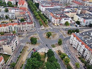
Tadeusz Kościuszko Square
Urban square in Szczecin, Poland
Distance: Approx. 2973 meters
Latitude and longitude: 53.42708333,14.53733333
The Tadeusz Kościuszko Square, until 1945 known as the Schinkel Square, is an urban square in Szczecin, Poland. It is located in the neighbourhood of Śródmieście-Zachód, within the district of Śródmieście, at the intersection of Piastów Avenue, Krzywoustego Street, and Sikorskiego Street. It was constructed in 1878.
Weather in this IP's area
clear sky
20 Celsius
20 Celsius
20 Celsius
21 Celsius
1029 hPa
54 %
1029 hPa
1027 hPa
10000 meters
3.58 m/s
70 degree
06:44:44
19:06:02