Country:
 Netherlands
Region:
City:
Latitude and Longitude:
Time Zone:
Postal Code:
IP information under different IP Channel
ip-api
Country
Region
City
ASN
Time Zone
ISP
Blacklist
Proxy
Latitude
Longitude
Postal
Route
IPinfo
Country
Region
City
ASN
Time Zone
ISP
Blacklist
Proxy
Latitude
Longitude
Postal
Route
MaxMind
Country
Region
City
ASN
Time Zone
ISP
Blacklist
Proxy
Latitude
Longitude
Postal
Route
Luminati
Country
NLASN
Time Zone
Europe/Amsterdam
ISP
Amsterdam Internet Exchange B.V.
Latitude
Longitude
Postal
db-ip
Country
Region
City
ASN
Time Zone
ISP
Blacklist
Proxy
Latitude
Longitude
Postal
Route
ipdata
Country
Region
City
ASN
Time Zone
ISP
Blacklist
Proxy
Latitude
Longitude
Postal
Route
Popular places and events near this IP address

De Nederlandsche Bank
The Netherlands' central bank
Distance: Approx. 190 meters
Latitude and longitude: 52.35872222,4.9
De Nederlandsche Bank (DNB, lit. 'The Dutch Bank') is the Dutch member of the Eurosystem and has been the monetary authority for the Netherlands from 1814 to 1998, issuing the Dutch guilder. Since 2014, it has also been the country's national competent authority within European Banking Supervision. It was originally founded by King William I, and has been since transformed into a state-owned public limited company (Dutch: naamloze vennootschap, abbreviated NV).

Albert Cuyp Market
Street market in Amsterdam
Distance: Approx. 487 meters
Latitude and longitude: 52.35597222,4.89536111
The Albert Cuyp Market is a street market in Amsterdam, The Netherlands, on the Albert Cuypstraat between Ferdinand Bolstraat and Van Woustraat, in the De Pijp area of the Oud-Zuid district of the city. The street and market are named for Albert Cuyp, a painter from the 17th century. The market began as an ad hoc collection of street traders and pushcarts.

De Duif
Church in Amsterdam, Netherlands
Distance: Approx. 171 meters
Latitude and longitude: 52.3613,4.8968
De Duif is a church on the Prinsengracht in Amsterdam. At present – after the recent restoration by Stadsherstel Amsterdam – it is rented out for all kinds of events.

InterContinental Amstel Amsterdam
Hotel in Amsterdam, Netherlands
Distance: Approx. 476 meters
Latitude and longitude: 52.36,4.90513889
The InterContinental Amstel Amsterdam Hotel, commonly referred to as the Amstel Hotel, is a hotel in Amsterdam, capital city of the Netherlands, on the east bank of the river Amstel. In 2007, it was the only hotel in the Netherlands on the list of World's Best Hotels, and was ranked in 90th place. The Amstel Hotel is part of the InterContinental Hotels chain.

La Rive
Restaurant in Amsterdam, Netherlands
Distance: Approx. 478 meters
Latitude and longitude: 52.35970833,4.90515278
La Rive is a former restaurant that was located in the InterContinental Amstel Amsterdam, Netherlands. It was a fine dining restaurant that was awarded one or more Michelin stars from 1993 to 2016. GaultMillau awarded the restaurant 18.0 points (out of 20 possible).

Reguliersgracht
Canal in Amsterdam
Distance: Approx. 462 meters
Latitude and longitude: 52.3639,4.8958
Reguliersgracht is a canal in Amsterdam, Netherlands. Established in 1658, it is located in the Grachtengordel, in the Centrum borough. During World War II the "nerve center" of the illegal paper Het Parool was housed there, in a house (number 111) occupied by Simon Carmiggelt, Max Nord, Wim van Norden and their families.

Vijzelgracht metro station
Station on the North–South Line of the Amsterdam Metro
Distance: Approx. 487 meters
Latitude and longitude: 52.36083333,4.89111111
Vijzelgracht metro station (Dutch: Station Vijzelgracht) is a station on the Route 52 (North–South Line) of the Amsterdam Metro in Amsterdam, Netherlands. It was opened on 22 July 2018. Vijzelgracht is an underground station situated in the Weteringschans neighbourhood of the Amsterdam-Centrum borough.

Achtergracht
Canal in Amsterdam
Distance: Approx. 264 meters
Latitude and longitude: 52.361304,4.901386
The Achtergracht (Dutch pronunciation: [ˈɑxtərˌɣrɑxt]) is a short canal in Amsterdam, located between Frederiksplein and the Amstel, parallel to the Prinsengracht. The Achtergracht is located in the eastern part of the Grachtengordel (canal belt).

Nieuwe Achtergracht
Canal in Amsterdam
Distance: Approx. 462 meters
Latitude and longitude: 52.3639,4.8958
The Nieuwe Achtergracht is a canal in Amsterdam in the east of the Grachtengordel (canal belt) in the Amsterdam-Centrum district. It runs parallel to the Nieuwe Prinsengracht and connects the Onbekendegracht with the Plantage Muidergracht. The canal is crossed by Weesperstraat (at the Weesperplein) and Roetersstraat.

Vijzelgracht
Canal in Amsterdam
Distance: Approx. 487 meters
Latitude and longitude: 52.360833,4.891111
The Vijzelgracht is a street and former canal in Amsterdam. The Vijzelgracht is adjacent to the Grachtengordel (canal belt) and is an extension of one of the most important city radii for public transport and normal traffic. This through route leads via Vijzelstraat, Rokin, Dam Square and Damrak to Central Station.

Amstelkerk
Distance: Approx. 275 meters
Latitude and longitude: 52.36222222,4.89638889
The Amstelkerk (English: Amstel Church) is a Reformed church building in central Amsterdam, Netherlands. It lies in the southern part of the Grachtengordel neighborhood, near the Amstel River, between the Prinsengracht, Reguliersgracht and Keizersgracht. The church was designed by Daniël Stalpaert and was originally intended as a wooden emergency church, erected to provide for church services in the fourth Golden Age extension of Amsterdam laid out in 1662, but it was never replaced by a more permanent building.
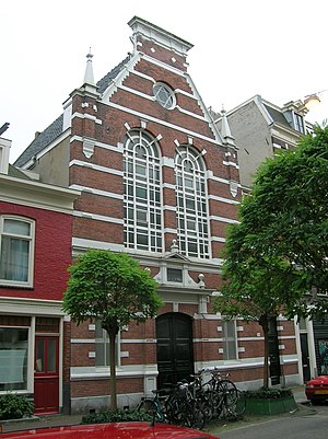
Gerard Doustraat Synagogue
Synagogue in Amsterdam, Netherlands
Distance: Approx. 327 meters
Latitude and longitude: 52.357066,4.897909
The Gerard Doustraat Synagogue is an Orthodox Jewish congregation and synagogue, located at Gerard Doustraat 238, in the de Pijp neighborhood of South Amsterdam, in North Holland, the Netherlands. Designed by architect E. M. Rood in the Renaissance Revival style, the synagogue was completed in 1892. The synagogue offers space for 250 men and 70 women.
Weather in this IP's area
broken clouds
16 Celsius
16 Celsius
15 Celsius
17 Celsius
1013 hPa
85 %
1013 hPa
1012 hPa
10000 meters
2.57 m/s
330 degree
75 %
08:11:16
18:39:24