91.197.111.128 - IP Lookup: Free IP Address Lookup, Postal Code Lookup, IP Location Lookup, IP ASN, Public IP
Country:
Region:
City:
Location:
Time Zone:
Postal Code:
ISP:
ASN:
language:
User-Agent:
Proxy IP:
Blacklist:
IP information under different IP Channel
ip-api
Country
Region
City
ASN
Time Zone
ISP
Blacklist
Proxy
Latitude
Longitude
Postal
Route
db-ip
Country
Region
City
ASN
Time Zone
ISP
Blacklist
Proxy
Latitude
Longitude
Postal
Route
IPinfo
Country
Region
City
ASN
Time Zone
ISP
Blacklist
Proxy
Latitude
Longitude
Postal
Route
IP2Location
91.197.111.128Country
Region
oost-vlaanderen
City
wetteren
Time Zone
Europe/Brussels
ISP
Language
User-Agent
Latitude
Longitude
Postal
ipdata
Country
Region
City
ASN
Time Zone
ISP
Blacklist
Proxy
Latitude
Longitude
Postal
Route
Popular places and events near this IP address
Laarne
Municipality in Flemish Community, Belgium
Distance: Approx. 2660 meters
Latitude and longitude: 51.01666667,3.85
Laarne (Dutch pronunciation: [ˈlaːrnə]) is a municipality located in the Belgian province of East Flanders. The municipality comprises the towns of Kalken and Laarne proper. On 1 January 2018, Laarne had a total population of 12,487.
Wetteren
Municipality in Flemish Community, Belgium
Distance: Approx. 590 meters
Latitude and longitude: 51,3.88333333
Wetteren (Dutch pronunciation: [ˈʋɛtərə(n)]) is a municipality in the Belgian province of East Flanders, comprising the towns of Massemen, Westrem and Wetteren proper. In 2021 it had a population of 26,206. Its total area is 36.68 km2.

Wichelen
Municipality in Flemish Community, Belgium
Distance: Approx. 5863 meters
Latitude and longitude: 51,3.96666667
Wichelen (Dutch pronunciation: [ˈʋɪxələ(n)] ) is a municipality located in the Denderstreek in the Belgian province of East Flanders, comprising the towns of Schellebelle, Serskamp and Wichelen proper. In 2021, its population was 11,690 and its area 22.87 km². The Molenbeek crosses Wichelen in Schellebelle, Serskamp and Wichelen.

Melle, Belgium
Municipality in Flemish Community, Belgium
Distance: Approx. 5872 meters
Latitude and longitude: 51,3.8
Melle (Dutch pronunciation: [ˈmɛlə] ) is a municipality located in the Belgian province of East Flanders. The municipality comprises the villages of Gontrode and Melle proper. On 1 January 2018 Melle had a total population of 11,574.

Heusden, Belgium
Sub-municipality in Destelbergen, Belgium
Distance: Approx. 6366 meters
Latitude and longitude: 51.02805556,3.8
Heusden was a municipality located in the Belgian province of East Flanders. In 1977 it merged with the municipality of Destelbergen, of which it is now part. It was mentioned for the first time in the 11th century, by abbot Othejbold.

Laarne Castle
Distance: Approx. 4061 meters
Latitude and longitude: 51.028,3.838
Laarne Castle (Dutch: Kasteel van Laarne) is a water castle near Laarne, East Flanders in Belgium near to the provincial capital of Ghent. Laarne Castle is situated at an elevation of 3 meters. Laarne is situated approximately 15 kilometres (9.3 mi) south-east of the major historic city of Ghent which was the capital of the County of Flanders.

Brasserie des Rocs
Distance: Approx. 5500 meters
Latitude and longitude: 51.0009,3.8052
The Brasserie des Rocs (formerly known as Brasserie de l'Abbaye des Rocs) is a brewery in Montignies-sur-Roc, Belgium. Founded in 1979, the company brews ales in the traditional Belgian style. Their Triple Imperiale, a tripel without added sugars, was the Chicago Tribune's "Beer of the Month" in 2007.
Huyghe Brewery
Belgian brewery
Distance: Approx. 5500 meters
Latitude and longitude: 51.00087,3.8052
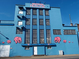
Huyghe Brewery (Dutch: Brouwerij Huyghe) is a brewery founded in 1906 by Leon Huyghe in the city of Melle in East Flanders, Belgium. Its flagship beer is Delirium Tremens, a golden ale.
Molenbeek (Erpe-Mere Bovenschelde)
River in Belgium
Distance: Approx. 5003 meters
Latitude and longitude: 51.00777778,3.95472222
The Molenbeek (English: Millbrook) is a brook in the Denderstreek, Belgium. The stream has a length of approximately 22 kilometers. The source of the Molenbeek is located in Grotenberge and the delta is in nearby Wichelen.
Nieuwenbosch Abbey
Distance: Approx. 6392 meters
Latitude and longitude: 51.01737,3.79417194
Nieuwenbosch Abbey, also Nieuwenbos Abbey (Dutch: Abdij Nieuwenbosch or Nieuwenbos) was a Cistercian nunnery in Heusden, East Flanders, Belgium, later relocated to Ghent.
Holy Cross Church, Heusden
Church in Flemish Region, Belgium
Distance: Approx. 6418 meters
Latitude and longitude: 51.02814722,3.79926389
The Holy Cross Church is a church in the Belgian sub-municipality of Heusden. The church was built in 1844 on the site of an older church. It is dedicated to the Exaltation of the Holy Cross.
Bueren Castle
Distance: Approx. 4433 meters
Latitude and longitude: 50.99083333,3.82444444
Bueren Castle is a 16th-century moated castle in Melle-Kwatrecht. The castle domain is 10 hectares and is located in two municipalities. The castle is named after Christophe-Bernard de Bueren, a scion of the Belgian noble family de Bueren.
Weather in this IP's area
overcast clouds
8 Celsius
4 Celsius
7 Celsius
8 Celsius
989 hPa
77 %
989 hPa
988 hPa
10000 meters
8.4 m/s
15.21 m/s
201 degree
100 %


