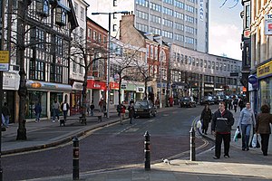
91.196.187.175 - IP Lookup: Free IP Address Lookup, Postal Code Lookup, IP Location Lookup, IP ASN, Public IP
Country:
Region:
City:
Location:
Time Zone:
Postal Code:
IP information under different IP Channel
ip-api
Country
Region
City
ASN
Time Zone
ISP
Blacklist
Proxy
Latitude
Longitude
Postal
Route
Luminati
Country
ASN
Time Zone
Europe/London
ISP
IX Reach Ltd
Latitude
Longitude
Postal
IPinfo
Country
Region
City
ASN
Time Zone
ISP
Blacklist
Proxy
Latitude
Longitude
Postal
Route
IP2Location
91.196.187.175Country
Region
england
City
nottingham
Time Zone
Europe/London
ISP
Language
User-Agent
Latitude
Longitude
Postal
db-ip
Country
Region
City
ASN
Time Zone
ISP
Blacklist
Proxy
Latitude
Longitude
Postal
Route
ipdata
Country
Region
City
ASN
Time Zone
ISP
Blacklist
Proxy
Latitude
Longitude
Postal
Route
Popular places and events near this IP address

Old Market Square
Square in Nottingham, England
Distance: Approx. 33 meters
Latitude and longitude: 52.95333333,-1.15027778
The Old Market Square (Slab Square) is an open, pedestrianised city square in Nottingham, England, forming the heart of the city, and covering an area of approximately 12,000 square metres (130,000 sq ft), or about 3 acres (1.2 ha). It is one of the largest paved squares in the United Kingdom. Located in the heart of Nottingham City Centre, the square is bounded by Beastmarket Hill to the West, Long Row to the North, and South Parade to the South.

Nottingham city centre
Distance: Approx. 121 meters
Latitude and longitude: 52.953,-1.149
Nottingham city centre is the cultural, commercial, financial and historical heart of Nottingham, England, and represents the central area of the Greater Nottingham conurbation. The centre of the city is usually defined as the Old Market Square, one of the largest surviving town squares in the United Kingdom. Covering about 12,000 square metres, it is within the boundaries of the centuries-old Great Market Place, which covered about 22,000 square metres.

The Bell Inn, Nottingham
Pub in Nottingham, England
Distance: Approx. 101 meters
Latitude and longitude: 52.95347,-1.15199
The Bell Inn is a pub in Nottingham, England. Completed from around 1437, it claims, along with Ye Olde Trip to Jerusalem and Ye Olde Salutation Inn, to be the oldest pub in the city. In 1982 the pub became a Grade II listed building.

Bromley House Library
Subscription library in Nottingham
Distance: Approx. 121 meters
Latitude and longitude: 52.9535,-1.1523
Bromley House Library (originally the Nottingham Subscription Library) is a subscription library in Nottingham, England.

Old Market Square tram stop
Nottingham Express Transit tram stop
Distance: Approx. 63 meters
Latitude and longitude: 52.95308,-1.150133
Old Market Square is a tram stop of Nottingham Express Transit (NET) in the centre of the city of Nottingham. It is situated on the South Parade of Nottingham's Old Market Square, from which it derives its name, and is the most central of the system's stops. The location is a high-profile one, benefiting from the long views and high pedestrian footfall of the market square.

Griffin & Spalding
Former department store in Nottingham
Distance: Approx. 33 meters
Latitude and longitude: 52.95330556,-1.15052778
Griffin & Spalding was a department store located in Nottingham. It later became part of the Debenhams chain.

Long Row
Street in Nottingham, England
Distance: Approx. 22 meters
Latitude and longitude: 52.9538,-1.1505
Long Row is a row of retail buildings in Nottingham City Centre forming the north side of Old Market Square, Nottingham.

South Parade, Nottingham
Row of buildings in Nottingham, England
Distance: Approx. 72 meters
Latitude and longitude: 52.953,-1.1501
South Parade is a row of buildings in Nottingham City Centre forming the south side of Old Market Square, Nottingham which runs from Wheeler Gate to Exchange Walk.

Wheeler Gate, Nottingham
Street in Nottingham, England
Distance: Approx. 125 meters
Latitude and longitude: 52.9525,-1.1501
Wheeler Gate is a street in Nottingham City Centre between Old Market Square and St Peter’s Square.

Beastmarket Hill
Row of buildings in Nottingham, England
Distance: Approx. 62 meters
Latitude and longitude: 52.9531,-1.1509
Beastmarket Hill is a row of buildings in Nottingham City Centre forming the west side of Old Market Square.

Queen's Chambers, Nottingham
Distance: Approx. 53 meters
Latitude and longitude: 52.95369444,-1.14972222
Queen's Chambers is a Grade II listed building on Long Row and King Street in Nottingham.

Central Post Office, Nottingham
Main post office in Nottingham England
Distance: Approx. 61 meters
Latitude and longitude: 52.95405556,-1.15
The Central Post Office in Nottingham was based on Queen Street from 1898 to 2019.
Weather in this IP's area
fog
9 Celsius
7 Celsius
8 Celsius
10 Celsius
1027 hPa
94 %
1027 hPa
1021 hPa
900 meters
3.09 m/s
210 degree
75 %