91.196.107.209 - IP Lookup: Free IP Address Lookup, Postal Code Lookup, IP Location Lookup, IP ASN, Public IP
Country:
Region:
City:
Location:
Time Zone:
Postal Code:
ISP:
ASN:
language:
User-Agent:
Proxy IP:
Blacklist:
IP information under different IP Channel
ip-api
Country
Region
City
ASN
Time Zone
ISP
Blacklist
Proxy
Latitude
Longitude
Postal
Route
db-ip
Country
Region
City
ASN
Time Zone
ISP
Blacklist
Proxy
Latitude
Longitude
Postal
Route
IPinfo
Country
Region
City
ASN
Time Zone
ISP
Blacklist
Proxy
Latitude
Longitude
Postal
Route
IP2Location
91.196.107.209Country
Region
groningen
City
winsum
Time Zone
Europe/Amsterdam
ISP
Language
User-Agent
Latitude
Longitude
Postal
ipdata
Country
Region
City
ASN
Time Zone
ISP
Blacklist
Proxy
Latitude
Longitude
Postal
Route
Popular places and events near this IP address

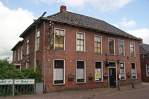
Winsum
Town and former municipality in Groningen, Netherlands
Distance: Approx. 462 meters
Latitude and longitude: 53.33333333,6.51666667
Winsum (Dutch: [ˈʋɪnsʏm] ; Gronings: Wìnzum [ˈʋɪ̃ːzəm]) is a town and a former municipality in the northeastern Netherlands. On 1 January 2019 the municipality merged with the municipalities of Bedum, De Marne and Eemsmond to form the new municipality Het Hogeland. The town of Winsum was officially established in 1057 as the fusion of three historic villages: Obergum (North), Winsum (center) and Bellingeweer (South).

Baflo
Village in Groningen, Netherlands
Distance: Approx. 3590 meters
Latitude and longitude: 53.36194444,6.51333333
Baflo (Dutch pronunciation: [ˈbɑfloː]; Gronings: Bavvelt [ˈbaʋl̩t]) is a village in the municipality of Het Hogeland, Netherlands. Famous people born in Baflo include humanist Rodolphus Agricola (1443/1444–1485) and jurist Gezina van der Molen (1892–1972). Until 1990, Baflo was a separate municipality.

Dingen, Netherlands
Hamlet in Groningen, Netherlands
Distance: Approx. 2243 meters
Latitude and longitude: 53.35,6.51666667
De Dingen is a former hamlet in the Dutch province of Groningen. It was located about 1 km south of Baflo. According to the 19th-century historian A.J. van der Aa, the hamlet consisted of four farms, stretching from east to west.

Baflo railway station
Railway station in Baflo, Netherlands
Distance: Approx. 3436 meters
Latitude and longitude: 53.36083333,6.51833333
Baflo (Dutch pronunciation: [ˈbɑfloː]; abbreviation: Bf) is a railway station located in Baflo, Netherlands. The station was opened on 16 August 1893 and is located on the Sauwerd–Roodeschool railway. The station is operated by Arriva.

Winsum railway station
Railway station in Winsum, Netherlands
Distance: Approx. 53 meters
Latitude and longitude: 53.33,6.52
Winsum is a railway station located in Winsum, The Netherlands. The station was opened on 16 August 1893 and is located on the Sauwerd–Roodeschool railway. The train services are operated by Arriva.

Wetsinge
Village in Groningen, Netherlands
Distance: Approx. 3341 meters
Latitude and longitude: 53.30055556,6.53055556
Groot Wetsinge (English: Big Wetsinge) and Klein Wetsinge (English: Small Wetsinge) are two villages in the municipality of Het Hogeland in the Dutch province of Groningen. The villages are less than half a kilometre apart and are often referred to together as Wetsinge. The closest village, at a distance of less than a kilometre to Wetsinge is Sauwerd.

Winsum train collision
Dutch train disaster
Distance: Approx. 1451 meters
Latitude and longitude: 53.31775,6.52823889
The Winsum train disaster took place on 25 July 1980 near Winsum in the Dutch province of Groningen. Nine people died and 21 were injured. The collision took place on a single track between Sauwerd and Roodeschool that did not have ATB or signals, instead the drivers were informed by radio where other trains on the tracks were, which was a less reliable system that relied on trust.
Garnwerd
Village in Groningen, Netherlands
Distance: Approx. 3401 meters
Latitude and longitude: 53.30444444,6.49277778
Garnwerd is a wierde village next to the Reitdiep in the municipality of Westerkwartier in the Dutch province of Groningen.

Obergum
Village in Groningen, Netherlands
Distance: Approx. 677 meters
Latitude and longitude: 53.335,6.515
Obergum is part of the town Winsum (Groningen, Netherlands) that lies north of the Winsumerdiep. Originally it was a separate village. Winsum and Obergum have been connected since 1808 by the bridge De Boog (The Arch).

Bellingeweer
Village in Groningen, Netherlands
Distance: Approx. 421 meters
Latitude and longitude: 53.32641111,6.51881389
Bellingeweer is part of the town of Winsum, in Groningen, Netherlands. Originally, it was an independent village built on a wierde. Bellingeweer had its own medieval church, which was demolished in 1824.

Aduarderzijl
Hamlet in Groningen, Netherlands
Distance: Approx. 3786 meters
Latitude and longitude: 53.31877,6.46705
Aduarderzijl (Dutch: [ˌaːdyɑrdərˈzɛil]; Gronings: Auwerderziel) is a hamlet in the municipality of Westerkwartier in the province of Groningen in the Netherlands, located to the south of the Reitdiep. Administratively, it is part of the village of Feerwerd. The hamlet is located east of the hamlet of Allersma, northeast of the village of Ezinge, north of the village of Feerwerd, and northwest of the wierde of Antum and the village of Garnwerd.

Tinallinge
Village in Groningen, Netherlands
Distance: Approx. 3100 meters
Latitude and longitude: 53.35657,6.53479
Tinallinge (Dutch: [tiˈnaːlɪ.ŋə]; Gronings: Tinaalng) is a small village in the municipality of Het Hogeland, in the province of Groningen. It is located just southeast of Baflo.
Weather in this IP's area
few clouds
-1 Celsius
-3 Celsius
-1 Celsius
-1 Celsius
1020 hPa
91 %
1020 hPa
1020 hPa
10000 meters
2.17 m/s
2.14 m/s
267 degree
11 %
