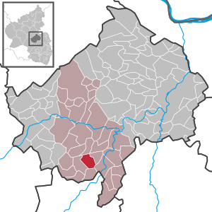
Country:
Region:
City:
Latitude and Longitude:
Time Zone:
Postal Code:
IP information under different IP Channel
ip-api
Country
Region
City
ASN
Time Zone
ISP
Blacklist
Proxy
Latitude
Longitude
Postal
Route
Luminati
Country
ASN
Time Zone
Europe/Berlin
ISP
VSE NET GmbH
Latitude
Longitude
Postal
IPinfo
Country
Region
City
ASN
Time Zone
ISP
Blacklist
Proxy
Latitude
Longitude
Postal
Route
db-ip
Country
Region
City
ASN
Time Zone
ISP
Blacklist
Proxy
Latitude
Longitude
Postal
Route
ipdata
Country
Region
City
ASN
Time Zone
ISP
Blacklist
Proxy
Latitude
Longitude
Postal
Route
Popular places and events near this IP address

Bad Sobernheim
Town in Rhineland-Palatinate, Germany
Distance: Approx. 4148 meters
Latitude and longitude: 49.78722222,7.65277778
Bad Sobernheim is a town in the Bad Kreuznach district in Rhineland-Palatinate, Germany. It belongs to the like-named Verbandsgemeinde, and is also its seat. It is a state-recognized spa town, and is well known for two fossil discovery sites and for the naturopath Emanuel Felke.
Meisenheim
Town in Rhineland-Palatinate, Germany
Distance: Approx. 3900 meters
Latitude and longitude: 49.71666667,7.66666667
Meisenheim (German: [ˈmaɪzn̩haɪm] ) is a town in the Bad Kreuznach district in Rhineland-Palatinate, Germany. It belongs to the like-named Verbandsgemeinde, and is also its seat. Meisenheim is a state-recognized recreational resort (Erholungsort) and it is set out as a middle centre in state planning.

Abtweiler
Municipality in Rhineland-Palatinate, Germany
Distance: Approx. 782 meters
Latitude and longitude: 49.74527778,7.65805556
Abtweiler is an Ortsgemeinde – a municipality belonging to a Verbandsgemeinde, a kind of collective municipality – in the Bad Kreuznach district in Rhineland-Palatinate, Germany. It belongs to the Verbandsgemeinde of Meisenheim, whose seat is in the like-named town.

Bärweiler
Municipality in Rhineland-Palatinate, Germany
Distance: Approx. 3614 meters
Latitude and longitude: 49.7425,7.60111111
Bärweiler is an Ortsgemeinde – a municipality belonging to a Verbandsgemeinde, a kind of collective municipality – in the Bad Kreuznach district in Rhineland-Palatinate, Germany. It belongs to the Verbandsgemeinde of Bad Sobernheim, whose seat is in the like-named town.

Desloch
Municipality in Rhineland-Palatinate, Germany
Distance: Approx. 3802 meters
Latitude and longitude: 49.71861111,7.62916667
Desloch is an Ortsgemeinde – a municipality belonging to a Verbandsgemeinde, a kind of collective municipality – in the Bad Kreuznach district in Rhineland-Palatinate, Germany. It belongs to the Verbandsgemeinde of Meisenheim, whose seat is in the like-named town. Desloch is a farming and winegrowing village.

Lauschied
Municipality in Rhineland-Palatinate, Germany
Distance: Approx. 2230 meters
Latitude and longitude: 49.74111111,7.62222222
Lauschied is an Ortsgemeinde – a municipality belonging to a Verbandsgemeinde, a kind of collective municipality – in the Bad Kreuznach district in Rhineland-Palatinate, Germany. It belongs to the Verbandsgemeinde of Bad Sobernheim, whose seat is in the like-named town.

Meddersheim
Municipality in Rhineland-Palatinate, Germany
Distance: Approx. 3766 meters
Latitude and longitude: 49.77694444,7.61833333
Meddersheim is an Ortsgemeinde – a municipality belonging to a Verbandsgemeinde, a kind of collective municipality – in the Bad Kreuznach district in Rhineland-Palatinate, Germany. It belongs to the Verbandsgemeinde of Bad Sobernheim, whose seat is in the like-named town. Meddersheim is a winegrowing village.

Raumbach
Municipality in Rhineland-Palatinate, Germany
Distance: Approx. 3095 meters
Latitude and longitude: 49.72227778,7.65324444
Raumbach is an Ortsgemeinde – a municipality belonging to a Verbandsgemeinde, a kind of collective municipality – in the Bad Kreuznach district in Rhineland-Palatinate, Germany. It belongs to the Verbandsgemeinde of Meisenheim, whose seat is in the like-named town.

Rehborn
Municipality in Rhineland-Palatinate, Germany
Distance: Approx. 3263 meters
Latitude and longitude: 49.734,7.688
Rehborn is an Ortsgemeinde – a municipality belonging to a Verbandsgemeinde, a kind of collective municipality – in the Bad Kreuznach district in Rhineland-Palatinate, Germany. It belongs to the Verbandsgemeinde of Nahe-Glan.

Bad Sobernheim (Verbandsgemeinde)
Distance: Approx. 4233 meters
Latitude and longitude: 49.788,7.652
Bad Sobernheim is a former Verbandsgemeinde ("collective municipality") in the district of Bad Kreuznach, Rhineland-Palatinate, Germany. The seat of the Verbandsgemeinde was in Bad Sobernheim. On 1 January 2020 it was merged into the new Verbandsgemeinde Nahe-Glan.

Bad Sobernheim station
Railway station in Bad Sobernheim, Germany
Distance: Approx. 3669 meters
Latitude and longitude: 49.78296,7.64978
Bad Sobernheim station is a through station, 38.44 km from Bingen on the Nahe Valley Railway (Bingen–Saarbrücken), in the town of Bad Sobernheim in the district of Bad Kreuznach in the German state of Rhineland-Palatinate. It is classified by Deutsche Bahn as a category 5 station.
Nahe-Glan
Distance: Approx. 3340 meters
Latitude and longitude: 49.78,7.65
Nahe-Glan is a Verbandsgemeinde ("collective municipality") in the district of Bad Kreuznach, Rhineland-Palatinate, Germany. The seat of the Verbandsgemeinde is in Bad Sobernheim. It was formed on 1 January 2020 by the merger of the former Verbandsgemeinden Bad Sobernheim and Meisenheim.
Weather in this IP's area
clear sky
6 Celsius
6 Celsius
5 Celsius
6 Celsius
1027 hPa
99 %
1027 hPa
992 hPa
10000 meters
0.02 m/s
0.11 m/s
283 degree
4 %
07:33:44
16:53:04
