91.147.255.18 - IP Lookup: Free IP Address Lookup, Postal Code Lookup, IP Location Lookup, IP ASN, Public IP
Country:
Region:
City:
Location:
Time Zone:
Postal Code:
ISP:
ASN:
language:
User-Agent:
Proxy IP:
Blacklist:
IP information under different IP Channel
ip-api
Country
Region
City
ASN
Time Zone
ISP
Blacklist
Proxy
Latitude
Longitude
Postal
Route
db-ip
Country
Region
City
ASN
Time Zone
ISP
Blacklist
Proxy
Latitude
Longitude
Postal
Route
IPinfo
Country
Region
City
ASN
Time Zone
ISP
Blacklist
Proxy
Latitude
Longitude
Postal
Route
IP2Location
91.147.255.18Country
Region
borsod-abauj-zemplen
City
miskolc
Time Zone
Europe/Budapest
ISP
Language
User-Agent
Latitude
Longitude
Postal
ipdata
Country
Region
City
ASN
Time Zone
ISP
Blacklist
Proxy
Latitude
Longitude
Postal
Route
Popular places and events near this IP address

Borsod County
County of the Kingdom of Hungary
Distance: Approx. 15 meters
Latitude and longitude: 48.1,20.78333333
Borsod was an administrative county (comitatus) of the Kingdom of Hungary. The capital of the county was Miskolc. After World War II, the county was merged with the Hungarian parts of Abaúj-Torna County and Zemplén counties to form Borsod-Abaúj-Zemplén county.

Gothic Protestant Church of Avas
Church in Miskolc, Hungary
Distance: Approx. 369 meters
Latitude and longitude: 48.1013,20.7787
The Gothic Protestant Church of Avas is the oldest building in the centre of the city of Miskolc in Northern Hungary. It was built in the 13th century as a small, Romanesque style church, and later it was expanded to a larger Gothic style church. In 1544, during the Ottoman occupation of Hungary the Turks set the church on fire.

Ferenc Földes Secondary School
Secondary school in Miskolc, Hungary
Distance: Approx. 13 meters
Latitude and longitude: 48.1,20.7833
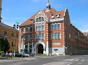
Ferenc Földes Secondary School (Hungarian: Földes Ferenc Gimnázium) is a secondary school in Miskolc, Hungary. It is famous for being one of the best secondary schools of the country.

Avas
Distance: Approx. 15 meters
Latitude and longitude: 48.1,20.78333333
The Avas is a hill of volcanic origin in Miskolc, Hungary. Its top (234 m above sea level, 104 m above the city) is the highest point of Miskolc proper (although other parts, annexed to the city later, lie higher up in the Bükk mountains). On the top stands a TV tower with observation deck which is a former symbol of the city and provides a nice panorama.

Ottó Herman Museum
Museum in Miskolc, Hungary
Distance: Approx. 502 meters
Latitude and longitude: 48.09558333,20.78513889
The Ottó Herman Museum is the largest museum in Miskolc, Hungary. It holds more than 600,000 artifacts. Its main focus is on archaeology, mineralogy, arts, history, and ethnography.

Miskolc Synagogue
Orthodox synagogue in Miskolc, Hungary
Distance: Approx. 480 meters
Latitude and longitude: 48.104,20.7852
The Miskolc Synagogue, also called the Kazinczy Street Synagogue or the Great Synagogue of Miskolc, is an Orthodox Jewish congregation and synagogue, located in the town of Miskolc, in the county of Borsod-Abaúj-Zemplén, Hungary. It is the only remaining synagogue in the Borsod-Abaúj-Zemplén county.

Miskolc Gömöri railway station
Railway station in Miskolc, Hungary
Distance: Approx. 15 meters
Latitude and longitude: 48.1,20.78333333
Miskolc–Gömöri railway station, operated by Hungarian State Railways, is the smaller of two railway stations of the city of Miskolc, Hungary. The railway station was built in the late 19th century and got its name after the historical Gömör county. It was mainly important because it connected the mines and metal factories of Gömör to the city.

City Centre (Miskolc)
Historic city centre of Miskolc, Hungary
Distance: Approx. 324 meters
Latitude and longitude: 48.10277778,20.78388889
Miskolc City Centre is the historical centre of Miskolc, Hungary. Most other areas of the city were independent towns or villages beforehand, or were subsequently built afterwards. Many of the characteristic buildings of Miskolc can be found in the city centre, although the most famous ones, such as the castle of Diósgyőr or the Cave Bath of Lillafüred are outside of it.

Mindszent Church
Church in Miskolc, Hungary
Distance: Approx. 166 meters
Latitude and longitude: 48.0988,20.7847
The Mindszent Church (Mindszenti templom) is a Roman Catholic parish church in the centre of Miskolc, Hungary. It was built between 1724 and 1880 in Baroque style. It is officially called St.

Szinva Terrace
Public square in Miskolc, Hungary
Distance: Approx. 258 meters
Latitude and longitude: 48.10202,20.784609
The Szinva Terrace (Hungarian: Szinva terasz) is the newest public square in Miskolc city centre, Hungary, next to the stream Szinva which runs through the city. The square was constructed in autumn 2005 in place of a parking lot, as a part of the reconstruction of the city centre, and was opened to the public on November 5. Construction cost 450 million Ft (mainly funded from European Union sources).

Miskolc District
Districts of Hungary in Borsod-Abaúj-Zemplén
Distance: Approx. 238 meters
Latitude and longitude: 48.1,20.78
Miskolc (Hungarian: Miskolci járás) is a district in central-western part of Borsod-Abaúj-Zemplén County. Miskolc is also the name of the town where the district seat is found. The district is located in the Northern Hungary Statistical Region.

Herman Ottó Gimnázium
Secondary grammar school (gimnázium) school in Miskolc
Distance: Approx. 13 meters
Latitude and longitude: 48.1,20.7833
Ottó Herman Secondary School (Hungarian: Herman Ottó Gimnázium) is a secondary school in Miskolc, Hungary. The school is famous for being ranked among the best secondary schools in Hungary. In 2018, HVG ranked the school as 12th best in the country outside Budapest, and third best excluding secondary schools located in the capital city of Hungary, Budapest.
Weather in this IP's area
overcast clouds
5 Celsius
3 Celsius
5 Celsius
5 Celsius
1019 hPa
84 %
1019 hPa
994 hPa
10000 meters
2.35 m/s
2.89 m/s
187 degree
97 %