91.147.254.249 - IP Lookup: Free IP Address Lookup, Postal Code Lookup, IP Location Lookup, IP ASN, Public IP
Country:
Region:
City:
Location:
Time Zone:
Postal Code:
IP information under different IP Channel
ip-api
Country
Region
City
ASN
Time Zone
ISP
Blacklist
Proxy
Latitude
Longitude
Postal
Route
Luminati
Country
Region
bz
City
sajoszentpeter
ASN
Time Zone
Europe/Budapest
ISP
PARISAT Tavkozlesi es Szolgaltato Korlatolt Felelossegu Tarsasag
Latitude
Longitude
Postal
IPinfo
Country
Region
City
ASN
Time Zone
ISP
Blacklist
Proxy
Latitude
Longitude
Postal
Route
IP2Location
91.147.254.249Country
Region
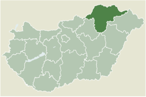
borsod-abauj-zemplen
City
szendro
Time Zone
Europe/Budapest
ISP
Language
User-Agent
Latitude
Longitude
Postal
db-ip
Country
Region
City
ASN
Time Zone
ISP
Blacklist
Proxy
Latitude
Longitude
Postal
Route
ipdata
Country
Region
City
ASN
Time Zone
ISP
Blacklist
Proxy
Latitude
Longitude
Postal
Route
Popular places and events near this IP address

Szendrő
Town in Borsod-Abaúj-Zemplén, Hungary
Distance: Approx. 2 meters
Latitude and longitude: 48.4,20.73333333
Szendrő is a small town in Borsod-Abaúj-Zemplén county, Northern Hungary, 40 kilometers (25 mi) from county capital Miskolc.
Abod
Village in Borsod-Abaúj-Zemplén, Hungary
Distance: Approx. 4930 meters
Latitude and longitude: 48.4,20.8
Abod is a village in Borsod-Abaúj-Zemplén county, Hungary.

Alsótelekes
Place in Borsod-Abaúj-Zemplén, Hungary
Distance: Approx. 5909 meters
Latitude and longitude: 48.41106,20.65509
Alsótelekes is a village in Borsod-Abaúj-Zemplén county, Hungary.

Meszes
Place in Borsod-Abaúj-Zemplén, Hungary
Distance: Approx. 6361 meters
Latitude and longitude: 48.4395,20.79552
Meszes is a village in Borsod-Abaúj-Zemplén county, Hungary.

Szuhogy
Place in Borsod-Abaúj-Zemplén, Hungary
Distance: Approx. 4653 meters
Latitude and longitude: 48.38403,20.67513
Szuhogy is a village in Borsod-Abaúj-Zemplén county, Hungary.
Szalonna (village)
Place in Borsod-Abaúj-Zemplén, Hungary
Distance: Approx. 5694 meters
Latitude and longitude: 48.45093,20.74045
Szalonna is a village in Borsod-Abaúj-Zemplén county, Hungary. In the village the church is an example of Romanesque architecture. It consists of two parts.
Felsőtelekes
Village in Northern Hungary, Hungary
Distance: Approx. 7156 meters
Latitude and longitude: 48.4066,20.63698056
Felsőtelekes is a village in Borsod-Abaúj-Zemplén County in northeastern Hungary. As of 2008, the village had a population of 773.
Ládbesenyő
Village in Northern Hungary, Hungary
Distance: Approx. 7479 meters
Latitude and longitude: 48.3428,20.786361
Ládbesenyő is a village in Borsod-Abaúj-Zemplén County in northeastern Hungary.

Martonyi
Village in Northern Hungary, Hungary
Distance: Approx. 8145 meters
Latitude and longitude: 48.46943,20.76811
Martonyi is a village in Borsod-Abaúj-Zemplén County in northeastern Hungary.

Szendrőlád
Village in Northern Hungary, Hungary
Distance: Approx. 5701 meters
Latitude and longitude: 48.35,20.75
Szendrőlád is a village in Borsod-Abaúj-Zemplén County in northeastern Hungary.
Edelény Subregion
Distance: Approx. 4138 meters
Latitude and longitude: 48.38333333,20.78333333
Edelény Subregion Borsod-Abaúj-Zemplén sixth largest of the subregions of Hungary. Area : 783,21 km².

Edelény District
Districts of Hungary in Borsod-Abaúj-Zemplén
Distance: Approx. 4137 meters
Latitude and longitude: 48.3833,20.7833
Edelény (Hungarian: Edelényi járás) is a district in northern part of Borsod-Abaúj-Zemplén County. Edelény is also the name of the town where the district seat is found. The district is located in the Northern Hungary Statistical Region.
Weather in this IP's area
overcast clouds
1 Celsius
1 Celsius
-1 Celsius
1 Celsius
1011 hPa
84 %
1011 hPa
994 hPa
10000 meters
0.52 m/s
0.98 m/s
170 degree
100 %