Country:
 Great Britain
Region:
City:
Latitude and Longitude:
Time Zone:
Postal Code:
IP information under different IP Channel
ip-api
Country
Region
City
ASN
Time Zone
ISP
Blacklist
Proxy
Latitude
Longitude
Postal
Route
IPinfo
Country
Region
City
ASN
Time Zone
ISP
Blacklist
Proxy
Latitude
Longitude
Postal
Route
MaxMind
Country
Region
City
ASN
Time Zone
ISP
Blacklist
Proxy
Latitude
Longitude
Postal
Route
Luminati
Country
GBASN
Time Zone
Europe/London
ISP
TalkTalk
Latitude
Longitude
Postal
db-ip
Country
Region
City
ASN
Time Zone
ISP
Blacklist
Proxy
Latitude
Longitude
Postal
Route
ipdata
Country
Region
City
ASN
Time Zone
ISP
Blacklist
Proxy
Latitude
Longitude
Postal
Route
Popular places and events near this IP address
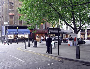
Hatton Garden
Street and area in Holborn, London
Distance: Approx. 72 meters
Latitude and longitude: 51.52,-0.10833333
Hatton Garden is a street and commercial zone in the Holborn district of the London Borough of Camden, abutting the narrow precinct of Saffron Hill which then abuts the City of London. It takes its name from Sir Christopher Hatton, a favourite of Queen Elizabeth I, who established a mansion here and gained possession of the garden and orchard of Ely Place, the London seat of the Bishops of Ely. It remained in the Hatton family and was built up as a stylish residential development in the reign of King Charles II. For some decades it often went, outside of the main street, by an alternative name St Alban's Holborn, after the local church built in 1861.
Farringdon Road
Distance: Approx. 130 meters
Latitude and longitude: 51.52027778,-0.10583333
Farringdon Road is a road in Clerkenwell, London.

Saffron Hill
Street in the London Borough of Camden
Distance: Approx. 80 meters
Latitude and longitude: 51.52016667,-0.10664167
Saffron Hill is a street and former ward in Holborn, in the south eastern corner of the London Borough of Camden, between Farringdon Road and Hatton Garden. The name of the street derives from the fact that it was at one time part of an estate on which saffron grew. The ecclesiastical parish was St Peter, Saffron Hill, a daughter parish of Holborn, which is now combined with St Alban (the Martyr), Holborn.

Bleeding Heart Yard
Courtyard in London
Distance: Approx. 143 meters
Latitude and longitude: 51.51929,-0.10697
Bleeding Heart Yard is a cobbled courtyard off Greville Street in the Holborn area of the London Borough of Camden. The courtyard is probably named after a 16th-century inn sign dating back to the Reformation that was displayed on a pub called the Bleeding Heart in nearby Charles Street. The inn sign showed the heart of the Virgin Mary pierced by five swords.

The Aquarium L-13
Distance: Approx. 95 meters
Latitude and longitude: 51.5205,-0.1063
The Aquarium L-13 was a contemporary commercial art gallery run by Steve Lowe. It was originally based in a Georgian building in Bloomsbury, London, and then moved to Farringdon. It worked with artists, musicians and writers, and specialised in more unorthodox punk-based art work, including Jamie Reid, Jimmy Cauty, Billy Childish, Sexton Ming and artists associated with the indie label Stolen Recordings.

Leather Lane
Human settlement in England
Distance: Approx. 135 meters
Latitude and longitude: 51.52,-0.10944444
Leather Lane is a street west of Hatton Garden, in the Holborn area of London. It is home to a well-used weekday market which specialises in clothing, footwear and fruit and vegetables. There are now many food retailers capitalising off the lunchtime trade offering a range of different foods from falafel wraps and burritos to hog roasts and jacket potatoes.
L-13 Light Industrial Workshop
Art studio in London
Distance: Approx. 95 meters
Latitude and longitude: 51.5205,-0.1063
L-13 Light Industrial Workshop is a contemporary art studio and publisher that opened in May 2009 in Clerkenwell, London. Founded and operated by Steve Lowe, it is a revised incarnation of his previous galleries and small presses, ‘the aquarium’ and The Aquarium L-13, and works with a small group of artists known for their unorthodox stances, in developing, exhibiting and publishing their work.

Saffron Hill, Hatton Garden, Ely Rents and Ely Place
Distance: Approx. 60 meters
Latitude and longitude: 51.52,-0.108
Saffron Hill, Hatton Garden, Ely Rents and Ely Place was a liberty and from 1866 to 1930 a civil parish in the metropolitan area of London, England. It was part of the ancient parish of St Andrew Holborn. The southern boundary was the street now called Holborn, the western boundary was Leather Lane.

Cowcross Street
Street in London, England
Distance: Approx. 169 meters
Latitude and longitude: 51.5198,-0.1055
Cowcross Street is a street in London. It runs east–west, from St John Street in the east, to Farringdon Road in the west.

Hatton Garden safe deposit burglary
2015 theft from an underground vault in Holborn, London
Distance: Approx. 130 meters
Latitude and longitude: 51.5194,-0.1083
In April 2015, an underground safe deposit facility in Hatton Garden, London, owned by Hatton Garden Safe Deposit Ltd., was burgled. According to official sources, the total stolen had an estimated value of up to £14 million (equivalent to £20 million in 2023), of which only £4.3 million (equivalent to £6 million in 2023) has been recovered. The heist was planned and carried out by six elderly men who were experienced thieves, all of whom were arrested, pleaded guilty and received prison sentences in March 2016.

Farringdon Road drill hall
Distance: Approx. 77 meters
Latitude and longitude: 51.52055,-0.10656
The Farringdon Road drill hall is a former military installation at 57A Farringdon Road in Finsbury, London.

Baird & Co
British bullion merchant company
Distance: Approx. 80 meters
Latitude and longitude: 51.52102222,-0.10846667
Baird & Co. is the largest gold refiner and the only full-service bullion merchant in the United Kingdom. Founded by Tony Baird in 1967; Baird & Co.
Weather in this IP's area
few clouds
14 Celsius
14 Celsius
13 Celsius
15 Celsius
1005 hPa
93 %
1005 hPa
1002 hPa
10000 meters
20 %
06:24:48
19:31:35