91.137.87.63 - IP Lookup: Free IP Address Lookup, Postal Code Lookup, IP Location Lookup, IP ASN, Public IP
Country:
Region:
City:
Location:
Time Zone:
Postal Code:
ISP:
ASN:
language:
User-Agent:
Proxy IP:
Blacklist:
IP information under different IP Channel
ip-api
Country
Region
City
ASN
Time Zone
ISP
Blacklist
Proxy
Latitude
Longitude
Postal
Route
db-ip
Country
Region
City
ASN
Time Zone
ISP
Blacklist
Proxy
Latitude
Longitude
Postal
Route
IPinfo
Country
Region
City
ASN
Time Zone
ISP
Blacklist
Proxy
Latitude
Longitude
Postal
Route
IP2Location
91.137.87.63Country
Region
nordrhein-westfalen
City
borken
Time Zone
Europe/Berlin
ISP
Language
User-Agent
Latitude
Longitude
Postal
ipdata
Country
Region
City
ASN
Time Zone
ISP
Blacklist
Proxy
Latitude
Longitude
Postal
Route
Popular places and events near this IP address
Borken (district)
District in North Rhine-Westphalia, Germany
Distance: Approx. 9051 meters
Latitude and longitude: 51.91666667,6.91666667
Borken is a Kreis (district) in the northwestern part of North Rhine-Westphalia, Germany in the Münster region. Neighboring districts are Steinfurt, Coesfeld, Recklinghausen, Wesel, Cleves, Bentheim in the Lower Saxony and the Dutch provinces Gelderland and Overijssel. The two biggest cities are Bocholt and Gronau.

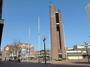
Borken, North Rhine-Westphalia
Town in North Rhine-Westphalia, Germany
Distance: Approx. 1322 meters
Latitude and longitude: 51.83333333,6.86666667
Borken (German pronunciation: [ˈbɔʁkn̩] , Westphalian: Buorken) is a town and the capital of the district of the same name, in North Rhine-Westphalia, Germany.

Heiden, Germany
Municipality in North Rhine-Westphalia, Germany
Distance: Approx. 5547 meters
Latitude and longitude: 51.82583333,6.93305556
Heiden is a municipality in the district of Borken in the state of North Rhine-Westphalia, Germany. It is located approximately 5 km east of Borken. Its most important symbol are the devil stones.

Raesfeld
Place in North Rhine-Westphalia, Germany
Distance: Approx. 8762 meters
Latitude and longitude: 51.76666667,6.83333333
Raesfeld (German pronunciation: [ˈʁaːsfɛlt]) is a municipality in the district of Borken in the state of North Rhine-Westphalia, Germany. It is located approximately 10 km south of Borken and 30 km east of the Dutch border. Raesfeld's landmark is the moated castle Schloss Raesfeld, originally built in the 13th century and extended and remodeled in Renaissance style in the 17th century.

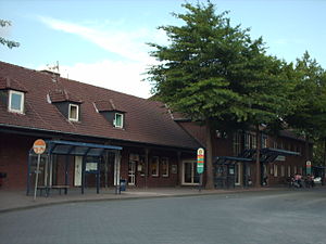
Borken (Westf) station
Railway station in Borken, Germany
Distance: Approx. 743 meters
Latitude and longitude: 51.84861111,6.86555556
Borken (Westf) station (German: Bahnhof Borken (Westf)) is the main station of the town of Borken and important transport hub of west Münsterland in the German state of North Rhine-Westphalia. Borken station is a former railway junction on the Gelsenkirchen-Bismarck–Winterswijk railway, the Empel-Rees–Münster railway and the Borken–Steinfurt railway. Since 1996, it has been the terminus of the only section of the Gelsenkirchen-Bismarck–Winterswijk line that is still operating.

Raesfeld Castle
Water castle in the district of Borken
Distance: Approx. 9179 meters
Latitude and longitude: 51.7637,6.8269
Raesfeld Castle is a water castle located in Raesfeld, a municipality in the district of Borken in the German state of North Rhine-Westphalia. The castle's history dates back to the beginning of the 12th century. At the end of the 16th century, the knight's castle of the Lords of Raesfeld came into the possession of the von Velen family.
Weather in this IP's area
light rain
5 Celsius
2 Celsius
4 Celsius
6 Celsius
1000 hPa
95 %
1000 hPa
994 hPa
5978 meters
2.98 m/s
8.1 m/s
195 degree
100 %