Country:
Region:
City:
Latitude and Longitude:
Time Zone:
Postal Code:
IP information under different IP Channel
ip-api
Country
Region
City
ASN
Time Zone
ISP
Blacklist
Proxy
Latitude
Longitude
Postal
Route
Luminati
Country
Region
th
City
badlangensalza
ASN
Time Zone
Europe/Berlin
ISP
Thueringer Netkom GmbH
Latitude
Longitude
Postal
IPinfo
Country
Region
City
ASN
Time Zone
ISP
Blacklist
Proxy
Latitude
Longitude
Postal
Route
db-ip
Country
Region
City
ASN
Time Zone
ISP
Blacklist
Proxy
Latitude
Longitude
Postal
Route
ipdata
Country
Region
City
ASN
Time Zone
ISP
Blacklist
Proxy
Latitude
Longitude
Postal
Route
Popular places and events near this IP address
Bad Langensalza
Town in Thuringia, Germany
Distance: Approx. 727 meters
Latitude and longitude: 51.10805556,10.64666667
Bad Langensalza (pronounced [baːt laŋənˈzaltsa]; until 1956: Langensalza) is a spa town of 17,500 inhabitants in the Unstrut-Hainich district, Thuringia, central Germany.
Schönstedt
Ortsteil of Unstrut-Hainich in Thuringia, Germany
Distance: Approx. 5186 meters
Latitude and longitude: 51.11666667,10.56666667
Schönstedt is a village and a former municipality in the Unstrut-Hainich-Kreis district of Thuringia, Germany. On 1 January 2024 it became part of the municipality Unstrut-Hainich.
Botanischer Garten in Bad Langensalza
Garden in Germany
Distance: Approx. 4492 meters
Latitude and longitude: 51.1051,10.5778
The Botanischer Garten in Bad Langensalza is a botanical garden located at Kurpromenade 5b, Bad Langensalza, Thuringia, Germany. The garden opened in 2002, and now contains an alpine garden, wet meadow, medicinal and aromatic garden, and succulent collections (agaves, cacti, yuccas), with notable specimens of Agave americana and Dioscorea elephantipes. It is open daily in the warmer months; admission is free.

Bad Langensalza Airfield
Airfield in Germany
Distance: Approx. 2227 meters
Latitude and longitude: 51.12944444,10.62166667
Bad Langensalza Airfield (ICAO: EDEB) is a general aviation facility located in Germany, about 4 kilometres (2 mi) north-northwest of Bad Langensalza (Thuringen); approximately 240 kilometres (149 mi) southwest of Berlin. It is classified as a Sonderlandeplatz meaning that it has no guaranteed hours of service, so that visitors need to obtain "prior permission". The airfield has a short grass runway, which is used primarily for light aircraft and gliders.

Salza (Unstrut)
River in Thuringia, Germany
Distance: Approx. 2177 meters
Latitude and longitude: 51.1195,10.6703
Salza is a river of Thuringia, Germany. It flows into the Unstrut near Bad Langensalza.
Zimmerbach (Salza)
River in Germany
Distance: Approx. 3072 meters
Latitude and longitude: 51.0902,10.6169
Zimmerbach is a river of Thuringia, Germany. It flows for 3 kilometres (1.9 mi) before joining the Salza near Bad Langensalza.
Battle of Langensalza (1761)
1761 battle
Distance: Approx. 737 meters
Latitude and longitude: 51.108,10.6468
The Battle of Langensalza (10 February 1761) was an engagement between French forces and allied Prussian and Hanoverian forces during the Seven Years' War. It was fought near Langensalza in what is now eastern Germany. An allied advance surprised the French, resulting in the capture of 2,000 French soldiers.
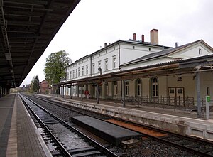
Bad Langensalza station
Railway station in Germany
Distance: Approx. 1291 meters
Latitude and longitude: 51.1018,10.6409
Bad Langensalza station is a railway station in Bad Langensalza, Thuringia, Germany.

Thamsbrück
Ortsteil of Bad Langensalza in Thuringia, Germany
Distance: Approx. 2876 meters
Latitude and longitude: 51.1391,10.63649972
Thamsbrück (pronounced [ˈtamsbʁʏk], in German also Ablassstadt Thamsbrück ["Indulgence town Thamsbrück"]) is a quarter of the town of Bad Langensalza in Thuringia, central Germany, about 35 kilometres (22 mi) northwest of Erfurt, with 940 inhabitants. The town, which has been independent since 1206, was incorporated into Bad Langensalza in 1994. Thamsbrück is the oldest small town in Thuringia and, with the Indulgence Festival (Ablassfest), has a tradition of more than 500 years.
Ufhoven
Ortsteil of Bad Langensalza in Thuringia, Germany
Distance: Approx. 1646 meters
Latitude and longitude: 51.1006,10.62889972
Ufhoven (pronounced [ˈuːfhoːfn̩]) is a quarter of the town of Bad Langensalza in Thuringia, central Germany.
Nägelstedt
Ortsteil of Bad Langensalza in Thuringia, Germany
Distance: Approx. 4967 meters
Latitude and longitude: 51.1095,10.7115
Nägelstedt (pronounced [ˈnɛːgl̩ʃtɛt]) is a village and a quarter of the town of Bad Langensalza in Thuringia, central Germany, with about 700 inhabitants.
Henningsleben
Ortsteil of Bad Langensalza in Thuringia, Germany
Distance: Approx. 4905 meters
Latitude and longitude: 51.06944444,10.63583333
Henningsleben (pronounced [ˈhɛnɪŋgsˌleːbn̩]) is a village and an Ortsteil (part) of the town of Bad Langensalza in Thuringia, central Germany, with about 230 inhabitants.
Weather in this IP's area
clear sky
7 Celsius
6 Celsius
6 Celsius
7 Celsius
1028 hPa
89 %
1028 hPa
1003 hPa
10000 meters
1.54 m/s
1.63 m/s
111 degree
1 %
07:22:35
16:39:53


