91.137.121.128 - IP Lookup: Free IP Address Lookup, Postal Code Lookup, IP Location Lookup, IP ASN, Public IP
Country:
Region:
City:
Location:
Time Zone:
Postal Code:
IP information under different IP Channel
ip-api
Country
Region
City
ASN
Time Zone
ISP
Blacklist
Proxy
Latitude
Longitude
Postal
Route
Luminati
Country
Region
bw
City
freudenstadt
ASN
Time Zone
Europe/Berlin
ISP
Thuega SmartService GmbH
Latitude
Longitude
Postal
IPinfo
Country
Region
City
ASN
Time Zone
ISP
Blacklist
Proxy
Latitude
Longitude
Postal
Route
IP2Location
91.137.121.128Country
Region
baden-wurttemberg
City
wittlensweiler
Time Zone
Europe/Berlin
ISP
Language
User-Agent
Latitude
Longitude
Postal
db-ip
Country
Region
City
ASN
Time Zone
ISP
Blacklist
Proxy
Latitude
Longitude
Postal
Route
ipdata
Country
Region
City
ASN
Time Zone
ISP
Blacklist
Proxy
Latitude
Longitude
Postal
Route
Popular places and events near this IP address
Freudenstadt (district)
District in Baden-Württemberg, Germany
Distance: Approx. 3788 meters
Latitude and longitude: 48.5,8.42
Freudenstadt is a Landkreis (district) in the middle of Baden-Württemberg, Germany. Neighboring districts are (from north clockwise) Rastatt, Calw, Tübingen, Zollernalbkreis, Rottweil and the Ortenaukreis.

Baiersbronn
Municipality in Baden-Württemberg, Germany
Distance: Approx. 6896 meters
Latitude and longitude: 48.50583333,8.37111111
Baiersbronn is a municipality and a village in the district of Freudenstadt in Baden-Württemberg in southern Germany. It is situated in the Black Forest on the Murg river. Nearby is the mountain of Rinkenkopf (759.6 m) with its hillfort, the Rinkenwall.

Freudenstadt
Town in Baden-Württemberg, Germany
Distance: Approx. 3007 meters
Latitude and longitude: 48.46333333,8.41111111
Freudenstadt (German pronunciation: [ˈfʁɔɪ̯dn̩ˌʃtat], Swabian: Fraidestadt) is a town in Baden-Württemberg in southern Germany. It is the capital of the district Freudenstadt. The closest population centres are Offenburg to the west (approx.

Reichenbach Priory (Baden-Württemberg)
Monastery in Baden-Württemberg, Germany
Distance: Approx. 6923 meters
Latitude and longitude: 48.52555556,8.40138889
Reichenbach Priory (German: Kloster Reichenbach) was a Benedictine monastery, located at Klosterreichenbach, now part of Baiersbronn in Baden-Württemberg in Germany.

Schopfloch
Municipality in Baden-Württemberg, Germany
Distance: Approx. 7769 meters
Latitude and longitude: 48.45444444,8.55138889
Schopfloch is a municipality in the district of Freudenstadt in Baden-Württemberg in southern Germany. It is located in the northern part of the Black Forest (Schwarzwald). Schopfloch consists of three communities: Schopfloch, Oberiflingen and Unteriflingen.

Dornstetten
Town in Baden-Württemberg, Germany
Distance: Approx. 3771 meters
Latitude and longitude: 48.46666667,8.5
Dornstetten is a town in the district of Freudenstadt in Baden-Württemberg in southern Germany. It is situated in the Black Forest, 7 km (4.3 mi) east of Freudenstadt. It was founded in the early Middle Ages and is well known for its half-timbered houses (German: Fachwerkhäuser).

Glatten
Municipality in Baden-Württemberg, Germany
Distance: Approx. 5681 meters
Latitude and longitude: 48.44305556,8.51277778
Glatten is a municipality in the district of Freudenstadt in Baden-Württemberg in Germany.

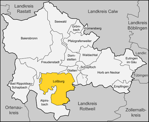
Loßburg
Municipality in Baden-Württemberg, Germany
Distance: Approx. 6802 meters
Latitude and longitude: 48.41111111,8.45138889
Loßburg is a municipality in the district of Freudenstadt in Baden-Württemberg in southern Germany.

Freudenstadt Hauptbahnhof
Station in Freudenstadt, Baden-Württemberg, Germany
Distance: Approx. 2025 meters
Latitude and longitude: 48.4605,8.4286
Freudenstadt Hauptbahnhof is the main station in the town of Freudenstadt in the German state of Baden-Württemberg, and an important railway junction in the Northern Black Forest.
Ettenbach
River in Germany
Distance: Approx. 2189 meters
Latitude and longitude: 48.467,8.4782
Ettenbach is a small river of Baden-Württemberg, Germany. It flows into the Glatt in Aach.
Stockerbach
River in Germany
Distance: Approx. 2074 meters
Latitude and longitude: 48.4687,8.4772
Stockerbach is a small river of Baden-Württemberg, Germany. It flows into the Glatt in Aach.
Rodt (Loßburg)
Distance: Approx. 6179 meters
Latitude and longitude: 48.4168,8.4444
Rodt is a village and a former municipality in Loßburg (Lossburg) in the district of Freudenstadt in Baden-Württemberg, Germany.
Weather in this IP's area
overcast clouds
2 Celsius
-3 Celsius
0 Celsius
2 Celsius
1006 hPa
88 %
1006 hPa
924 hPa
10000 meters
5.43 m/s
12.24 m/s
276 degree
88 %