91.137.119.27 - IP Lookup: Free IP Address Lookup, Postal Code Lookup, IP Location Lookup, IP ASN, Public IP
Country:
Region:
City:
Location:
Time Zone:
Postal Code:
ISP:
ASN:
language:
User-Agent:
Proxy IP:
Blacklist:
IP information under different IP Channel
ip-api
Country
Region
City
ASN
Time Zone
ISP
Blacklist
Proxy
Latitude
Longitude
Postal
Route
db-ip
Country
Region
City
ASN
Time Zone
ISP
Blacklist
Proxy
Latitude
Longitude
Postal
Route
IPinfo
Country
Region
City
ASN
Time Zone
ISP
Blacklist
Proxy
Latitude
Longitude
Postal
Route
IP2Location
91.137.119.27Country
Region
nordrhein-westfalen
City
bocholt
Time Zone
Europe/Berlin
ISP
Language
User-Agent
Latitude
Longitude
Postal
ipdata
Country
Region
City
ASN
Time Zone
ISP
Blacklist
Proxy
Latitude
Longitude
Postal
Route
Popular places and events near this IP address

Dinxperlo
Town and former municipality in Gelderland, Netherlands
Distance: Approx. 9580 meters
Latitude and longitude: 51.86666667,6.48333333
Dinxperlo (Dutch: [ˈdɪŋkspərloː] ; Dutch Low Saxon: Dinsper) is a town and former municipality in the eastern Netherlands (Achterhoek region), situated directly at the Germany-Netherlands border. Since 1 January 2005, Dinxperlo has been part of the municipality of Aalten. Before 2005, Dinxperlo was a separate municipality, covering the town of Dinxperlo itself and the village of De Heurne.
Bocholt, Germany
Town in North Rhine-Westphalia, Germany
Distance: Approx. 607 meters
Latitude and longitude: 51.83333333,6.61666667
Bocholt (German pronunciation: [ˈbɔxɔlt]) is a city in the north-west of North Rhine-Westphalia, Germany, part of the district Borken. It is situated 4 km (2+1⁄2 miles) south of the border with the Netherlands. Suderwick is part of Bocholt and is situated at the border annex to Dinxperlo.

Rhede
Town in North Rhine-Westphalia, Germany
Distance: Approx. 5908 meters
Latitude and longitude: 51.83333333,6.70055556
Rhede (German: [ˈʁeːdə] ) is a municipality in the district of Borken in the state of North Rhine-Westphalia, Germany. It is located near the border with the Netherlands, approximately 5 km (3.1 mi) east of Bocholt.
Aalten railway station
Railway station in Aalten, the Netherlands
Distance: Approx. 9521 meters
Latitude and longitude: 51.92111111,6.57805556
Aalten is a railway station located in Aalten, Netherlands. The station is on the Winterswijk–Zevenaar railway and the station opened on 15 July 1885. The building began construction in 1884 and was finished in 1885.

Aasee (Bocholt)
A lake in North Rhine-Westphalia, Germany
Distance: Approx. 1726 meters
Latitude and longitude: 51.82972222,6.63555556
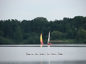
Aasee is an artificial lake in Bocholt, Kreis Borken, North Rhine-Westphalia, Germany. At an elevation of 23.8 meters, its surface area is 0.32 km2. It serves as a local recreation area which has a total area of around 0.74 km2.

Heurne
Hamlet in Gelderland, Netherlands
Distance: Approx. 7365 meters
Latitude and longitude: 51.89951,6.5729
Heurne is a hamlet in the municipality of Aalten, near Aalten (Achterhoek region) in the eastern Netherlands. It was first mentioned in 1492 as Horne, and means "bent [of a hill]". The postal authorities have placed it under Aalten.

IJzerlo
Hamlet in Gelderland, Netherlands
Distance: Approx. 7502 meters
Latitude and longitude: 51.88333333,6.53333333
IJzerlo is a hamlet in the municipality of Aalten, between Aalten and Dinxperlo in the (Achterhoek region) in the eastern Netherlands. It was first mentioned in 1356 as Yserlo, and means "forest with primeval soil". In 1840, it was home to 438 people.

Dingden station
Railway station in Germany
Distance: Approx. 7601 meters
Latitude and longitude: 51.77055556,6.60805556
Dingden is a station in Dingden, North Rhine-Westphalia, Germany. It is part of Hamminkeln.

Bocholt station
Railway station in Bocholt, Germany
Distance: Approx. 580 meters
Latitude and longitude: 51.83472222,6.62055556
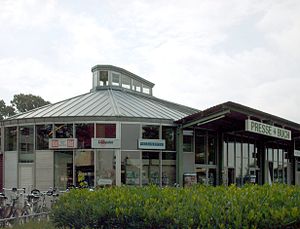
Bocholt is a station in Bocholt, North Rhine-Westphalia, Germany. It is now the terminus of the Rhein-IJssel-Express service. In the past trains ran in four directions, including to Winterswijk in the Netherlands.
Bocholt textile museum
Museum in Bocholt
Distance: Approx. 704 meters
Latitude and longitude: 51.8355499,6.6239785
The Bocholt textile museum is a museum in Bocholt, a city in the north-west of North Rhine-Westphalia, Germany, part of the district Borken. It is situated 4 km south of the border with the Netherlands. The museum opened in 1989 as one of the eight locations of the LWL Industrial Museum: it is an Anchor point on the European Route of Industrial Heritage.
Suderwick
Distance: Approx. 8505 meters
Latitude and longitude: 51.86666667,6.5
Suderwick is a village in the city of Bocholt, Kreis Borken in the German State of North Rhine-Westphalia. Suderwick is situated at the Germany-Netherlands border and forms one urban area with Dinxperlo, a town in Aalten municipality of Gelderland province of the Netherlands. One street in Dinxperlo, Heelweg, is partly German.
Spork (locality)
Ortsteil of Bocholt in North Rhine-Westphalia, Germany
Distance: Approx. 4779 meters
Latitude and longitude: 51.86316,6.55798
Spork is a locality (German: Ortsteil) of the town of Bocholt in the district of Borken. It was first mentioned in 1188 as Sporklo. Formerly an independent municipality, it was merged into the city of Bocholt in 1975.
Weather in this IP's area
clear sky
1 Celsius
1 Celsius
1 Celsius
1 Celsius
1020 hPa
63 %
1020 hPa
1017 hPa
10000 meters
0.72 m/s
0.75 m/s
316 degree


