Country:
Region:
City:
Latitude and Longitude:
Time Zone:
Postal Code:
IP information under different IP Channel
ip-api
Country
Region
City
ASN
Time Zone
ISP
Blacklist
Proxy
Latitude
Longitude
Postal
Route
Luminati
Country
Region
15
City
sunndalsora
ASN
Time Zone
Europe/Oslo
ISP
Neas Energi Telekom As
Latitude
Longitude
Postal
IPinfo
Country
Region
City
ASN
Time Zone
ISP
Blacklist
Proxy
Latitude
Longitude
Postal
Route
db-ip
Country
Region
City
ASN
Time Zone
ISP
Blacklist
Proxy
Latitude
Longitude
Postal
Route
ipdata
Country
Region
City
ASN
Time Zone
ISP
Blacklist
Proxy
Latitude
Longitude
Postal
Route
Popular places and events near this IP address

Sunndal
Municipality in Møre og Romsdal, Norway
Distance: Approx. 7970 meters
Latitude and longitude: 62.61277778,8.63416667
is a municipality in the Nordmøre region located in the northeast part of Møre og Romsdal county, Norway. The administrative center of the municipality is the village of Sunndalsøra. Other villages include Gjøra, Grøa, Hoelsand, Jordalsgrenda, Romfo, Ålvund, Ålvundeidet, and Øksendalsøra.
Driva
River in Møre og Romsdal, Norway
Distance: Approx. 562 meters
Latitude and longitude: 62.6764,8.54502
The Driva river runs through Trøndelag and Møre og Romsdal counties in Norway. The headwaters lie in the Dovrefjell mountains in the south, from where it flows northward, downward through the Drivdalen valley in the municipality of Oppdal. When the river gets to the village of Oppdal, it turns westward and heads down the Sunndalen valley to the Sunndalsfjord at the village of Sunndalsøra in the municipality of Sunndal.

Sunndalsøra
Village in Western Norway, Norway
Distance: Approx. 421 meters
Latitude and longitude: 62.6752,8.5633
Sunndalsøra () is the administrative centre of Sunndal Municipality in Møre og Romsdal county, Norway. The village of Sunndalsøra lies at the mouth of the river Driva at the beginning of the Sunndalsfjord. Sunndalsøra is surrounded by steep mountains, such as Hårstadnebba, which reach elevations as high as 1,700 metres (5,600 ft).
Hoelsand
Village in Western Norway, Norway
Distance: Approx. 4397 meters
Latitude and longitude: 62.6602,8.6354
Hoelsand or Holssanden is a village in Sunndal Municipality in Møre og Romsdal county, Norway. The village is located along the river Driva, just west of the Vinnufossen waterfall. The village lies along the Norwegian National Road 70, about 4 kilometres (2.5 mi) east of the village of Sunndalsøra and about 5 kilometres (3.1 mi) west of the village of Grøa.
Vinnufjellet
Distance: Approx. 5293 meters
Latitude and longitude: 62.69083333,8.6525
Vinnufjellet is an 1,818-metre (5,965 ft) tall mountain in Sunndal Municipality in Møre og Romsdal county, Norway. Vinnufjellet consists of the two peaks named Dronningkrona at 1,816 metres (5,958 ft) and Kongskrona at 1,818 metres (5,965 ft). The names of the two peaks are translated as Queen's crown and King's crown.

Dronningkrona
Distance: Approx. 5216 meters
Latitude and longitude: 62.6975,8.64416667
Dronningkrona is a 1,816-metre (5,958 ft) tall mountain peak in Sunndal Municipality in Møre og Romsdal county, Norway. It is one of the two peaks on the main mountain Vinnufjellet. Its neighbor peak is Kongskrona, which reaches 2 metres (6 ft 7 in) higher.
Kongskrona
Distance: Approx. 5458 meters
Latitude and longitude: 62.68944444,8.65694444
Kongskrona is a 1,818-metre (5,965 ft) tall mountain peak in the municipality of Sunndal in Møre og Romsdal county, Norway. It is the higher of the two peaks on the main mountain Vinnufjellet. Its neighbouring peak is Dronningkrona, which is about 2 metres (6 ft 7 in) shorter.

Vinnufossen
Waterfall in Møre og Romsdal, Norway
Distance: Approx. 5965 meters
Latitude and longitude: 62.66416667,8.66972222
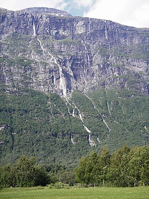
Vinnufossen or Vinnufallet is one of the tallest waterfalls in Europe and the eighth-tallest in the world. The 845 m (2,772 ft) tall tiered horsetail waterfall is located just east of the village of Sunndalsøra in the municipality of Sunndal in Møre og Romsdal county, Norway. The falls are part of the Vinnu river which flows down from the Vinnufjellet mountain and it is fed from the Vinnufonna glacier.

Norwegian National Road 70
National road in Trøndelag and Møre og Romsdal, Norway
Distance: Approx. 3457 meters
Latitude and longitude: 62.70555556,8.55555556
National Road 70 (Norwegian: Riksvei 70) is a 162.0-kilometre (100.7 mi) long national highway that runs from the town of Kristiansund in Kristiansund Municipality in Møre og Romsdal county and the village of Oppdal in Oppdal Municipality in Trøndelag county, Norway. The road starts in downtown Kristiansund. It passes an intersection with the terminus of County Road 64, before passing by Kristiansund Airport, Kvernberget.
Aura Hydroelectric Power Station
Hydroelectric power station in Norway
Distance: Approx. 2054 meters
Latitude and longitude: 62.66472222,8.52111111
Aura Power Station (Aura kraftverk) is a hydroelectric power station located in the municipality Sunndal in Møre og Romsdal, Norway. It operates at an installed capacity of 290 MW, with an average annual production of 1,776 GWh.

Øksendal Church
Church in Møre og Romsdal, Norway
Distance: Approx. 7879 meters
Latitude and longitude: 62.71648742,8.43098491
Øksendal Church (Norwegian: Øksendal kirke) is a parish church of the Church of Norway in Sunndal Municipality in Møre og Romsdal county, Norway. It is located in the village of Øksendalsøra. It is the church for the Øksendal parish which is part of the Indre Nordmøre prosti (deanery) in the Diocese of Møre.

Hov Church
Church in Møre og Romsdal, Norway
Distance: Approx. 782 meters
Latitude and longitude: 62.67265224,8.56995553
Hov Church (Norwegian: Hov kyrkje) is a parish church of the Church of Norway in Sunndal Municipality in Møre og Romsdal county, Norway. It is located in the village of Sunndalsøra. It is the church for the Hov parish which is part of the Indre Nordmøre prosti (deanery) in the Diocese of Møre.
Weather in this IP's area
overcast clouds
9 Celsius
7 Celsius
9 Celsius
9 Celsius
1012 hPa
95 %
1012 hPa
1012 hPa
7191 meters
2.61 m/s
2.39 m/s
218 degree
100 %
08:43:04
15:38:02

