91.132.201.238 - IP Lookup: Free IP Address Lookup, Postal Code Lookup, IP Location Lookup, IP ASN, Public IP
Country:
Region:
City:
Location:
Time Zone:
Postal Code:
IP information under different IP Channel
ip-api
Country
Region
City
ASN
Time Zone
ISP
Blacklist
Proxy
Latitude
Longitude
Postal
Route
Luminati
Country
ASN
Time Zone
Europe/Berlin
ISP
weber.digital GmbH
Latitude
Longitude
Postal
IPinfo
Country
Region
City
ASN
Time Zone
ISP
Blacklist
Proxy
Latitude
Longitude
Postal
Route
IP2Location
91.132.201.238Country
Region
baden-wurttemberg
City
balingen
Time Zone
Europe/Berlin
ISP
Language
User-Agent
Latitude
Longitude
Postal
db-ip
Country
Region
City
ASN
Time Zone
ISP
Blacklist
Proxy
Latitude
Longitude
Postal
Route
ipdata
Country
Region
City
ASN
Time Zone
ISP
Blacklist
Proxy
Latitude
Longitude
Postal
Route
Popular places and events near this IP address
Zollernalbkreis
District in Baden-Württemberg, Germany
Distance: Approx. 5903 meters
Latitude and longitude: 48.28333333,8.93333333
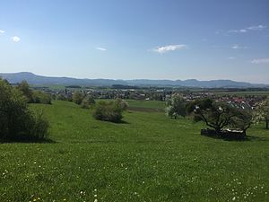
The Zollernalbkreis is a Landkreis (district) in the middle of Baden-Württemberg, Germany. The district is located in the Swabian Alb, and contains the second highest elevation of this range, the 1,011-metre (3,317 ft) high Oberhohenberg. In the south-east the district nearly reaches to the river Danube.
Bang Your Head!!!
Heavy metal and hard rock festival held in Germany
Distance: Approx. 2388 meters
Latitude and longitude: 48.25472222,8.845
Bang Your Head!!! was a heavy metal and hard rock festival held annually in Germany. First held in 1996 as a one-day indoor event in the Stefan-Hartmann-Halle in Tübingen with a crowd of 600 people, Bang Your Head!!!

Balingen
Town in Baden-Württemberg, Germany
Distance: Approx. 383 meters
Latitude and longitude: 48.27305556,8.85055556
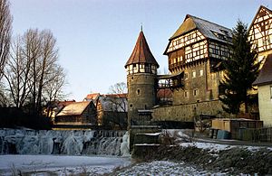
Balingen (German pronunciation: [ˈbaːlɪŋən] ; Swabian: Balenga) is a town in Baden-Württemberg, Germany, capital of the district of Zollernalbkreis. It is located near the Swabian Jura, approx. 35 km to the south of Tübingen, 35 km northeast of Villingen-Schwenningen, and 70 km south southwest of Stuttgart.

Geislingen, Zollernalbkreis
Town in Baden-Württemberg, Germany
Distance: Approx. 3406 meters
Latitude and longitude: 48.2875,8.8125
Geislingen is a town in the Zollernalbkreis district of Baden-Württemberg, Germany. It is situated 4 km northwest of Balingen. The population stands at roughly 6,000.

Bisingen
German municipality
Distance: Approx. 6215 meters
Latitude and longitude: 48.31194444,8.91777778
Bisingen (German pronunciation: [ˈbiːzɪŋən]) is a municipality in the Zollernalbkreis district of Baden-Württemberg, Germany.

Dotternhausen
Municipality in Baden-Württemberg, Germany
Distance: Approx. 6967 meters
Latitude and longitude: 48.22805556,8.79277778
Dotternhausen is a municipality in the Zollernalbkreis district, in Baden-Württemberg, Germany.

Grosselfingen
German municipality
Distance: Approx. 6806 meters
Latitude and longitude: 48.3325,8.88666667
Grosselfingen is a town in the Zollernalbkreis district, in Baden-Württemberg, Germany.

Ostdorf
Stadtteil of Balingen in Baden-Württemberg, Germany
Distance: Approx. 2782 meters
Latitude and longitude: 48.3,8.85
Ostdorf is a Swabian village within the city limits of Balingen, Germany. Originally a village of its own, Ostdorf and Balingen have grown towards each other since the close of World War II. Finally, in 1971 Ostdorf was included to Balingen as a suburb. It is located 75 kilometers in the south of Stuttgart.
Hundsrücken (Swabian Jura)
Mountain in Baden-Württemberg, Germany
Distance: Approx. 5553 meters
Latitude and longitude: 48.28027778,8.92916667
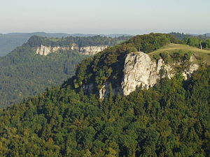
The Hundsrücken is a mountain in Baden-Württemberg, Germany. It is located in the county of Zollernalbkreis.

Irrenberg
Distance: Approx. 7125 meters
Latitude and longitude: 48.28333333,8.95
Irrenberg is a mountain of Baden-Württemberg, Germany. It is located in Zollernalbkreis.

Lochen (Swabian Jura)
Distance: Approx. 6220 meters
Latitude and longitude: 48.21944444,8.84916667
The Lochen is a mountain of Baden-Württemberg, Germany. It is located in Zollernalbkreis, southwestern Germany, and part of the mountain range Swabian Jura. Gerhard Bersu work in 1923 on the Lochen.
Steinberg (Swabian Jura)
Distance: Approx. 6639 meters
Latitude and longitude: 48.23444444,8.92
The Steinberg is a mountain in the Swabian Jura in the German state of Baden-Württemberg. It is located in Zollernalbkreis.
Weather in this IP's area
overcast clouds
-6 Celsius
-6 Celsius
-7 Celsius
-4 Celsius
1038 hPa
95 %
1038 hPa
953 hPa
10000 meters
0.92 m/s
0.7 m/s
46 degree
95 %