91.132.193.144 - IP Lookup: Free IP Address Lookup, Postal Code Lookup, IP Location Lookup, IP ASN, Public IP
Country:
Region:
City:
Location:
Time Zone:
Postal Code:
IP information under different IP Channel
ip-api
Country
Region
City
ASN
Time Zone
ISP
Blacklist
Proxy
Latitude
Longitude
Postal
Route
Luminati
Country
ASN
Time Zone
Asia/Baku
ISP
pasha Technology LLC
Latitude
Longitude
Postal
IPinfo
Country
Region
City
ASN
Time Zone
ISP
Blacklist
Proxy
Latitude
Longitude
Postal
Route
IP2Location
91.132.193.144Country
Region
baki
City
bilajari
Time Zone
Asia/Baku
ISP
Language
User-Agent
Latitude
Longitude
Postal
db-ip
Country
Region
City
ASN
Time Zone
ISP
Blacklist
Proxy
Latitude
Longitude
Postal
Route
ipdata
Country
Region
City
ASN
Time Zone
ISP
Blacklist
Proxy
Latitude
Longitude
Postal
Route
Popular places and events near this IP address

Baku Khanate
Khanate under Iranian control, 1747 to 1806
Distance: Approx. 3409 meters
Latitude and longitude: 40.46666667,49.83333333
The Baku Khanate (Persian: خانات باکو, romanized: Khānāt-e Baku), was a khanate under Iranian suzerainty, which controlled the city of Baku and its surroundings from 1747 to 1806.

Battle of Baku
Battles involving Armenian National movement
Distance: Approx. 1995 meters
Latitude and longitude: 40.45,49.78333333
The Battle of Baku (Azerbaijani: Bakı döyüşü, Turkish: Bakü Muharebesi, Russian: Битва за Баку) took place in August and September 1918 between the Ottoman–Azerbaijani coalition forces led by Nuri Pasha and Bolshevik–ARF Baku Soviet forces, later succeeded by the British–Armenian–White Russian forces led by Lionel Dunsterville and saw Soviet Russia briefly re-enter the war. The battle took place during World War I, was a conclusive part of the Caucasus Campaign, but a beginning of the Armenian–Azerbaijani War.
Sulutəpə
Place in Baku, Azerbaijan
Distance: Approx. 3529 meters
Latitude and longitude: 40.43333333,49.76666667
Sulutepe (Azerbaijani: Sulutəpə, also spelled Sulu Tepe) is a settlement in Baku, Azerbaijan. The settlement forms part of the municipality of Bilajary in Binagadi raion. It is an unofficial township built up in the 1980s by rural migrants and refugees from Nagorno-Karabakh.

Bilajary
Municipality in Baku, Azerbaijan
Distance: Approx. 1462 meters
Latitude and longitude: 40.43138889,49.80805556
Bilajary (Azerbaijani: Biləcəri) is a settlement and municipality in Baku, Azerbaijan. It has a population of 45,008. The municipality consists of the settlements of Bilajary and Sulutepe.

Rəsulzadə
Municipality in Baku, Azerbaijan
Distance: Approx. 2612 meters
Latitude and longitude: 40.43444444,49.83361111
Rasulzade (Azerbaijani: Rəsulzadə) is a settlement and municipality in Baku, Azerbaijan. It has a population of 47,921. It is named after Mahammad Amin Rasulzade.
Binəqədi
Municipality in Baku, Azerbaijan
Distance: Approx. 3056 meters
Latitude and longitude: 40.46611111,49.82777778
Binəqədi (also, Binagadi, Binagady, Binaghad, and Bonogady) is an urban-type settlement and municipality in the eponymous Binəqədi raion of Baku, Azerbaijan. It is located 7 km (4.3 mi) from the Biləcəri railway station .

Baku International Bus Terminal
Bus station in Baku, Azerbaijan
Distance: Approx. 1943 meters
Latitude and longitude: 40.4281,49.7975
Baku International Bus Terminal is a bus terminal located in Baku, Azerbaijan. The foundation stone for the complex was laid in 2004, and construction work was carried out by local firm "Baku 21st century". Baku International Bus Terminal was opened officially on 12 February 2009.

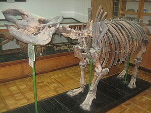
Binagadi asphalt lake
Cluster of tar pits in urban Baku, Azerbaijan
Distance: Approx. 2631 meters
Latitude and longitude: 40.46777778,49.80111111
The Binagadi asphalt lake (or Binagadi tar pits; Azerbaijani: Binəqədi gölü) are a cluster of tar pits in urban Baku, Azerbaijan. Asphaltum or tar has seeped up from the ground in this area for tens of thousands of years. The tar is often covered with dust, leaves, or water.

Azadliq prospekti (Baku Metro)
Baku Metro Station
Distance: Approx. 3626 meters
Latitude and longitude: 40.42611111,49.84111111
Azadlıq prospekti is a Baku Metro station. It was opened on 30 December 2009.
2015 Baku residence building fire
Fire in Baku, Azerbaijan
Distance: Approx. 3561 meters
Latitude and longitude: 40.42502778,49.83913889
The 2015 Baku residence building fire occurred on 19 May 2015 in a 16-level residence building located in Azadlig Avenue 200/36 in Binagadi raion of Baku, Azerbaijan. The official death toll from the fire was 15, of whom five were children; at least 63 people were injured. Most of the dead were killed by toxic smoke as the building caught fire.

Avtovağzal (Baku Metro)
Baku Metro Station
Distance: Approx. 2729 meters
Latitude and longitude: 40.42130013,49.79493098
Avtovağzal is a Baku Metro station. It was opened on 19 April 2016, connecting the Baku International Bus Terminal to the Baku Metro network.

Heydar Mosque
Mosque in Baku, Azerbaijan
Distance: Approx. 2323 meters
Latitude and longitude: 40.42916667,49.82444444
The Heydar Mosque (Azerbaijani: Heydər Məscidi; Arabic: مسجد حيدر) is a mosque, located in the Binəqədi raion of Baku, in Azerbaijan. Opened on 26 December 2014, the mosque is named after Heydar Aliyev, a former President of Azerbaijan. It is the largest mosque in Azerbaijan and the Caucuses.
Weather in this IP's area
moderate rain
9 Celsius
6 Celsius
9 Celsius
9 Celsius
1015 hPa
94 %
1015 hPa
1012 hPa
10000 meters
4.83 m/s
8.18 m/s
164 degree
100 %