91.126.87.216 - IP Lookup: Free IP Address Lookup, Postal Code Lookup, IP Location Lookup, IP ASN, Public IP
Country:
Region:
City:
Location:
Time Zone:
Postal Code:
IP information under different IP Channel
ip-api
Country
Region
City
ASN
Time Zone
ISP
Blacklist
Proxy
Latitude
Longitude
Postal
Route
Luminati
Country
Region
cb
City
riosapero
ASN
Time Zone
Europe/Madrid
ISP
Adamo Telecom Iberia S.A.
Latitude
Longitude
Postal
IPinfo
Country
Region
City
ASN
Time Zone
ISP
Blacklist
Proxy
Latitude
Longitude
Postal
Route
IP2Location
91.126.87.216Country
Region
cantabria
City
carrejo
Time Zone
ISP
Language
User-Agent
Latitude
Longitude
Postal
db-ip
Country
Region
City
ASN
Time Zone
ISP
Blacklist
Proxy
Latitude
Longitude
Postal
Route
ipdata
Country
Region
City
ASN
Time Zone
ISP
Blacklist
Proxy
Latitude
Longitude
Postal
Route
Popular places and events near this IP address

Western coast of Cantabria
Comarca in Cantabria, Spain
Distance: Approx. 9489 meters
Latitude and longitude: 43.37138889,-4.28722222
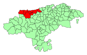
The Western Coast of Cantabria is a comarca of said Spanish autonomous community which comprises the municipalities of Val de San Vicente, San Vicente de la Barquera, Valdáliga, Comillas, Udías, Ruiloba, Alfoz de Lloredo and Santillana del Mar. As its own name indicates, this comarca extends over the western coast of the autonomous community, from its border with Asturias by the mouth of the Deva River, to the Saja-Besaya mouth in Suances, although this limits may vary depending on the source, since this comarca, as the rest of Cantabria's, is not regulated, but there are common characteristic elements in the municipalities that belong to it. This zone has great tourism assets like beaches, nature, gastronomy and culture.

Saja and Nansa valleys
Comarca in Cantabria, Spain
Distance: Approx. 9716 meters
Latitude and longitude: 43.24638889,-4.33777778
The Valleys of the Saja and Nansa Rivers comprise an administrative comarca in Cantabria, Spain. It is formed by the valleys of said rivers, each one being a natural comarca of its own.

Cabezón de la Sal
Municipality in Cantabria, Spain
Distance: Approx. 1535 meters
Latitude and longitude: 43.3075,-4.2325
Cabezón de la Sal is a municipality located in the autonomous community of Cantabria, Spain. According to the 2023 census, the town has a population of 8,181 inhabitants.

Cabuérniga
Municipality in Cantabria, Spain
Distance: Approx. 8976 meters
Latitude and longitude: 43.22777778,-4.30027778
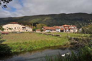
Cabuérniga (Spanish pronunciation: [kaˈβweɾniɣa]) is a municipality located in the autonomous community of Cantabria, Spain. According to the 2007 census, the city has a population of 999 inhabitants. Its capital is Valle.

Sierra del Escudo de Cabuérniga
Distance: Approx. 7110 meters
Latitude and longitude: 43.26666667,-4.31666667
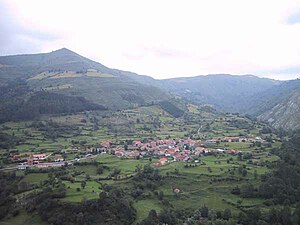
The Sierra del Escudo de Cabuérniga is a mountain range in Cantabria, Spain. It is a northern foothill of the Cantabrian Mountains, located between the main ranges and the Bay of Biscay. Its highest point is 927 m high Gándara.
SD Textil Escudo
Association football club in Spain
Distance: Approx. 531 meters
Latitude and longitude: 43.298929,-4.23669
Sociedad Deportiva Textil Escudo is a football team based in Cabezón de la Sal in the autonomous community of Cantabria. Founded in 1925, the team plays in the Tercera División RFEF – Group 3. The club's home ground is Campo de Fútbol Juan María Parés Serra, which has a capacity of 1,500 spectators.

Ruiloba
Place in Cantabria, Spain
Distance: Approx. 9796 meters
Latitude and longitude: 43.38166667,-4.25083333
Ruiloba is a municipality in Cantabria Province, Spain.

Ruente
Place in Cantabria, Spain
Distance: Approx. 4514 meters
Latitude and longitude: 43.2594,-4.2661
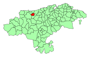
Ruente is a municipality in Cantabria, Spain. It is situated in the lowest part of the Cabuerniga valley and it is the biggest village in the zone.

Valdáliga
Place in Cantabria, Spain
Distance: Approx. 9847 meters
Latitude and longitude: 43.32916667,-4.34916667
Valdáliga is a municipality in Cantabria, Spain.

Udías
Municipality in Cantabria, Spain
Distance: Approx. 4972 meters
Latitude and longitude: 43.33833333,-4.24694444
Udías is a municipality located in the autonomous community of Cantabria, Spain.
Weather in this IP's area
broken clouds
9 Celsius
8 Celsius
9 Celsius
9 Celsius
1035 hPa
77 %
1035 hPa
994 hPa
10000 meters
2.15 m/s
2.32 m/s
46 degree
79 %