91.126.85.90 - IP Lookup: Free IP Address Lookup, Postal Code Lookup, IP Location Lookup, IP ASN, Public IP
Country:
Region:
City:
Location:
Time Zone:
Postal Code:
ISP:
ASN:
language:
User-Agent:
Proxy IP:
Blacklist:
IP information under different IP Channel
ip-api
Country
Region
City
ASN
Time Zone
ISP
Blacklist
Proxy
Latitude
Longitude
Postal
Route
db-ip
Country
Region
City
ASN
Time Zone
ISP
Blacklist
Proxy
Latitude
Longitude
Postal
Route
IPinfo
Country
Region
City
ASN
Time Zone
ISP
Blacklist
Proxy
Latitude
Longitude
Postal
Route
IP2Location
91.126.85.90Country
Region
asturias, principado de
City
ribadesella
Time Zone
Europe/Madrid
ISP
Language
User-Agent
Latitude
Longitude
Postal
ipdata
Country
Region
City
ASN
Time Zone
ISP
Blacklist
Proxy
Latitude
Longitude
Postal
Route
Popular places and events near this IP address

Sella River (Bay of Biscay)
River in Asturias, Spain
Distance: Approx. 750 meters
Latitude and longitude: 43.46722222,-5.06416667
The Sella is a river located in northwest Spain. It flows through the province of León and Asturias from the Picos de Europa to the Cantabrian Sea of the Atlantic Ocean at Ribadesella.

Ribadesella
Municipality in Asturias, Spain
Distance: Approx. 155 meters
Latitude and longitude: 43.4625,-5.05833333
Ribadesella (Asturian: Ribeseya) is a small 84-square-kilometre (32 sq mi) municipality in the Autonomous Community of the Principality of Asturias, Spain. Known for its location on the Cantabrian Sea, at the outlet of the River Sella, Ribadesella is a town that forms part of the Picos de Europa (Peaks of Europe). It is bordered on the east by Llanes, on the south by Cangas de Onís and Parres, and on the west by Caravia.

Pría
Parish in Asturias, Spain
Distance: Approx. 6473 meters
Latitude and longitude: 43.44222222,-4.98388889
Pría is the westernmost parish (administrative division) of the municipality of Llanes, in the autonomous community of the Principality of Asturias, in northern Spain.
Collera
Parish in Asturias, Spain
Distance: Approx. 2023 meters
Latitude and longitude: 43.45,-5.04
Collera is one of nine parishes (administrative divisions) in Ribadesella, a municipality within the province and autonomous community of Asturias, in northern Spain. It is 32.44 km2 (12.53 sq mi) in size, with a population of 745 (INE 2006).
Xuncu
Distance: Approx. 2529 meters
Latitude and longitude: 43.44,-5.07
Xuncu (Asturian pronunciation: [ˈʃuŋku]) is one of nine parishes (administrative divisions) in Ribadesella, a municipality within the province and autonomous community of Asturias, in northern Spain. It is 37.69 km2 (14.55 sq mi) in size, with a population of 144 (INE 2006).
San Esteban, Ribadesella
Distance: Approx. 6060 meters
Latitude and longitude: 43.48,-5.13
San Esteban (Spanish: Leces) is one of nine parishes (administrative divisions) in Ribadesella, a municipality within the province and autonomous community of Asturias, in northern Spain. It is 85.97 km2 (33.19 sq mi) in size, with a population of 1,164 (INE 2007).
Moru, Ribadesella
Distance: Approx. 4274 meters
Latitude and longitude: 43.45,-5.11
Moru is one of nine parishes (administrative divisions) in Ribadesella, a municipality within the province and autonomous community of Asturias, in northern Spain. It is 30.67 km2 (11.84 sq mi) in size, with a population of 288 (INE 2006).
Santianes del Agua
Distance: Approx. 3496 meters
Latitude and longitude: 43.43,-5.06
Santianes del Agua is one of nine parishes (administrative divisions) in Ribadesella, a municipality within the province and autonomous community of Asturias, in northern Spain. It is 14.45 km2 (5.58 sq mi) in size, with a population of 171 (INE 2006).
Samiguel d'Ucio
Distance: Approx. 2772 meters
Latitude and longitude: 43.45,-5.09
Samiguel d'Ucio is one of nine parishes (administrative divisions) in Ribadesella, a municipality within the province and autonomous community of Asturias, in northern Spain. It is 5.06 km2 (1.95 sq mi) in size, with a population of 367 (INE 2006).
Acebo (river)
River in Asturias, Spain
Distance: Approx. 6514 meters
Latitude and longitude: 43.48083333,-5.13555556
The Acebo is a river in northern Spain flowing through the Autonomous Community of Asturias.

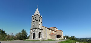
Church of Santa María de Junco
Church in Asturias, Spain
Distance: Approx. 2317 meters
Latitude and longitude: 43.44083333,-5.06388889
The Church of Santa María de Junco (Spanish: Iglesia de Santa María de Junco) is a Romanesque-style, Roman Catholic church located in the municipality of Ribadesella in Asturias, Spain. A church at the site was erected in the early 13th century.

Tito Bustillo Cave
Cave and archaeological site with prehistoric paintings in Spain
Distance: Approx. 667 meters
Latitude and longitude: 43.4607,-5.0677
The Tito Bustillo Cave is a prehistoric rock shelter located in the small town of Ribadesella, in the autonomous community of Asturias, Spain. The cave was inhabited by humans (cro-magnon) before the year 10,000 BC. Due to the collapse of the rock, the original entrance to the cave was sealed thousands of years ago, which made it possible for preservation of objects, tools and wall paintings that were discovered in 1968. Based on those objects found in the cave, it is known that there was a significant human presence during the Magdalenian culture of the Upper Palaeolithic, but the cave was probably inhabited before that time.
Weather in this IP's area
overcast clouds
15 Celsius
14 Celsius
15 Celsius
15 Celsius
1002 hPa
60 %
1002 hPa
981 hPa
10000 meters
7.66 m/s
17.33 m/s
192 degree
100 %